Country:

 City:
City:


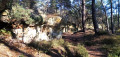
Starting point and access: Fontainebleau-Forêt station.
- Transilien – Line R, on the section between Paris-Lyon and Montargis (the stop is situated between Bois-le-Roi and Fontainebleau-Avon stations).
N.B. Services to the forest stop are limited (see the ‘Practical Information’ section for further details):
~ There are no services to the stop on weekdays.
~ It is only served on journeys from Paris to Montargis. Passengers alight at the front of the train, on the gravel-covered area which serves as a platform.
Blue signposting
(S) On the path running parallel to the railway line, head towards the ‘1000 balises’ information sign, turning left if you have alighted at the front of the train. Then take the marked path that starts at the foot of the sign, leaving it on your right. Wind your way through the woodland, cross two other paths and arrive at a third junction.
Blue Circles
(1) Cross the Route de la Fausse Oronge and take a path sloping off to the left. Wind your way through the woods, staying roughly parallel to the road. Then take a sharp right-hand bend (three-trunk oak) and head off the road in a north-westerly direction. Continue winding through the forest, taking care to stay on the path.
Red Circle Markings
(2) Cross a track, continue along the path opposite and you’ll soon reach the Mare du Marchais (bench on the right). Then turn left and walk along the edge of the pond on your right. As you approach the track you crossed earlier, turn right. At a junction, go straight on.
No markings
(3) At the next junction, turn right. Follow a faintly marked path north-westwards, which ends in a trail. You’ll come out onto a wide track; follow it to the right and walk alongside the railway line on your left. You’ll come out onto a road; cross it, follow it to the left and pass under the railway line (caution: busy road and narrow passage). On the other side, turn right immediately, go through a forest gate and walk alongside the railway line on your right.
(4) Take the first track on the left, the Route de la Plaine de Bois-le-Roi. At the Barillon junction, carry on straight ahead. At the end of the track, cross the D138 (caution: no pedestrian crossing). On the other side, pass through a forest gate.
Blue markings
(5) Turn left straight away onto path no. 15. Further on, cross the Route de l’Hexagone and continue straight ahead. Follow the marked path as it winds through the woods, crossing four wider tracks in succession.
(6) Cross the Route de l’Hexagone again and continue along the blue-marked path which winds through the forest. Cross a path running at right angles and carry on along the path.
(7) At the junction, turn left – heading due south – onto Route Eugénie, and walk alongside a fence on your right. At the next junction, go straight on. Then cross Route du Rocher Cassepot and continue along Route Eugénie for about fifty metres. Then turn left (sign prohibiting cyclists) and walk past some small rocks.
Yellow markings + Blue markings + blue capital letters on some rocks (see the recommendations in the practical information)
(8) At the crossroads, turn right at a 90° angle onto trail no. 14 towards the Rocher Cassepot viewpoint. Wind your way uphill through the forest and between a few rocks.
(9) At the top, turn sharply left onto path no. 3 towards Route Jean Bart. Pass under rock I, climb over a few small rocks and follow the winding path. Go past rock G and head downhill. At a junction, go straight on and climb slightly. This will take you to a viewpoint (rock F).
Yellow markings
(10) With your back to the view, go straight on and, at the first Fork in the road, take the wide path on the right. At a left-hand bend, turn right to reach another viewpoint (marked by a signpost).
Blue markings + blue capital letters on some rocks (see the recommendations in the practical information)
(11) Follow the blue markings for Trail No. 3 to the left and descend via a series of switchbacks between the rocks. Leave Rock O on your right and pass under a rock marked with a star. Leave Rock S on your right, pass under Rock T and go past Rock U (very narrow passage). Continue down a gentle slope along the hillside path.
Yellow markings
(12) At a junction, head straight on (east) along the Route de la Vallée de la Solle. After about a hundred metres, take the first path on the right, the Route Domet.
Yellow with a bar + Blue markings
Just before the track straightens out, turn right onto path no. 3 and climb gently through the forest.
Yellow markings
(13) At the Carrefour de la Béhourdière, rejoin Route Domet and follow it due south (more or less straight ahead). After a bend to the left, cross the Blue path and continue straight ahead.
Yellow markings (faded)
(14) Cross a tarmac road (no motor traffic) and turn right onto the looping path leading to the Cassepot Rock viewpoint.
No markings
At the first junction, go straight on (ignore the yellow arrow indicating a left turn).
Blue markings
At the next junction, turn left onto a footpath. You’ll come out onto the D116 at the Carrefour de la Croix d’Augas and cross it carefully (no pedestrian crossing).
(15) Follow the road to the right, carefully cross an exit slip road from the D606 and take the bridge over this four-lane road.
Blue markings + blue capital letters on some rocks (see the recommendations in the practical information)
(16) At the end of the safety barrier, turn sharply left to follow path no. 1 towards Mont d’Ussy. At the Fork in the road that appears immediately, turn right. Further on, turn right, leaving a pond on your left, and at a Fork in the road, take the path on the right.
(17) At the crossroads, go straight on. Pass rock D on your left, turn right and go down a flight of sandstone steps. Turn right and walk alongside the rocks on your right-hand side. Pass at the foot of Rock E (on the right-hand side), turn right and walk alongside the rocks. Turn left, leaving Rock G on your left. At Rock H, there are two options: go underneath it or go round it to the left. Then leave Rock I on your right.
(18) At a crossroads of paths, continue straight on towards Mont Ussy. Cross a tarmac forest track and continue straight ahead on path no. 1. At a fork in the road, turn left. Pass rocks Q, N, M (featuring a painted Virgin and Child) and L in turn. Ignore a path branching off to the right, pass rock K and then go under rock J. When you reach a sort of plateau, turn left and leave rock H on your right. Pass under rock G, leave rock F on your right and descend via a series of switchbacks. At a junction, continue straight on along the signposted path and pass rocks D, C and B. You’ll reach a crossroads of paths (rock Z on the right).
Unmarked
(19) Then take the shortcut to the left via the Grotte des Montussiennes. At the Fork in the road shortly afterwards, turn right onto a roughly level path (do not continue left down the more clearly marked path). Then descend via switchbacks.
Blue markings
(20) Join path no. 1 again, follow it to the left and leave the Grotte des Montussiennes on your right. Further on, go down a flight of steps. At a T-junction, follow a path to the right. After a few dozen metres, turn left. Further on, you’ll reach a fountain and come out onto a wide path. Follow this path to the left until you reach the Carrefour de la Vallée de la Chambre (forest ranger’s house, small car park).
Red and white markings
(21) Take the second path on the left (forest gate). After about 150 m, ignore a blue arrow pointing to the right and carry on straight ahead. Pass through a forest gate, turn right and cross a tarmac road. Pass through another forest gate, go straight on along a wide path, heading east-southeast, and walk past a car park on your left. At the next junction (large oak tree in the centre), continue straight on. The path then veers to the right and joins a tarmac road. Follow this road to the left and you will immediately come to a junction (traffic lights).
(22) Go round the junction on the right to use the pedestrian crossings: first cross the small road and arrive at the foot of the Notre-Dame de Bon Secours Chapel; then cross the D606 in two stages, followed by the small road again. Follow this road to the right for a few metres, turn left to pass through a forest gate and immediately turn right. Further on, turn slightly right onto theGR®® and let a Blue trail branch off to the left. At the next junction, turn right again.
(23) As you approach some houses, turn left and stay on a path running parallel to a tarmac road. At the end, turn right to cross the road at the corner of a hotel. Cross an avenue at the pedestrian crossing, then go down a flight of steps on the left. Cross a car park and head towards Fontainebleau-Avon station.
To get back home:
- Transilien – Line R, towards Paris-Lyon (direct access) or Montargis or Montereau (use the underpass).




 Visorando Member
 Difficult

 Easy
Easy