Country:

 City:
City:


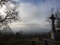
The Croix de Toulouse junction is situated halfway along the D138 road linking Bois-le-Roi to Pont de Valvins (Samoreau). It is marked by an obelisk. Park on the eastern side, as the walk starts on that side of the roundabout.
(S/E) Head north-north-west along the Route de l’Amiral until, 400 metres further on, you reach the Blue Trail No. 15.
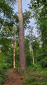
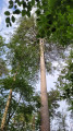
(1) Turn right onto the well-marked path and take the opportunity to admire some of the finest Larricio pines, grafted onto Scots pines nearly 200 years ago (one of the unique features of the Fontainebleau massif).
(2) Cross the Route de Fontaine-le-Port (D116) with care and continue until you reach the railway line. Pass under the tracks and follow the railway line to the right for 150 m.
(3) Join the Blue trail again, which branches off to the left at the bus stop in the forest (for weekend walkers).
(4) When the path reaches the edge of the forest, marked by the fence of a private property, leave the Blue Path and turn left onto the Route de la Coimelle, which soon joins the tarmac road leading to the upper part of the village of Samois (D137). Cross it carefully and continue straight on, along the boundary path that runs alongside the state-owned forest for 600 m.
(5) At the crossroads, turn right onto the Chemin empierré du Champ de Mars, heading towards the village of Samois. As soon as you reach the tarmac section, turn left at the edge of the housing estate, taking the Route des Bonshommes. Cross the Rue de la Brunette, then the Route de Courbuisson.
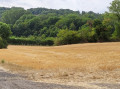
(6) Continue straight on. You are now on the Chemin descendant des Rousseaux, where woods, crops and fields alternate in a hedgerow-lined landscape, offering both light and a certain coolness. The path leads to a T-junction.
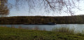
(7) Turn right onto the Route du Petit Barbeau, which continues as the Boulevard Aristide Briand until it reaches the banks of the Seine, with its barges – often converted into homes or restaurants – moored along the Quai de la République.
(8) Take the footbridge crossing the Vautère (a developed branch of the Seine) for a pleasant stroll on the Île du Berceau, before returning to the quayside lined with its stunning, vast mansions built by wealthy bourgeois families during thefirst half ofthe 20th century.
(9) As soon as you reach the forest, turn right and head up to the plateau via the 111-step staircase. Hang in there! This is the only challenging part of this healthy walk. Once you reach the upper road (D137), opposite a forester’s cottage, walk about ten metres to the left before taking the path that goes round it.
(10) Simply follow the Blue Trail, which winds its way through the woods.
(11) Turn right onto the Route de l’Agaric, then left at the next junction onto the Route du Cèpe. Pass under the railway line.
(12) 50 m further on, take the Route de la Girolle on the right, a wide lane that winds through beautiful woodland scenery and which, in season, will add to your mushroom harvest – the mushrooms that have been honoured in the names of the paths along this route. Continue for about 800 m.
(13) Take thesecond left at a star-shaped junction, a reminder that this part of the massif was once a hunting ground renowned amongst the kings of France. Follow the Route Dugay-Trouin, passing along the edge of young oak stands, full of promise, to reach the Carrefour de la Croix de Toulouse (S/E).
 Visorando Member
 Difficult
 Moderate