Country:
 City:


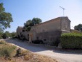
Park in the car park at the Domaine de Fondespierre and head east.
(S/E) Continue along a path running alongside the field.
(1) When you reach the tarmac path, head straight ahead onto a PR®-marked path until you reach a road; follow it to the left for about 150 m and continue on the PR® to the right.
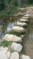
(2) Watch out for this very narrow path which crosses a stream. If you cannot cross it, continue along the PR® path until you reach a sports ground; turn right and, after crossing the stream, turn immediately right to walk alongside it, ignoring the Yellow Cross on the PR® sign.
(3) Walk a few metres to the right to join a track on the left at a well.
(4) At this junction of three paths, take the one furthest to the right – a hairpin bend – and follow the PR® as it skirts the Font d’Armand quarry. Pay close attention to the trail. When you reach the road, head left for about 80 metres.
(5) Cross the road and take a small, unmarked path on the right, just before the first buildings. Follow it until you cross paths with a PR® again, with wooden structures in sight. Turn right and cross a stream.
(6) At this junction, leave a private area on your left; opposite is a PR® path. Head right up the slope onto another PR® path.
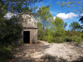
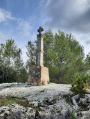
(7) Leave the PR® to explore the old Pasquier quarry on the right, then return to the PR®. Take the tarmac path running alongside the Beaulieu quarries. At the far end of this area, head towards the open-air theatre on the left and on towards the Croix des Carrières.
(8) Take a path on the right, which goes round a former quarry and rejoins the tarmac track leading to the Beaulieu quarry, which is still in operation. Continue along the tarmac track.
(9) At the far end of the site, take a path on the left. Using your GPS, follow the route uphill towards the Croix des Carrières.
(10) Carry on to the left to join a path – GPS is very useful here.
(11) Please note: take this small path on the left, which leads back to the parallel track.
(12) Follow the tarmac road until you reach the M120. Turn left.
(13) A well-marked path climbs to the left towards the village and leads to Sussargues Town Hall. Turn right towards the village centre, then left at the church. Continue along the PR®.
(14) At this junction, carry on straight ahead along a tree-lined path.
(15) On the left, take a lovely path leading to the estate’s car park (S/E).
 Visorando Member

 Easy