Country:

 City:
City:


Start from the car park just above the Séchenailles holiday village.
(S/E) Walk down the road towards the lakeside, crossing the beach.
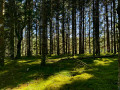
(1) Continue along the fitness trail through the woodland.
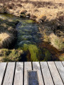
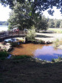
(2) At the end of the lake, turn left and cross the two streams (2 bridges).
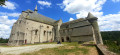
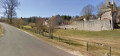
(3) Cross the D76 and take the road going uphill opposite (passing the castle on the right) and, at the top of the hill, turn right. Follow this road to the hamlet of Laubard.
(4) At the crossroads in the hamlet of Laubard, turn right onto the path towards the locality known as Les Prades.
(5) After this locality, turn left, walk for about 200 metres and turn left onto theGR®440B. Continue along theGR®440Bto the railway bridge.
(6) Cross the railway line (Pont de la Reine); shortly after the bridge, theGR® turns westwards. Follow it.
(7) After the hamlet of La Goutte Morte, at the junction, continue along theGR®440B(second left).
(8) At the left-hand bend before Matrillat Haut, take the dirt track which climbs through the woods and joins the road on the other side.
(9) Cross the road to rejoin theGR®. Continue for about 500m then turn right. The path climbs close to the highest point of the walk (898m).
(10) Leave theGR®440Band take the path on the left. Walk down to La Gautherie
(11) At La Gautherie, join the D76 on the left, then take the path on the right which descends towards Le Charillou, rejoining the D76.
(12) Turn left towards the church and continue to the junction with the D76, which you follow for about a hundred metres.
(3) Turn right and retrace the outward route in the opposite direction to return to the starting point (S/E).


 Visorando Member
 Difficult
 Easy
Easy