Country:
 City:
City:


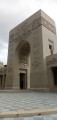
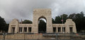
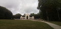
Starting point and access: Chaville Rive Droite station.
- Transilien – Line L, on the section between Paris-Saint-Lazare and Versailles.
- Transilien, Line U, on the section between La Défense and Versailles-Chantiers.
Take the Rue Carnot exit, at the front of the train when travelling from Paris or La Défense towards Versailles.
Red and white + yellow signposting
(S) On leaving the station, turn right onto Rue Carnot, preferably keeping to the left-hand pavement. At the stop sign, cross Rue du Coteau, go through a forest gate and follow a forest track that climbs gently. Pass a large oak tree marked with a signpost and you will immediately come to a crossroads.
Markings: Green horseshoe on a white background
(1) Take the first path on the left (plot no. 132), immediately ignore a path coming from the right and head slightly downhill. Continue straight on, due west, and cross a wide path running perpendicular to it (plots nos. 131 and 129). At a Fork in the road, keep to the right. At the next junction, go straight on and climb steeply.
(2) You’ll come out onto a wide path (plots nos. 130, 129 and 128) and follow it to the left. Walk on roughly level ground and you’ll soon reach another junction (plot no. 128).
No signposting
Carry on straight ahead. Pass a viewpoint (you’ll probably have to wait until winter for a clear view), leave a playground on your left and continue straight on (plot no. 126).
(3) At the crossroads, take the first path on the right, which starts between two trees, each bearing the number 127. At the junction shortly afterwards, go straight on. At the next crossroads (benches), take the third path on the right, which is tarmac. Arrive at the Carrefour des Quatre Bornes and begin a short descent towards the Étangs de Ville-d’Avray.
(4) Immediately turn onto the first path on the left, which goes downhill, and pass the base of a tree marked with the number 111.
Yellow markings
At the first junction, turn left. At the next junction, go straight on and head downhill.
Red and yellow + yellow markings
At another junction, carry on straight ahead. Pass a pond on the left, cross a stream and arrive at a large crossroads.
No markings
(5) Then follow a wide, compacted track to the right towards Ville-d’Avray. At two successive junctions, go straight on and stay on the main track.
Red and yellow signposting
(6) At the next junction (plot no. 96), carry straight on. After about 200 m, turn left, immediately ignore a path coming from the right and walk alongside one of the two ponds at Ville-d’Avray on your right (this is the Vieil Étang). Cross a stream via a footbridge without a railing, then turn right onto the path, still following the edge of the pond.
(7) At the end of the pond, cross a tarmac road and take the first turn right then left to walk alongside the second pond (the Étang Neuf), still on your right. At a fork in the road, keep to the right and walk past the monument honouring the painter Camille Corot. Then turn right and follow the pond’s embankment.
No signposting
(8) At the end, turn right and walk along the pond on your right-hand side. At the south-western end, turn right and follow the embankment between the two ponds.
(7) Pass a chicane and walk up a street. At the end, cross Rue de Versailles (D985) at the pedestrian crossing (traffic lights) and follow it to the right.
Red and white + yellow markings
(9) Just after a bus shelter, turn sharply left. Pass a car park on your right, go through a forest gate and take a path that climbs quite steeply. At the crossroads (with a large oak tree in the centre), take the third path on the right (roughly opposite) and follow it for about 250 m.
Yellow signposting
(10) At the junction, turn left onto the PR®4 and follow a path that winds through the woodland. A little further on, turn right onto this path. At the junction that appears shortly afterwards, take the second left, a tarmac track. At the end, pass through a forest gate and walk alongside a road for a few dozen metres. Then turn right to cross the road carefully. There are two paths on the other side: take the one on the left, leaving the Pavillon Thierry Forest House on your right.
(11) At the junction (plot no. 50), turn left. At the next two junctions (plots no. 38 and then no. 37), go straight on. Pass through a forest gate, go round a small car park on the right and, at the corner of the car park, turn right. Enter the Haras de Jardy Departmental Park, pass a small house on the left and you’ll soon come to a junction.
No signposting
(12) Then follow a wide concrete path to the left. At the end (site map on the left, metal gate opposite), turn right. When you reach the large buildings housing horse stalls, go round a small roundabout on the right and turn right onto a path which soon becomes a hard-surfaced track. Walk between exercise arenas and pastures.
(13) At a fork in the road, keep to the right on the compacted track. Shortly afterwards, at a junction, continue straight on along a concrete path and follow a fenced meadow on your right. After about 300 m (site map), turn left and leave the park. You will soon reach the Carrefour du Haras.
(14) Then turn right, heading due south. At the next crossroads, take the second path on the left (the map shows one too many) and pass by the foot of a tree marked with the number 50. Continue straight on until you reach a junction you have passed through previously.
(11) Then turn left. At the next junction, go straight on along a tarmac road and follow a boundary wall on your left. At the next junction, take the second right towards Sèvres.
Red and white + yellow markings
(15) Cross the access road to the cemetery on your right, then turn left into Rue Neuve Thierry. Carry on straight ahead and continue along Allée d’Albon (change of municipality). When the street becomes a no-entry road, turn left and walk past the west end of the Church of Sainte-Eugénie. Then turn right to walk between the town hall and the church. Cross the D407 at the pedestrian crossing and reach Place de la Mairie.
Red and white markings
(16) Turn right towards the Domaine National de Saint-Cloud and head uphill. Pass through the Porte Blanche and enter the Parc de Saint-Cloud. Then veer to the right and take a dirt track. At the junction that appears immediately, go straight on and you’ll soon reach another junction.
(17) Turn left onto the GR® and continue uphill. Join a wide path and follow it to the left for about a hundred metres, until you reach a Fork in the road.
No signposting
(18) Turn left and head slightly downhill. Turn right, then left along this track, where you can make out old patches of tarmac. After another left-hand bend, turn right onto a narrow dirt track. Ignore a faint track leading down to the left; turn right with the track and head uphill. At a junction, go straight on.
Red and white markings
(19) Return to the former tarmac path and follow it to the right. Ignore two offshoots on the left.
No markings
Walk alongside a railing on your left and ignore another turn-off on the left. Turn right onto the main track, pass some concrete blocks on the left, then ignore a track coming from the right. At a junction, carry straight on along the old tarmac track and follow it for a further hundred metres.
(20) Then turn left onto a faintly marked path which remains roughly level and runs parallel to the main track (ignore a vague turn-off on the left). After about 150 m, turn left. Descend along a path that is barely marked at first but becomes increasingly so as you go down. You’ll rejoin the GR®1 and a junction you passed earlier.
Red and white markings
(17) Turn left, go straight on at the next junction and leave the Parc de Saint-Cloud via the Porte Blanche. Walk down the street to the Place de la Mairie.
Red and white + yellow markings
(16) Turn right at the corner by the old post office. Walk past the monument to Louis Pasteur (who spent the end of his life in Marnes-la-Coquette) and cross a lawn. Go through a gate and re-enter the Parc de Saint-Cloud. Then take a path that veers diagonally to the left. Walk alongside a fenced-off meadow on your left and, at a junction, continue straight on. At the T-junction, follow a wide path to the right for about 200 metres.
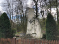
(21) Then turn left towards the La Fayette Squadron Memorial. Go through a narrow tunnel under the A13 motorway (visibility is very poor but the path is even). Then take a footbridge over a railway line.
(22) On the other side, turn left and walk alongside a pond on your right.
No signposting
(23) At the junction, continue straight ahead along a gravel path which crosses a lawn and leads to the foot of the La Fayette Squadron Memorial.
(24) Walk round the monument, either clockwise or anti-clockwise.
(24) Cross the lawn again via the gravel path.
Red and white + yellow markings
(23) At the junction, turn left onto the GR® and cross a metal bridge over a stream.
No markings
Pass a car park on the left and turn right onto a small road. Just after a signpost, turn right towards Garches station. Walk as close as possible to the pond on your right and ignore the paths branching off to the left. Cross a stone bridge and return to a junction you passed earlier.
Red and white + yellow markings
(22) Cross the footbridge over the railway line again, then go through the tunnel under the A13.
(21) At the junction, turn left towards Garches-Marnes-la-Coquette station. Continue straight on, running parallel to the motorway. When the wide path turns right, carry on straight ahead. Pass through a forest gate, follow the road to the left and cross over the motorway. Cross the railway line at the level crossing and turn right immediately. Carry on straight ahead until you reach Garches-Marnes-la-Coquette station (E).
To get back home:
- Transilien – Line L, towards La Défense and Paris-Saint-Lazare (direct access) or Saint-Nom-la-Bretèche (use the underpass).
 Visorando Member
 Easy
Easy 
 Very difficult