Country:

 City:
City:


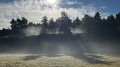
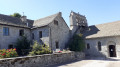
Park at the top of the village of Chabanne, next to the picnic area.
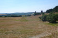
(S/E) Take a good path heading north across the plateau until you reach a junction at a place called Les Pergos.
(1) Continue diagonally to the left, then gently descend along a winding path towards the viewpoint at Pont de Basile.
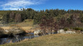
(2) Continue downwards until you finally reach a beautiful meadow at the confluence of the Truyère and the Rimeize. Please note: these are hay meadows; please respect the grass when it is tall.
(3) Then follow the course of the Truyère upstream along a fishermen’s path. The few sections with barbed wire have been made safe. After more than a kilometre, the river approaches a rocky barrier.
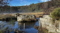
(4) When the river runs alongside the rocky outcrop, head up to the left for about 150 metres to go round it via more or less marked paths. This is the only slightly tricky bit of the route. Continue along the river to reach the ruins of the Conzé bridge.
(5) Cut across to the left through the meadow to join a good path and follow it to the left. Where the path bends to the right, carry on straight ahead until you reach a junction,just after a small stream that flows into the Truyère.
(6) Take the path that climbs to the left and follow it to the next junction (elevation 1010 on the IGN map).
(7) Continue to the right and reach Chabannes at a fountain. Turn left and return to the car park (S/E).

 Visorando Member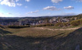
 Moderate
 Difficult
 Very difficult