From Carry-le-Rouet to Sausset-les-Pins along the coast

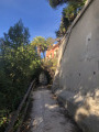
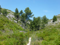
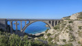
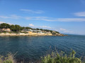
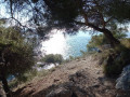
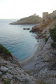
This short seaside walk from Carry-le-Rouet to Sausset-les-Pins is easily suitable for families, with no particular difficulties. The setting, the views and the path are all very pleasant, and you can dip your feet in the water to cool off along the way.

Details

73930010
Creation:
Last update:
Last review:
  • Walking
    Activity: Walking
  • ↔
    Distance: 7.12 mi
  • ◔
    Average duration: 3h 20 
  • ▲
    Difficulty: Moderate

  • ⚐
    Back to start: Yes
  • ↗
    Ascent: + 79 ft
  • ↘
    Descent: - 72 ft

  • ▲
    Highest point: 59 ft
  • ▼
    Lowest point: 0 ft

Photos

Description of the walk

Park in the designated spaces on Quai Professeur Émile Vayssière, at the harbour in Carry-Le-Rouet.

(S/E) Walk all the way round the harbour and continue along the path past the last jetty to reach the small lighthouse. 

(1) Continue along the seaside path towards Sausset-Les-Pins. You’ll reach a small car park at the Calanque de la Tuilière.

(2) Immediately rejoin the coastal path. You’ll come out onto the D5 (Avenue de l’Europe) at the small Plage des Beaumettes. 

(3) Leave the path and continue along the road, turning left. You will reach the Anse du Gros Cerveau. 

(4) Turn left onto the road that climbs (Promenade de la Corniche), ignoring the Chemin de la Calanque, which is a dead end. 

(5) Pass Anse du Petit Rouveau and continue along Avenue du Général Leclerc. 

(6) Go round the roundabout on the left and carry on straight ahead, staying on Avenue du Général Leclerc. Pass the nursery school and continue to the junction with Boulevard Armand Audibert, which you will return via later. 

(7) Carry on to the left, staying as close to the sea as possible, and head for the Sausset-les-Pins marina. Go round it and continue to the large roundabout. 

(8) Carry on to the left along Route de la Couronne until you reach the château grounds. 

(9) Turn round and head back to the roundabout. 

(8) Follow the avenue to the right, then turn right onto Avenue Simon Gouin. Continue to the junction with Boulevard Armand Audibert, which you passed on the way there.

(10) Turn right and follow it to the end, where you’ll rejoin Avenue du Général Leclerc. 

(7) Turn left and retrace your steps in the opposite direction to return to the car park at the port of Carry-Le-Rouet (S/E). 
Waypoints

  1. S/E : mi 0 - alt. 10 ft - Carry-le-Rouet harbour
  2. 1 : mi 0.37 - alt. 13 ft - Lighthouse
  3. 2 : mi 1.06 - alt. 13 ft - Calanque de la Tuilière
  4. 3 : mi 1.46 - alt. 20 ft - Beaumettes Beach
  5. 4 : mi 1.99 - alt. 39 ft - Climb to the left
  6. 5 : mi 2.27 - alt. 23 ft - Anse du Petit Rouveau
  7. 6 : mi 2.49 - alt. 10 ft - Roundabout
  8. 7 : mi 2.92 - alt. 7 ft - Junction with Boulevard Armand Audibert
  9. 8 : mi 3.23 - alt. 13 ft - Sausset-les-Pins Harbour
  10. 9 : mi 3.56 - alt. 23 ft - Turn round
  11. 10 : mi 4.08 - alt. 26 ft - Boulevard Armand Audibert
  12. S/E : mi 7.12 - alt. 10 ft - Carry-le-Rouet harbour

Reviews and comments

4.7 / 5
Based on 2 reviews

Reliability of the description
4.5 / 5
Ease of following the route
5 / 5
Route interest
4.5 / 5
KATELINE1976
KATELINE1976
• Edited:

Overall rating : 4.7 / 5

Date of your route : Aug 16, 2026
Reliability of the description : ★★★★☆ Good
Ease of following the route : ★★★★★ Very good
Route interest : ★★★★★ Very good
Very busy route : No

A pleasant and very scenic walk that takes you from Carry-le-Rouet to Sausset-les-Pins along the coastal path.
It’s best to set off early, especially in the middle of August.
You’ll need sturdy footwear as there are steps and some sections are stony.
Don’t hesitate to bring your swimming costume and plastic shoes, as there are some lovely spots for a swim.

Machine-translated

alain.volery@wanadoo.fr

Overall rating : 4.7 / 5

Date of your route : Nov 20, 2025
Reliability of the description : ★★★★★ Very good
Ease of following the route : ★★★★★ Very good
Route interest : ★★★★☆ Good
Very busy route : Yes

Hello
This route is pleasant because it runs along the coast, sheltered from the wind depending on its direction, and is flat.
The downside is that much of the route is on tarmac and, what's more, in town with fairly heavy traffic.
I think this route is best suited to tourists, who are sure to marvel at this stretch of the Côte Bleue.

Machine-translated

Other walks in the area

For more walks, use our search engine .

The GPS track and description are the property of this route's author. Please do not copy them without permission.