Country:
 City:


Park between the town hall and the château, on the esplanade.
(S/E) Walk up Rue de la République, which runs alongside the château (on your right) and descends towards the village entrance. Continue to the junction just after number 35 on the street.
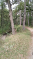
(1) Turn right onto the wide, grassy path leading downhill, which curves to pass beneath the village. After about a hundred metres, you’ll reach a junction.
(2) You now have two options:
1) If the path opposite looks too overgrown, turn left onto the path which leads, about 150 metres further on, to a road. Follow it to the right for about 200 metres.
2) Carry on straight ahead (the option chosen on the map). The path turns left and joins the tarmac road below.
(3) Then take the path opposite (or on the left if you chose option 1) and follow it for about 500 m until you reach a path branching off to the left towards the Salès farm. There, turn right again and walk a few metres before reaching the building. Follow this along a tarmac road to the hamlet of Coutançon. After a bend to the left, then to the right, pass through the hamlet of Anarques and emerge at the Stop sign onto the D1117.
(4) Walk carefully along the right-hand side of the D1117 (caution: busy road), then, at thefirst junction just before the hamlet of L’Ermitou, turn left onto the gravel track, which becomes a path and descends towards the Ruisseau du Marès. Cross the stream and follow it to the right for 100 m, then leave it behind by turning left and heading uphill. Shortly afterwards, turn right and head towards a T-junction.
(5) Turn 90° to the right, heading downhill. Follow this track until it joins the tarmac road leading to Cazilhac. Take this road to the right and, after a right-hand bend, you’ll rejoin the D1117.
(6) Cross it carefully, then take the tarmac road opposite. Ignore a road on the left; then, when the road curves slightly to the left, take the wide, ascending track that opens up opposite (note a large field of solar panels on the left). At the top of the track, at the T-junction, take the track on the right and continue to the hamlet of Les Bouscarres along a tarmac road leading to this hamlet.
(7) Follow this for a few metres until you find the path branching off to the left and heading uphill. At the next T-junction, turn right onto the tarmac road. Leave this behind and take thefirst path on the left, which goes uphill. Further on, you’ll reach a T-junction and another stony track; follow this to the right for about fifty metres.
(8) Leave this track and turn left onto the path leading down towards the Rigole du Canal de Midi (quite a steep slope at the start). When it joins the road, turn left for a few metres, then right to cross the bridge over the Rigole.
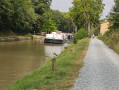
(9) Then leave the road and follow the canal downstream to the right. Continue along the bank on the GR®653 until you reach the junction with the D58, near a bridge.
(10) Leave the GR® and turn right onto the bridge to head back up towards Montmaur along this departmental road. Pass Fondrech, continue uphill and, after the sharp left-hand bend, take the right-hand lane to reach the old mill.
(11) At the junction, do not take the road opposite, which appears to lead directly to the village, but take the one on the left. After a sharp bend to the right, it passes through a built-up area before joining the D1, which, to the right, leads to the car park on the esplanade (S/E).

 Visorando Member

 Easy