Country:

 City:


Park in the car park opposite the village church.
(S/E) Head due south, passing the village restaurant and then the post office , where you can admire a carved, hundred-year-old tree. Pass Place de la Fontaine and continue along the road (Grande Rue), still heading south at the first junction.
(1) Turn left onto Route de Laffarre and walk past the fire station.
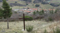
(2) Take the first right onto Route de la Green Cross, follow it for about a hundred metres and, at the next junction, turn left. Pass under the stadium and continue along the path to the Croix de Royer.
(3) Turn right, pass the Royer farm and carry on until you reach the D 17. Watch out for traffic: turn right onto it and follow it for 80 metres.
(4) Turn left onto the downhill track towards the Bellières farm. Take great care at the farm’s access road to take the barely visible path opposite, to the left of the hedge; this path leads to the ford on the Ruisseau de la Couranne.
(5) Cross the stream and continue slightly to the right along the ascending path until you reach a small road. Follow it to the left. At the next junction, turn left again and walk slightly uphill for about a hundred metres.
(6) Take the well-marked path branching off to the left, which descends gently to rejoin the Ruisseau de Couranne, which you cross via a small footbridge. Pass the house known as Le Petit Ruas, then join the D17.
(7) Cross it carefully and follow the path opposite towards the hamlet of Ruas. Walk through the hamlet and follow a long wall at the end of it.
(8) Take the path on the left, which descends gently until it meets a small tarmac road.
(9) Turn right onto it, continuing downhill, and cross a bridge over the Ruisseau du Furon after about a hundred metres.
(10) After about 1 km, turn left off this road onto a very well-marked path.
(11) Cross the Ruisseau du Furon via a small bridge. The path climbs gently. At the end of the climb, you’ll rejoin a tarmac track and soon reach the junction with the Green Cross Road.
(2) Follow the route back in the opposite direction to return to the car park opposite the church (S/E).
 Visorando Member
 Moderate