Country:

 City:
City:


Next to the cemetery, there is a car park where you can leave your vehicle.
(S/E) Leaving the car park, turn right and walk through the village following theGR®420route (marked in white and red) until you reach a crossroads.
(1) Stay on theGR® until you reach Chemin de la Bachole. Turn right towards a steep, narrow road leading onto a path.
Follow theGR®420markings until you reach a small road.
(2) From here, you should no longer follow theGR®420but the white and yellowPR® markings.
Then turn left and follow the main road until you reach Montplot.
(3) Turn slightly right and follow theGR®420for a few metres. At the next junction, turn left, leaving theGR®420behind once again.
Continue along the path to the next junction.
(4) Head along the path on the right, which is quite narrow and leafy. Continue along this path for a few hundred metres. It then becomes increasingly open. You will reach a small stone building in the hamlet of La Grioulet.
(5) Turn left, passing between the two buildings, then continue along the path. You will then come to a crossroads with several directions before the hamlet of Châtarain
(6) Turn right onto an uphill path.
After a few hairpin bends, the path becomes wider and wider. You will then reach a crossroads leading in several directions.
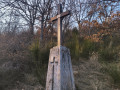
(7) Turn left and then right and continue along the path; you will then reach a fork where there is a metal cross.
(8) Continue left for about a hundred metres, then turn onto the small path on the right.
Ignore the small paths to the right and left until you reach a wider path.
(9) Turn right, then very quickly take a small sloping path on the left; here, take great care to ensure you take the correct path – you must leave the wide path.
Continue along this small path until you reach another wider path.
(10) Turn right onto it and take the first small path on the left as soon as you can.
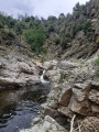
From there, follow the path running alongside the small stream.
The vegetation here can be confusing, so make sure you keep track of the path.
(11) Turn right and stay on the main path. Cross a tiny stone bridge.
When you reach the next crossroads, turn right.
After a few hundred metres, turn right onto a tarmac road – this is the Chemin de la Maison Blanche.
Follow the road downhill until you spot a small path leading uphill.
(12) Once on the very narrow path, stay on it for about five hundred metres.
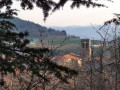
You should see the bell tower of Saint Victor’s church below, on the left.
At the end of this path is a metal cross marked with a V.
Continue a little further, cross the small road and carry on along a narrow path with low stone walls on either side. You’ll reach theGR® junction you passed on the way out.
(1) Turn left and follow theGR®420signposts until you return to the cemetery car park (S/E).

 Visorando Member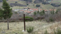

 Local authority
 Easy
Easy