Kerhalon Route

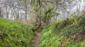
A short route through the countryside around Plouégat-Guérand that takes you close to the Douron before returning to the village, where you can admire its beautiful, fully renovated church.

Details

11931850
Creation:
Last update:
Last review:
  • Walking
    Activity: Walking
  • ↔
    Distance: 3.29 mi
  • ◔
    Average duration: 1h 45 
  • ▲
    Difficulty: Easy

  • ⚐
    Back to start: Yes
  • ↗
    Ascent: + 289 ft
  • ↘
    Descent: - 269 ft

  • ▲
    Highest point: 285 ft
  • ▼
    Lowest point: 92 ft

Description of the walk

The start is at the car park by the cemetery, next to the information board.

Green Triangle signposting

(S/E) At the end of the car park, take the path on the right; then, at the end of the path, continue along the road to the left and pass to the right of the Keramoal farm.

(1) At the end of the road, turn right, then take the first path on the right which crosses a road. Continue to the hamlet of Ty Ar Groaz.

(2) Turn off onto the road branching off to the left, towards Goaz Raoul, then head up through the woodland.

(3) Turn right, then, after about fifty metres, turn left. You are now halfway along the route. Continue through a wooded area and turn right onto the first path, which joins a road at Kervéatous.

(4) Turn left, then right at the next junction, towards Kerannou.

(5) After Kerannou, take the path on the left which runs alongside a stream and leads to a road. Turn right onto this road, then take the path that crosses the Convenant Yvinen housing estate to come out onto Rue du Fouennou.

(6) As you leave the housing estate, take the cul-de-sac almost opposite, then the path on the right towards the primary school. Go round Saint-Agapit Church on the left, pass the town hall and turn left towards the bakery. After crossing the park, you’ll arrive at the car park of Plouégat-Guérand Cemetery (S/E).

Waypoints

  1. S/E : mi 0 - alt. 213 ft - Cemetery car park
  2. 1 : mi 0.59 - alt. 98 ft - Crossroads
  3. 2 : mi 1.04 - alt. 174 ft - Ty Ar Groaz
  4. 3 : mi 1.49 - alt. 180 ft - Crossroads - Douron (fleuve)
  5. 4 : mi 2.14 - alt. 233 ft - Road junction
  6. 5 : mi 2.44 - alt. 223 ft - Junction on the path after Kerannou
  7. 6 : mi 2.92 - alt. 243 ft - Rue du Fouennou
  8. S/E : mi 3.29 - alt. 213 ft - Cemetery car park

Notes

3:: Halfway along the route, at the crossroads, a sign points you in the direction of the Douron.
You can take a short detour to this coastal river, but be aware that the slope is a bit steep and you’ll have to return via the same path.

Worth a visit

Before returning to your starting point, take a short break to visit the fully renovated Church of Saint-Agapit.

Reviews and comments

4.7 / 5
Based on 3 reviews

Reliability of the description
4.7 / 5
Ease of following the route
4.7 / 5
Route interest
4.7 / 5
cla29620
cla29620

Overall rating : 5 / 5

Date of your route : Sep 14, 2026
Reliability of the description : ★★★★★ Very good
Ease of following the route : ★★★★★ Very good
Route interest : ★★★★★ Very good
Very busy route : No

A very beautiful path winding through sunken lanes and woods

Machine-translated

User 6591992

Overall rating : 5 / 5

Date of your route : Apr 20, 2026
Reliability of the description : ★★★★★ Very good
Ease of following the route : ★★★★★ Very good
Route interest : ★★★★★ Very good
Very busy route : No

A lovely walk through the woods. Very peaceful and easy: it’s perfect for families.

Machine-translated

Bernes29
Bernes29

Overall rating : 4 / 5

Date of your route : Jan 28, 2024
Reliability of the description : ★★★★☆ Good
Ease of following the route : ★★★★☆ Good
Route interest : ★★★★☆ Good
Very busy route : No

A lovely walk in the countryside. Following some magnificent paths through the woodland.

Machine-translated

Other walks in the area

For more walks, use our search engine .

The GPS track and description are the property of this route's author. Please do not copy them without permission.