In the Plogonnec countryside

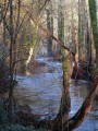
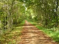
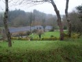
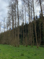
Following paths through fields and woodland, and along small roads, let’s set off to explore a corner of the countryside and its religious heritage.

Details

n°92985
Creation:
Last update:
Last review:
  • Walking
    Activity: Walking
  • ↔
    Distance: 6.32 mi
  • ◔
    Average duration: 3h 25 
  • ▲
    Difficulty: Moderate

  • ⚐
    Back to start: Yes
  • ↗
    Ascent: + 554 ft
  • ↘
    Descent: - 574 ft

  • ▲
    Highest point: 479 ft
  • ▼
    Lowest point: 135 ft
  • ⚐ Country: France
  • ⚐ City: Plogonnec (29180)
  • ⚑
    Start/End: N 48.053286° / W 4.130203°
  • ❏
    IGN map(s): Ref. 0518OT, 0519OT
  • Hour-by-hour weather

Photos

Description of the walk

Starting point: the hamlet of Seznec, on the Quimper–Plogonnec road.
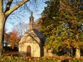
(Out and back) Head left onto the small road (signposted) and turn right (signposted) onto the narrow path between two embankments, which leads to the chapel. Return to the small road, where you turn right, then right again at the first junction. Walk past the farm and the 16th-century manor house on your right. Walk past the Ty Hor Vihan lodges.

(1) At the three-way junction, turn left onto the wide path which descends towards a stream and then climbs back up towards Keradily. Follow this path to the left and carry on, ignoring the road on your right.

(2) Then turn left towards Kernou. Pass the farm on your left to reach the D39, the road to Quimper. Cross it (Caution! Busy road) and carry on straight ahead along the old road that runs alongside the main road until you reach a house. Then continue along the D39 for 300 metres (walk on the grass verge on the left).

(3) Turn left onto Chemin de Kervao. Go round the farm by turning right (there’s a lovely well at the entrance) and carry on until you reach a road at a wayside cross.

(4) Turn left to follow the old Quimper road. At a bend, leave this road and carry on straight ahead along the one-way road. Walk uphill to the next junction. Carry on straight ahead, leaving the roads leading to the Résidence de la Lorette on your right. Just before the chapel, you can admire a cross dating from the Early Middle Ages (see photo).

(5) The Notre-Dame-de-la-Lorette Chapel is a little further on, on the left. The vast grassy and wooded area is ideal for a break. On leaving the chapel grounds, continue along the road as it descends.

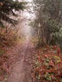
(6) At the junction with the Chemin de Roz ar Brug (coming from your right), turn left near a house to join theGR®®38path, which climbs steadily. Carry on, following theGR®® markings and those of a mountain bike trail. Ignore all other paths until you reach a road at Kergréac’h. On your right, you’ll see several piles of firewood. Continue along this road until the next junction, then turn right.

(7) Carry on along this road. Pass the road leading to Kervanous Farm until you reach the road leading to Gouesnac’h on your right. Continue until you reach the D39.

(8) Cross it with care – there is no pedestrian crossing – and carry on straight ahead towards the car park near the chapel (S/E).

Waypoints

  1. S/E : mi 0 - alt. 394 ft - Seznec hamlet, Quimper–Plogonnec road
  2. 1 : mi 0.54 - alt. 400 ft - Wide farm track
  3. 2 : mi 1.42 - alt. 443 ft - Turn left towards Kernou
  4. 3 : mi 2.17 - alt. 472 ft - Leave the D39
  5. 4 : mi 2.74 - alt. 440 ft - Old Quimper Road
  6. 5 : mi 3.77 - alt. 335 ft - Notre-Dame-de-la-Lorette Chapel
  7. 6 : mi 4.25 - alt. 135 ft - GR38 on the left
  8. 7 : mi 5.54 - alt. 413 ft - Turn right
  9. 8 : mi 6.24 - alt. 374 ft - D39
  10. S/E : mi 6.32 - alt. 394 ft - Seznec hamlet, Quimper–Plogonnec road

Notes

A pedestrian crossing on the D39 (after point (3)). This road is busy, but a wide grass verge allows you to walk safely at the side . Take care when crossing.

The chapels are open every Wednesday in July and August from 2 pm to 5 pm.

Worth a visit

Always be cautious and plan ahead when you're outdoors. Visorando and the author of this route cannot be held responsible for any accidents occurring on this route.

The GR® and PR® markings are the intellectual property of the Fédération Française de Randonnée Pédestre.

Reviews and comments

5 / 5
Based on 1 review

Reliability of the description
5 / 5
Ease of following the route
5 / 5
Route interest
5 / 5
FLOCH
FLOCH ★

Thank you for your comment and your pertinent observation.
I’ve made the correction.
All the best with Visorando

Machine-translated

LeGug
LeGug

Overall rating : 5 / 5

Date of your route : Apr 27, 2018
Reliability of the description : ★★★★★ Very good
Ease of following the route : ★★★★★ Very good
Route interest : ★★★★★ Very good

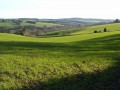
A lovely walk offering stunning views.
There’s a slight error in the numbering of the route description: No. 2 has been omitted, which throws the rest of the description out of order.
Thank you

Machine-translated

Other walks in the area

For more walks, use our search engine .

The GPS track and description are the property of this route's author. Please do not copy them without permission.