Country:
 City:


The start point is at the “La Gastaude” stop on line 14 between Aubagne station and Éoures. For cars, there is a large car park at this location.
(S/E) Head back up towards Aubagne along the path running parallel to the road (towards Font de Mai). Cross a tarmac road and take the track opposite which leads down towards Font de Mai. Go through a gate and continue downhill. When you reach the road, turn left towards Font de Mai, following the Marcel Pagnol trails (yellow markings).
Further on, on the right, you’ll come to a gate marked ‘La Font de Mai’. This gate is open from 6 am to 7 pm: go through it and take the track on the left opposite, which leads uphill. After a bend, you’ll see a large farmhouse with a big cedar tree: this is La Font de Mai. Do not take the track coming in from the left; instead, head towards the farmhouse, which has toilets and a refreshment bar, open on Wednesdays, Saturdays and Sundays.
(1) Continue along the path and, at the Fork in the road, turn right (towards Garlaban/Sentier des Scolopendres). Look out for a wheat field on the left, below you. You’ll come to a Fork in the road with a small wooden sign marked ‘Limite de zone de dérogation’. Turn left to join a fairly wide dirt track. Follow it to the right, towards Garlaban via the Sentier des Scolopendres. Continue until you reach a crossroads with a large well.
(2) Do not take the flat track to the left, nor the one going uphill to the right. Take the small path heading due north. You are now on the Sentier des Scolopendres. Pass a ruined sheepfold on the right, then at the Fork in the road turn left, following the yellow markings. Do not take any of the small side paths; stay on the marked route. Enjoy the lovely view over Marseille and continue to a junction in front of a large electricity pylon.
(3) Take the wide track on the right towards Le Garlaban, following the yellow markings. Further on, you’ll come to a huge cairn and a track that climbs. Follow it to the right (towards Le Garlaban via Le Draïoulet). The track has some very steep shortcuts: do not take them; follow the hairpin bends.
(4) At the final hairpin bend, on the left, there is a small cairn and a black sign on the ground marked ‘Gravures’. Follow this small path and admire the numerous engravings by Louis Douard depicting Provençal life. Magnificent view over Marseille. Return to the main track and turn left towards Garlaban and its cross.
(5) On reaching the Col de Garlaban, turn right beneath the pine trees. Keeping to the right, after about a hundred metres, you’ll see a stone wayside shrine dedicated to the Curé d’Ars. Take the path heading due east which goes round the pine tree. Do not take the path that descends to the right towards Aubagne/Le Pin Vert. Follow the path that climbs up to the cross.
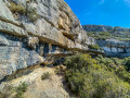
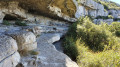
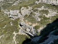
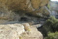
(6) Set off again from the cross, following the cliff face northwards. At a fork in the road between two stony, descending paths, turn right. When you reach a path, turn right again, heading north-east, until you reach a junction with a collapsed cairn.
(7) Take the path that descends to the left. At the next cairn, turn left again. Continue straight down the cliff face until you reach the Barquieu spring.
(8) Then turn right onto the level path heading south-east along the top of the cliff. You are now on the Sentier des Dansaïres. Navigate a hairpin bend to the left, then another to the right. Further on, a path joins from the left: carry on straight ahead. Then ignore another path on the right, carry on straight ahead and reach a junction with a large oak tree and two large boulders in the middle of the path. A path comes from the left: take the path opposite, following the yellow markings, and emerge onto a road with a small car park on the right.
(9) Turn left onto this road and follow it until you reach the Chemin de Gaudissard on the right. Follow this path until you reach a crossroads.
(10) Take the Chemin des Manaux on the right. Ignore the Impasse des Agaçons on the right; continue to the Fork in the road and turn left towards Roquevaire.
(11) At the crossroads, follow Route de Lascours to the right and enter Roquevaire. Turn left onto Avenue Médecin Aspirant Jean Coulomb and follow the railway line to the old station.
(12) Just before the station, cross the tracks and go through the car park of the Salle Raymond Reynaud. At the roundabout, turn right onto Avenue Georges Clémenceau towards the town hall, cross the junction and continue straight ahead onto Boulevard Piot, still heading towards the town hall. You will come to the junction with the D96; turn left and continue to the church, where you will find the “Église de Roquevaire” bus stop (S/E).

 Association / Club / Walk leader
 Easy
 Visorando Member