Country:
 City:


By car, head for the car park at Santa Pola Lighthouse. To do this, from Alicante, take the N332 towards Santa Pola. However, it is not possible to turn off the main road onto the track leading to the lighthouse, so you’ll need to go a little further. When you’re almost at Santa Pola, turn left onto the Ronda Norte (signposted CV8520 Santa Pola). At the roundabout, retrace your steps (i.e. takethe third exit) and then turn right back onto the N332 (towards Alicante). After the 90 km mark, turn right onto the road leading to the lighthouse. This road is narrow and runs in a straight line; it ends with a ‘no entry’ sign just before the lighthouse. Park in the car park on the right.
(S/E) Return to the road leading to the lighthouse, but immediately turn onto the first track on the right to see some ruins dating from the Civil War.
(1) You’ll come to a bunker fitted with a rangefinder that was used to determine the position of enemy aircraft, information which was then relayed to the gun batteries. You then proceed to the southern battery and, a little further on, to another battery after turning left. The main purpose was to protect the Alicante airfield located at Rabassa. There is also an information board.
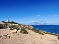
We continue along the path towards the foot of the lighthouse, but the area is fenced off and we cannot get any closer. The hike through the Sierra de Santa Pola can now begin. We retrace our steps along the road and take the first path on the right.
At the crossroads, keep left, ignoring the path leading to the El Faro holiday residence. Carry on straight ahead until you reach a junction where three paths meet.
(2) We keep to the left. We cross another path by going straight on, then head due north until we reach a main track.
(3) Take this on the left. When you reach the multi-way junction, turn right, then turn left about a hundred metres further on. Then carry straight on.
(4) Turn left, then keep to the right at the next junction. You’ll soon reach a four-way crossroads and turn left.
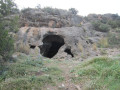
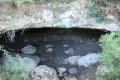
(5) Look out for the tiny path on the right, somewhat hidden amongst the vegetation, which leads to the cave. Fortunately, there are cairns and purple paint to help you find your way. You’ll come to a large rock overlooking a precipice. But you mustn’t climb down the whole precipice. You just need to climb down this rock two to three metres, and the cave is on the left. This short section, which involves a bit of scrambling, is only suitable for experienced walkers.
(6) Entrance to the cave. We retrace our steps.
(5) We rejoin the path we had left and follow it to the right. We head due south, taking care not to take any of the paths on the left. This brings us to a clearing where several paths meet.
(7) Turn left and carry on in the same direction (east) until you reach another junction with several paths.
(8) Turn right and head straight on to rejoin the road leading to the lighthouse. Follow it, turning left, and continue to the car park (S/E).

 Visorando Member
 Easy

 Difficult