Country:
 City:


The starting point for the walk is at the car park in the centre of Clot de Galvany. To get there by car, see the ‘Practical Information’ section.
There is an interpretation centre at the entrance to the site, and the local council has marked out two walking trails: a very short one (trail R1) and a longer one (called R2). It is this second trail that is mapped out here. You should therefore follow the signs marked “R2”. This path is a dirt track but it is wide and features amenities such as benches and viewing points.
(S/E) Head towards the far end of this car park and the centre’s interpretation centre, then turn right onto the wide path called “ruta el humedal”. Please note that at the start of this walk there is a large area equipped with tables and benches for picnicking.
(1) Turn right.
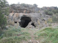
(2) Bunkers dating from the Spanish Civil War, now used by bats. You can also take the time to climb up to the various observation posts. Ignore a path branching off to the right and carry on to the viewpoint.
(3) Take the small path on the left. At the next junction, follow the path on the right and carry on straight ahead until you reach a multi-way junction.
(4) Carry on to the left. Keep to the right and, after two bends, you’ll reach another junction where you should turn left.
(5) Follow the road to the left.
(6) Turn left again.
(7) Take a detour to see the remains of Roman buildings. This part is optional.
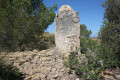
(8) These are the remains of a Roman barn thought to date from the1st century BC. At the time, the land all around was used for farming. This is the furthest point of the walk: retrace your steps.
(7) Turn right.
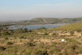
(9) A birdwatching spot where, well hidden, you can take some superb photos. Walk for about a hundred metres, then turn left.
(1) Turn right and head back to the car park (S/E).

 Visorando Member


 Moderate

 Difficult