


Cornichai 02/BX 13 via Plat Bois


This is the Cornichai 02/BX 13 walk, modified to avoid tarmac roads. The route has therefore been re-planned to favour dirt tracks or rocky paths in places, whilst retaining more or less the same route.
Details
Creation:
Last update:
–
–
Last review:
–
–
-
 Activity: Walking
-
 Distance: 6.59 mi
-
 Average duration: 3h 35
-
 Difficulty: Moderate
-
-
 Back to start: Yes
-
 Ascent: + 610 ft
-
 Descent: - 607 ft
-
-
 Highest point: 1,447 ft
-
 Lowest point: 1,073 ft
-
 Country:
Belgium
-
 Area: Massif des Ardennes
-
 City:
Bertrix
-
 Start/End: N 49.844461° / E 5.2213°
-


 Hour-by-hour weather


Waypoints
- S/E : mi 0 - alt. 1,375 ft - Path
- 1 : mi 1.21 - alt. 1,293 ft - Fork
- 2 : mi 2.44 - alt. 1,325 ft - Plat Bois
- 3 : mi 6 - alt. 1,339 ft - Junction
- S/E : mi 6.59 - alt. 1,375 ft - Path
Other walks in the area
From Bertrix to Cugnon and from Château des Fées to Point de Vue de La Mergire
 Visorando Member
 9.78 mi
+1,227 ft
-1,220 ft
5h 35
Moderate
 Departure from Bertrix (Province de Luxembourg)
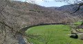
Route on one of the slopes of the Semois, from Bertrix to Cugnon, from the Château des Fées to the Point de Vue de La Mergire, from the Moulin de Cugnon to the Old Cemetery of Mortehan, returning via the old Bertrix-Herbeumont railway line, now the RAVeL and Route des Pierres qui Parlent.
The woods of Bertrix via the arboretum
4.85 mi
+331 ft
-315 ft
2h 30
 Easy
Departure from Bertrix (Province de Luxembourg)
A short walk through Bertrix, passing a restored former water tower, with views of Bertrix and the arboretum.
A walk towards the Arboretum and the Château des Fées
 10.80 mi
+1,762 ft
-1,752 ft
6h 30
 Difficult
Departure from Bertrix (Province de Luxembourg)
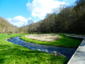
Set off to explore the Château des Fées, a rocky outcrop secured by a few low stone walls, as well as the Bertrix Arboretum, where you can discover numerous specimens of trees from all corners of the world.This beautiful, exclusively woodland walk, which is very quiet, should be considered difficult not only because of its cumulative elevation gain but also due to a few sections on steeply sloping paths or paths that are virtually non-existent on the ground. It’s not the Alps or the Vosges... just Wallonia on the Semois side!
Passing by the Cave of Saint Remacle de Cugnon
 6.86 mi
+1,017 ft
-997 ft
4h 00
Moderate
Departure from Bertrix (Province de Luxembourg)
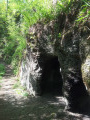
From Château Pierlot, you will visit the Grotte Saint Remacle via the Thibeauroche viewpoint and the bridge. With a little extra climbing, you will reach the Croix viewpoint overlooking the entire valley. The return journey will be along a short section of neglected paths, ending at the Prompt Secours Chapel and the Mergyre viewpoint.
From La Roche aux Corbeaux to the Saint-Bernard Hermitage
 7.30 mi
+1,063 ft
-1,056 ft
4h 15
Moderate
Departure from Bertrix (Province de Luxembourg)
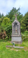
Passing by La Potale and the Chapel of Saint Barbara, patron saint of slate miners, set off to discover the remains of the Hermitage of Saint Bernard of Bertrix, starting from La Roche aux Corbeaux in Herbeumont. Along the way, look out for the various slate quarries known as La Côte de Champion, La Goutelle Husson and Linglé.
Les Hayons, one of the villages in the Bouillon area
 8.28 mi
+1,391 ft
-1,391 ft
5h 00
Moderate
Departure from Bouillon (Belgique) (Province de Luxembourg)
Roche Levée, Saut des Sorcières, Mont Zatrou viewpoint, Roche Percée: these are just some of the places you will discover on this hike.
Forest walk in Jéhonville
 11.21 mi
+682 ft
-666 ft
5h 45
Moderate
Departure from Bertrix (Province de Luxembourg)
This region of the southern Ardennes is particularly active in forestry: the small village of Jéhonville alone has two sawmills.
The forest is omnipresent, even though the route crosses a few areas of pasture and crops.
The hike is a free combination of sections of local walking trails, GR® trails, the "Between Lesse and Lomme" route that circles the municipality of Libin, and unmarked but publicly accessible paths.
The route crosses a didactic route called "Sur les traces de 14-18" (In the footsteps of 14-18) and passes through the Vieille Rochette Nature Reserve.
You may or may not like the unusual shape of the bell tower of the church in Jéhonville.
From Château d’Herbeumont to the Libaipire viewpoint
 11.86 mi
+1,627 ft
-1,621 ft
6h 50
Difficult
Departure from Herbeumont (Province de Luxembourg)
From Château d’Herbeumont, set off via the Herbeumont Viaduct into the Bois de Conques, home to the Grotte des Moines and the 17th-century Redoute des Mauleus. Follow the Semois river, discover the Castelain viewpoint, and return via the Bois de Sainte-Cécile and the Libaipire viewpoint overlooking the Tombeau du Chevalier and Herbeumont Castle.
For more walks, use our search engine .
The GPS track and description are the property of this route's author. Please do not copy them without permission.

