Country:
 City:
City:


To get to the starting point. Take the D185, Fabrègues <> Villeneuve-lès-Maguelone, near the SPA Montpellier – Métropole-Fourrière Animale Noé animal shelter. Park in the unpaved car park between the animal shelter and the entrance to the path leading to the hamlet (opposite the information sign: Gardiole Mont-Bauzille).
Important notes:
- This route passes through a network of numerous paths and tracks; the use of a GPS or mobile app is strongly recommended and will make navigation easier.
(S/E) Set off from the car park, keep to the left of the road heading west for 40 metres, until you reach the junction. At a fork in the road, leave the road to the left and follow the path heading south-west. Walk alongside the fence on your right. Pass a clump of shrubs and paths on your left. Approach the hamlet on your right, go through the gate and close it behind you. Continue along the path, keeping the same direction. Avoid all side paths. (The track, the hamlet and the path are not shown on the map). You will come to a three-way junction.
Turn right, heading south-west; at several path junctions, keep to the right and reach a section.
(1) Turn right, heading north-west then west. Pass through two closely spaced crossroads and keep to the right, heading north-west downhill. Reach a fork.
(2) Turn left, heading south-west. Avoid the first two left-hand turnings, follow a stream and, after a short climb, reach a Fork in the road.
Continue to the left, following a stream on your right and then on your left through the Truc des Cades woodland, until you reach a crossroads.
(3) Turn right uphill, take a left-hand bend and reach a Fork in the road.
Turn right, heading north-east, and reach a crossroads.
Turn left at a 45° angle, go round the second bend at a 90° angle, pass under a power line and reach a section
(4) Turn left onto a descending path heading south-west, follow a circular path, cross a stream and the dead-end track. Continue straight on along the ascending track and reach a path.
Carry on, keeping to the right in a south-westerly direction, until you reach a path. Go straight on, cross a car park, reach a Fork in the road, keep to the right and join the section (DFCI road).
(5) Turn left, going round the barrier on the DFCI track, onto the ascending path. Continue for 50 m, then turn right onto a steep ascent along a visible track, keeping the power line on your left, and join a path.
Turn right, then take the left-hand bend uphill, cross the power line, stay on the shaded path and reach the 131-metre mark along a short stretch.
Turn left onto the south-east-facing firebreak and reach a junction further down.
Continue straight on uphill, cross a power line, climb the steep ascent of Pioch Champ and reach a junction further downhill.
(6) Turn right, heading south-west, onto a descending track, cross some scrub and reach a stream at a junction of tracks (not shown on the map).
Turn right uphill at a bend facing west. Pass under a power line and reach a track.
Turn left uphill, keeping the power line on the same side, and reach a section at the pylon. Go round the pylon in a right-hand bend, cross the power line, then reach a fork in the road.
(7) Turn right, cross the embankment and follow the track. Keep left at the junction with a path, cross the rocky area (Roque Rousse) to the right, then descend a steep slope and, at the 100 contour line, reach a Fork in the road.
Turn left onto the south-westerly ascent, cross the coppiced woodland on the descent and reach a fork in the road.
Continue halfway up the slope until you reach a junction.
Head left at a 45° angle, climbing in a south-easterly direction, make a circular turn to the right and reach a section.
(8) Turn left further down (cairn), head south-west through open terrain along the barely visible track, keep to the left of a stretch of barbed wire and reach a crossroads.
Turn left at the fallen pole facing south, follow an old power line whose poles have fallen to the ground, cross a stretch of barbed wire on the left and a pile of stones on the right, and reach a section.
Keep to the left for 30 m, heading south-west, and reach a section. Turn left onto the path (landmark: flat rock on the ground) and reach a section.
(9) Turn left onto the winding track heading uphill, cross through some scrub and avoid the right-hand exit. Pass under the power line at elevation 124 and reach a section.
Keep to the left and follow the bend to a Fork in the road.
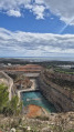
Turn right heading west towards the hamlet of La Tortue, pass under a power line and walk alongside an old quarry on your left. Take a left-hand bend, cross another power line, reach the rock and arrive at the crossroads.
Continue straight on heading south-east, cross the car park and keep the water tank on your left. Follow the road on your right and join the track (DFCI).
(10) Turn left, go through the barrier on the DFCI track, stay on the path, avoid all left and right turn-offs and reach the Fork in the road.
Head left uphill heading north and come to another junction.
Turn left up the north-facing slope (landmark: boundary marker and covered drinking trough), join the track further up and turn right at Marker 32. Pass a water tank on your left as you round a bend, then the go-kart track fence on your right, and reach a section of track.
Take thesecond exit on the left down the slope. Join the path below at a crossroads.
(11) Switch to the lower, descending track in a gully heading east, follow the road overhead on your right, cross a hilly section and, as the track curves to the left, join a section.
Turn right onto the descending path, cross a technical section and reach the road below.
Turn left, follow the road on your right-hand side and reach the junction.
Go straight on to reach a section.
(12) Turn left then right, heading north-east, uphill, and reach a junction at contour line 125.
(13) Continue straight on to the right; atthe second bend, ignore two turn-offs by keeping to the left, proceed in a north-east to north-west direction (it is possible to cut across the hairpin bends) and reach a junction via a right-hand bend.
(14) Take thesecond right-hand exit onto a stream bed, head downhill, reach the Canabière Valley and its stream below, and reach a junction.
Turn left, follow the valley and its stream, and reach a junction.
Turn right uphill onto the eastern slope, reach a path upstream at the 110 contour line and arrive at the crossroads.
Turn left up a steep slope and reach another junction.
(15) Turn right downhill onto the stony path. Walk past a rock on your right; after the left-hand bend, begin the two successive climbs, keeping the quarry on your right and following the 135-metre contour line, until you reach a section.
Turn right, head towards the chapel at a place called Mont Saint-Bauzille, go round it on your right to arrive opposite the cross and a crossroads.
(16) Take thesecond left turn off the cross, head downwards towards the south-west, after a right-hand bend, and reach a Fork in the road.
Keep to the right, maintaining the same direction, and approach a junction. Turn right downhill heading north-east and, after a left-hand bend and a fork in the path, rejoin a section of the trail.
Turn right downhill to reach the path running alongside the road and a section. Turn left to reach a junction after a bend. Keep to the right, follow the road below and head downhill to join the road.
(17) Head left towards the west along the road and reach a section. Continue straight on at the 100 contour line and reach a section.
Turn right onto the steeply descending path, cross Table Mise and reach a stream and a Fork in the road. Continue uphill and reach a crossroads.
(18) Turn right, pass between the boulders and walk alongside a property. Go past the pylon and the power line, finish at a left-hand bend (stone-lined path) and reach a section.
Head right, heading east. (Chemin de l’Aire de l’Hermite), pass under the power line and a stream, and rejoin a track.
Turn left and reach a junction.
(19) Turn right, heading east, and reach a junction. Continue straight ahead along the track heading east-north-east (not shown on the map), cross an area of coppice and reach another junction.
Keep to the right and cross a three-way junction. Keep to the right-hand side as you round a left-hand bend and arrive at the initial crossroads you passed on the way out.
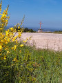
(1) Turn right and head towards the earth mound and altitude 53 at a crossroads. Turn left, heading north-east. Walk along both sides of the earth mound (topped by a mast and its stele) and (a resurgence and its reed beds).
Head towards the SPA kennels, turning left as you approach the exit.
Cross a mound of earth (between a boulder and a small copse), then turn right.
Go through the gate (close it behind you) and head for a lay-by. Turn left, keeping the road on your right, and head for the car park near the SPA refuge (S/E).

 Visorando Member
 Average
 Easy
Easy