The Pioch Noir circular walk starting from the Tortue car park

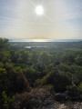
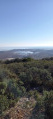
In the heart of the Gardiole state forest, nature lays down its own rules amidst a labyrinth of pure, wild white limestone. Far from the hustle and bustle, the paths follow the contours of the Combe des Bestiaux, then the ascent up the Jasses gradually leads towards the heights of the massif. As you climb the slopes of the Pioch Noir – that dark, mysterious dome and the highest point of the route – your measured effort is rewarded by viewing platforms overlooking the vast expanse of the coastline and the salt marshes. A truly mineral landscape where every ridge reveals a breathtaking panorama.

Details

n°106860476
Creation:
Last update:
Last review:
–
  • Walking
    Activity: Walking
  • ↔
    Distance: 8.03 mi
  • ◔
    Average duration: 4h 25 
  • ▲
    Difficulty: Average

  • ⚐
    Back to start: Yes
  • ↗
    Ascent: + 784 ft
  • ↘
    Descent: - 758 ft

  • ▲
    Highest point: 709 ft
  • ▼
    Lowest point: 138 ft
  • ⚐ Country: France
  • ⚐ City: Fabrègues (34690)
  • ⚑
    Start/End: N 43.515746° / E 3.769648°
  • ❏
    IGN map(s): Ref. 2743ET
  • Hour-by-hour weather

Photos

Description of the walk

La Tortue car park, on the D114 between Vic-la-Gardiole and Fabrègues.

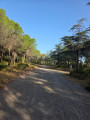
(S/E) With your back to the road, set off along the wide track which winds gently uphill. You’ll come to a junction just after a left-hand bend.

(1) Leave the track and take a path starting on the left.

(2) Continue to the left, pass a water tank and carry on straight ahead to reach the end of a wide track.

(3) Go straight on, skirting the Combe des Bestiaux on the left, and arrive at a four-way junction.

(4) Take thesecond route along the track on the right, ignoring thefirst path on the right which leads back the way you came. Reach the junction with a track.

(5) Carry on to the right and you’ll reach another junction.

(6) Head to the right and follow the track leading to the Pioch Noir, situated on the right.

(7) Return to the track and rejoin the route to the right.

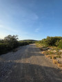
(8) Turn left onto a wide, stony track.

(9) Stay on the wide path as it curves to the right.

(10) Do the same at this junction to stay on the main path, which curves to the right before opening out onto a large cleared area.

(11) Keep to the right to follow the straight track to the cisterns at the end.

(12) Take another track on the right.

(13) Head left and you’ll reach a large star-shaped junction.

(14) Turn left, then immediately keep to the right to climb towards the Pioch des Jasses. Go round it on the left and reach a junction of tracks.

(15) Continue to the right, staying on the same track.

(16) Leave the track on your right and head straight on to rejoin the first junction you passed at the start.

(1) Carry on straight ahead, in the opposite direction to the outward journey, to return to the car park (S/E).

Waypoints

  1. S/E : mi 0 - alt. 272 ft - La Tortue car park
  2. 1 : mi 0.96 - alt. 427 ft - Junction of the circular loop
  3. 2 : mi 1.36 - alt. 407 ft - Junction
  4. 3 : mi 2 - alt. 262 ft - End of track
  5. 4 : mi 2.32 - alt. 141 ft - Junction
  6. 5 : mi 2.44 - alt. 167 ft - Junction
  7. 6 : mi 2.69 - alt. 272 ft - Junction
  8. 7 : mi 3.73 - alt. 705 ft - Pioch Noir (216 m)
  9. 8 : mi 3.82 - alt. 709 ft - Start on a stony path
  10. 9 : mi 4.01 - alt. 699 ft - Stick to the track
  11. 10 : mi 4.32 - alt. 676 ft - Stick to the track
  12. 11 : mi 4.61 - alt. 659 ft - Cleared area
  13. 12 : mi 4.93 - alt. 692 ft - Citernes
  14. 13 : mi 5.19 - alt. 705 ft - Junction
  15. 14 : mi 5.53 - alt. 581 ft - Crossroads
  16. 15 : mi 6.19 - alt. 463 ft - Junction of trails
  17. 16 : mi 6.7 - alt. 476 ft - Junction
  18. S/E : mi 8.03 - alt. 272 ft - La Tortue car park

Notes

La Tortue car park, free and unsupervised, on the D114 between Vic-la-Gardiole and Fabrègues. The ground here is quite rough — take care not to scrape the underside of your vehicle when manoeuvring.

There are no water sources along the entire route: make sure you carry enough water, particularly in hot weather.

The path offers little shade for much of the way.

FFRandonnée rating : E2/T1/R1, Effort: 2/5 (Fairly easy, 41/100) — Technical difficulty: 1/5 (Easy) — Risk: 1/5 (Low).

This rating assumes an average level of fitness: for a hiker who is not very fit, the walk may feel more strenuous despite this rating.

This walk may be closed depending on the fire risk level. Remember to check the fire risk map before setting off.

Worth a visit

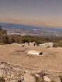
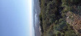
Pioch Noir (216 m). A viewpoint offering unobstructed views of the lagoons and the sea, the highest point on the route.

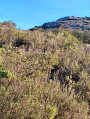
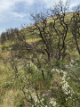
Vegetation — typical Mediterranean heath of the Gardiole: pine and holm oak in the undergrowth, kermes oak, rosemary and thyme on the ground, and broom in bloom depending on the season.

Geology — white limestone characteristic of the massif, exposed on the most exposed sections.

Other walks in the area

For more walks, use our search engine .

The GPS track and description are the property of this route's author. Please do not copy them without permission.