


Refine your search for walks in Colle della Valletta
Colle della Valletta walks


 Tour of the Argentera
 Visorando Member
 36.82 mi
 +14,636 ft
 -14,633 ft
 5 days
 Difficult
 Departure from Valdieri (Cuneo)
There are several ways to circumnavigate this mountain: closer to the summit or further away. But this suggested route allows you to walk around the Argentera via the lakes and the King Victor Emmanuel II trails, always with a view of the Argentera and, of course, a comforting stop at the mountain huts every evening. The stages are fairly well balanced in terms of the effort required, so let’s set off on the tour.
Walks near Colle della Valletta
Sant’Anna Valdieri – Livio Bianco Mountain Hut
 4.46 mi
+2,943 ft
-0 ft
4h 35
4.46 mi
+2,943 ft
-0 ft
4h 35
 Moderate
Departure from Valdieri (Cuneo)
Moderate
Departure from Valdieri (Cuneo)
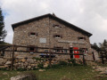
A picturesque climb through a deciduous forest leading out into an alpine valley. Nestled at the far end of this valley, in the hollow of an imposing mountain cirque, lies the refuge. What a delight it is, in the evening, to sit on the terrace and gaze at the reflection of the peaks in the mirror-like surface of the lake.
Isola 2000 – Rifugio Questa
7.19 mi
+4,163 ft
-3,159 ft
6h 55
Difficult
Departure from Isola (Alpes-Maritimes)
The first stage of a circular walk around Isola. The route starts at the top of the resort and finishes at Rifugio Questa, on the Italian side, passing by the Terre Rouge Lakes and Lake Tavels.
Le Boreon - Refuge de Nice
 10.85 mi
+5,971 ft
-3,678 ft
12 hrs
10.85 mi
+5,971 ft
-3,678 ft
12 hrs
 Very difficult
Departure from Saint-Martin-Vésubie (Alpes-Maritimes)
Very difficult
Departure from Saint-Martin-Vésubie (Alpes-Maritimes)
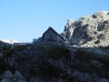
The most difficult stage of thisGR®, but the most beautiful for its landscapes, flora and fauna: chamois, marmots, ibex.
After the Pas des Ladres, we chose to take theGR®52via the alternative route that passes close to the Col de Fenestre, then descends to Lac de Fenestre before reaching La Madone de Fenestre.
Three sections are particularly difficult: between Lac de Trecolpas and the Pas des Ladres, the ascent of the Pas du Colomb, and the descent from the Pas du Colomb.
Boréon – Cougourde Mountain Hut
 5.37 mi
+2,559 ft
-472 ft
4h 40
Moderate
Departure from Saint-Martin-Vésubie (Alpes-Maritimes)
5.37 mi
+2,559 ft
-472 ft
4h 40
Moderate
Departure from Saint-Martin-Vésubie (Alpes-Maritimes)
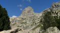
This first stage largely follows theGR®52. It takes you through wooded countryside and offers a relaxing break by the peaceful Lac de Trécolpas. From the Cougourde Mountain Hut, you’ll enjoy superb views of this majestic, pumpkin-shaped peak.
Editor’s note added on 26/07/2021: A section is closed due to bad weather. See the notices for an alternative route
From the Longon Refuge to Saint-Dalmas
 15.05 mi
+3,540 ft
-5,518 ft
10h 00
Difficult
Departure from Alpes-Maritimes
15.05 mi
+3,540 ft
-5,518 ft
10h 00
Difficult
Departure from Alpes-Maritimes
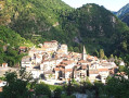
This nineteenth stage continues the long traverse of the Mercantour. From the Refuge de Longon, the path descends the Vallon du Longon diagonally across the slope to the hamlet of Rougios, before following the Fracha forest road and then taking a shortcut to the pretty Provençal village of Roure. Via a stony descent, it cuts across the hairpin bends of the M130 and M30 roads and reaches Saint-Sauveur-sur-Tinée, which it passes through before climbing up to the Chapelle Saint-Roch. Running along the hillside, it crosses the Vallon du Romarinier, passes through the hamlet of Roubinastre, crosses the Ravin de l’Esclosé and arrives at Rimplas. The GR®5 descends gently towards the small pass of Ragias and crosses the Vallon Gros, before climbing back up to the ridge on that side of the slope and then skirting the hamlet of La Bolline. From there, it climbs to the hamlet of La Roche and then ascends the ridge of the Vallon de Bramafam to reach Saint-Dalmas Valdeblore.
Rabuons Mountain Hut – Saint-Étienne de Tinée
4.93 mi
+164 ft
-4,642 ft
2h 25
Moderate
Departure from Saint-Étienne-de-Tinée (Alpes-Maritimes)
The final day is less demanding than the previous one, consisting entirely of a descent. It’s a chance to walk the ‘Chemin de l’Énergie’ one last time before a long descent to Saint-Étienne-de-Tinée.
Rabuons Refuge – Vens Refuge
 9.54 mi
+3,383 ft
-3,875 ft
7 hrs
Very difficult
Departure from Saint-Étienne-de-Tinée (Alpes-Maritimes)
9.54 mi
+3,383 ft
-3,875 ft
7 hrs
Very difficult
Departure from Saint-Étienne-de-Tinée (Alpes-Maritimes)
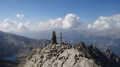
After a night at the Rabuons Mountain Hut, you’ll be ready to climb Mont Ténibre, the main highlight of this second stage. The route is challenging but you’ll be richly rewarded by the panoramic views that await you. To the south, you’ll recognise the Refuge de Rabuons and the lake; to the north and west, there are numerous lakes and the peaks on the border with Italy. After a more leisurely walk along the Chemin de l’Énergie, the scenery will become more pastoral as you approach the Lacs de Vens.
You are now in the Mercantour National Park; there are regulations to be observed, and failure to do so may result in a fine of up to €1,500 – please see the practical information.