


Olivier73

 Visorando Member
 Premium user
 Sign up:
Published route(s)
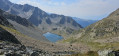
 Combe and lakes of the Grande Valloire
 8.41 mi
 +5,072 ft
 -5,046 ft
 8h 15
8h 15
 Difficult
 Departure from La Ferrière (Isère) (Isère)
A very pretty hike in the Belledonne massif. A forest to climb in the cool, mountain pastures offering unobstructed views of the surrounding area and very pretty lakes that reward the effort it takes to get there. Raspberries and blueberries along the way in season, which is a nice bonus!
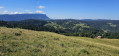
Col de la Cochette circular from Saint-Offenge-Dessus
 7.04 mi
+2,205 ft
-2,228 ft
5h 10
7.04 mi
+2,205 ft
-2,228 ft
5h 10
 Moderate
Departure from Saint-Offenge-Dessus (Savoie)
Moderate
Departure from Saint-Offenge-Dessus (Savoie)
This route offers stunning panoramic views of the Bauges and Mont Blanc on one side, and the Revard and the Albanais on the other. With an ascent and descent through the cool forest and a mountain pasture plateau at the top offering magnificent views, this route has many attractions. The route presents no technical difficulties. Note that there is a section with a cable after the Mermet chalets, which is not particularly difficult.