


Refine your search for walks in Col de Crusous (2203m)
Col de Crusous (2203m) walks


No walk here yet
There are no hikes starting from or close to “Col de Crusous (2203m)”
Walks near Col de Crusous (2203m)
 Refugi Mont Roig – Cabane de Marterat
 Visorando Member

 5.60 mi
 +1,844 ft
 -2,300 ft
 4h 10
 Moderate
 Departure from Lladorre (Lleida)
A short transitional stage, offering a chance to rest and enjoy the scenery. You can also extend the route with the fourth stage to complete the circular route in three days. Another route, which is slightly longer and arguably more interesting, is also possible. It is mentioned as an alternative in the route description and is of a higher difficulty level.
Guzet viewpoint from Guzet Neige
 8.03 mi
+1,490 ft
-2,641 ft
5h 00
Moderate
Departure from Ustou (Ariège)
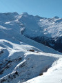
A hike best undertaken in July–August, when the chairlifts from Guzet Neige are operating, for a touch of originality. The first section (from the start (S) at the top of the chairlift to (1) and back) is optional and shortens the walk by an hour, but it’s a shame to miss it as the view over the Cirque de Cagateille is well worth it!
A varied walk without any major difficulties, offering magnificent views, with some sections in the open and others in the shade, and a steady alternation of descents and ascents.
Refuge du Pinet - Montcalm/Estats/Verdaguer Peaks - Refuge Vallferrera
7.84 mi
+3,786 ft
-4,790 ft
6h 55
 Very difficult
Departure from Auzat (Ariège)
The second day is a high-mountain stage passing through the highest point of this itinerary: Pic d'Estats, as well as two other peaks over 3,000 m nearby, Pic du Montcalm and Pic de Verdaguer. The route is largely over scree and rocky terrain, which will greatly appeal to mineral enthusiasts. The trail largely follows the Porta del Cel hike and the GR®T61. Although not particularly technical, this stage should not be taken lightly due to its altitude (three peaks over 3,000 metres), its length, its elevation gain and its trails composed of loose stones that can make progress difficult.
Bassiès-Port de Lers mountain hut via the Étang d’Alate and Mont Ceint
 3.97 mi
+1,883 ft
-2,313 ft
3h 30
 Difficult
Departure from Auzat (Ariège)
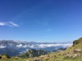
Before heading back, there is the option of a return trip to the Étang de Bassiès from the refuge, leaving some of your luggage at the refuge.A fairly short second stage, with two steep ascents (19% to 38%): one from the Refuge de Bassiès to the Port de Bassiès, and the even more challenging one from the Port de Saleix to the Pic de Girantès or Mont Ceint. In fact, it is a rather gruelling, up-and-down stage, classified as difficult. The ascents and descents are on challenging trails (pebbles, rocks, scree). The whole day is spent in open country with stunning panoramic views. The route passes the beautiful Étang d’Alate.The relative altitude, between 1,520 m and 2,100 m, means this day’s walk is feasible even in the height of summer.
Port de Lers–Bassiès Refuge via Pas du Roc, Étang de Labant, Col Fouzès
 7.46 mi
+2,927 ft
-2,493 ft
6h 00
Difficult
Departure from Suc-et-Sentenac (Ariège)
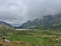
The first day takes you to the Refuge de Bassiès, passing huts, a valley, mountain passes, an old mine, a pond, and various cols and mountain passes. The stretch from the Col de las Fouzès to the Port de Bassiès is particularly beautiful.The route follows paths and tracks that are difficult due to their terrain (rock, scree, unmarked).See practical information * From (3) to (6) an unmarked path with gradients of 15% and 25%, with the presence of Patou dogs from (4). From (12) to (18) a marked path with gradients of 16% to 30%.The GPX track is necessary in places to avoid any confusion, as the route does not necessarily follow GR®, GRP® or PR® trails.Allow around 6 hours for the walk.
Vallferrera Refuge - Pic de Comapedrosa - Comapedrosa Refuge
6.88 mi
+3,727 ft
-2,549 ft
6h 25
Very difficult
Departure from Alins (Lleida)
Third stage passing through the highest point in Andorra: Pic de Comapedrosa. A high-mountain stage with no particular difficulties apart from the climb to Portella de Baiau over scree and the descent along the somewhat exposed ridge of Pic de Comapedrosa.
Marc's Lodge - Refuge du Pinet
4.31 mi
+4,012 ft
-36 ft
5h 30
Difficult
Departure from Auzat (Ariège)
The first stage of the journey, the shortest and easiest, to warm up your legs, passing through the Bois de Fontanal and the Étang Sourd to the Refuge du Pinet. The elevation gain is still significant.
Etang de Soulcem - Etang Fourcat
 5.17 mi
+4,377 ft
-1,621 ft
6 hrs
Very difficult
Departure from Auzat (Ariège)
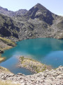
A magnificent hike in the upper Ariège in a spectacular setting. On the agenda for the day are the Etangs du Picot and the two Etangs Fourcat, which quickly make you forget the intense effort required during the climb.
From the Maison du Valier to the Col de la Core – update to the GR®10 route
8.66 mi
+4,692 ft
-3,192 ft
8h 05
Very difficult
Departure from Les Bordes-sur-Lez (Ariège)
Since the fire in July 2026, the terrain has been very unstable (frequent rockfalls) on the GR®10 towards the Ayes Lake, and this section of the path is therefore closed. Consequently, the ONF recommends an alternative route, the details of which are given below, between the Maison du Valier and the Col de la Core. The start and finish points of this stage are accessible by car.
From Étang de Soulcem to the Josep M. Monfort Baiau Refuge
 9.00 mi
+4,629 ft
-1,752 ft
8h 10
Difficult
Departure from Auzat (Ariège)
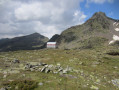
First stage of the 3-day hike that is circular and loops around the Étang de Soulcem. This beautiful, long stage will take us into Catalonia, first passing by small lakes and then through the Port de Bouet, through gentle high-mountain landscapes, over the grassy, undulating slopes of the Ariège and then Catalonia; we finally reach the unmanned Josep M. Monfort Baiau refuge, which is in perfect condition and offers safe shelter (sleeps 9).