Country:

 City:
City:


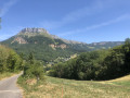
At Les Déserts, park near the recycling centre, heading towards Saint-Jean-d’Arvey.
(S/E) Walk up the D912 local road for 100 m and follow the GR® de pays on the left, which passes by the church and then the cemetery.
(1) Walk up a tarmac road to the last houses. The climb is quite steep for the start of the walk. Join a road.
(2) Leave the path leading to Les Charmettes on your left and take the one on the right leading to the Route des Blanchards, then cross the hamlet.
(3) At Les Blanchards, at the end of the houses, turn left onto a path that climbs towards the pastures. This unmaintained path crosses a field to reach the Doria car park.
(4) Follow the sign for “Col de la Doria”. At the pass, several paths are signposted, including the one to Mont Peney. Walk a short way to the left along the GRP® to spot the yellow arrow on a green background, which is hidden by the vegetation.
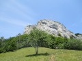
(5) Head up to the right, due south. The climb to the summit is signposted in places with “Mont Peney” signs.
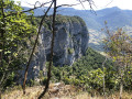
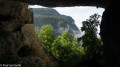
(6) From the summit, the descent along the cliff begins. The view is magnificent, but you must be on your guard as the cliff is steep.
(7) Pass the signpost for the Passage de la Dorette on your right and continue to the left, crossing the Route forestière du Peney further on.
(8) Carry on to the left along the path, which is rutted in places by logging machinery, until you reach a fork in the path. A sign points towards “Col de la Doria, du Peney and Les Déserts”.
(9) Turn right and follow the GR® de Pays towards Les Déserts. It crosses through fields (marked with a few yellow arrows on a green background). Follow the lower part of the field to reach a wider track that leads to Côte Benoit.
(10) The track becomes wide enough for vehicles and leads to the hamlet of Les Charmettes.
(11) A small, barely visible path branches off to the left, taking you back to the junction towards Les Blanchards.
(2) Turn right and, following the route back in the opposite direction to the way out, return to the car park (S/E).
 Visorando Member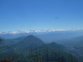

 Difficult
 Tourism professional
 Very difficult