Route Orange in Sainte-Honorine-la-Guillaume

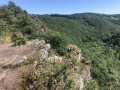
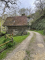
A refreshing walk in the heart of Suisse Normande, through dense woods, sunken paths, alongside small streams and across farmland. Some lovely climbs to give your calves a good workout. The paths are very easy to walk on, well-maintained and marked in orange.

Details

59826107
Creation:
Last update:
Last review:
  • Walking
    Activity: Walking
  • ↔
    Distance: 5.54 mi
  • ◔
    Average duration: 2h 55 
  • ▲
    Difficulty: Easy

  • ⚐
    Back to start: Yes
  • ↗
    Ascent: + 417 ft
  • ↘
    Descent: - 410 ft

  • ▲
    Highest point: 817 ft
  • ▼
    Lowest point: 531 ft

Description of the walk

Park in the mini-market car park on the D15.

(S/E) Walk up the main street for a few hundred metres. Pass the town hall and the school.

(1) Turn left onto Route du Bois André towards the village hall.

(2) Take the path on the left towards La Fournaise, then quickly turn right to cross the woods. You’ll emerge onto Chemin du Bois de la Mousse near the poultry farm.

(3) Carry on straight towards the Bois de la Mousse. Then make sure you keep going in the same direction, ignoring the paths on either side.

(4) Turn left before the hamlet of La Séramberie. Carry on straight ahead at the first junction, continue for about a hundred metres, then turn sharply right to join a tarmac road near La Boderie.

(5) Cross the road towards La Galbranière, then head right into the woods about a hundred metres further on. Once at La Galbranière, carry on straight ahead to reach the private mill at Sainte-Honorine.

(6) Take a break at the mill before a long climb. Return to the tarmac road at the houses and head straight on to rejoin the road you crossed earlier.

(7) Cross it to take the path opposite, then cross the tarmac road to continue along the edge of the Bois de la Mousse. Join the D216.

(8) Cross it and follow the farm track opposite. Navigate a 90° left-hand bend and head straight on to reach La Belsandière and then the D880. Continue straight on along this road for about 200 m.

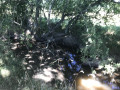
(9) Don’t miss the path on the right; cross over the stream (the Coulandre) to head deep into the Bois du Fil. Further on, ignore the path on the right and carry on until you reach the D15, which you’ll come to at a small clearing that can be used as a car park.

(10) Take a path on the left to head back into the woods and rejoin the D15 just before the village.

(11) Carry on to the left to reach the mini-market car park (S/E).

Waypoints

  1. S/E : mi 0 - alt. 666 ft - Convenience shop car park
  2. 1 : mi 0.24 - alt. 679 ft - Junction of the D15 and Route du Bois André
  3. 2 : mi 0.45 - alt. 745 ft - Path to the left
  4. 3 : mi 0.67 - alt. 807 ft - Poultry farm
  5. 4 : mi 1.5 - alt. 768 ft - La Séramberie
  6. 5 : mi 2.11 - alt. 748 ft - Tarmac road
  7. 6 : mi 2.6 - alt. 545 ft - Mill - Rouvre (rivière)
  8. 7 : mi 3.2 - alt. 774 ft - Tarmacked road
  9. 8 : mi 3.67 - alt. 814 ft - D216 junction
  10. 9 : mi 4.7 - alt. 699 ft - Path on the right
  11. 10 : mi 5.22 - alt. 755 ft - D15
  12. 11 : mi 5.45 - alt. 679 ft - D15
  13. S/E : mi 5.54 - alt. 666 ft - Convenience shop car park

Notes

Walking poles will come in handy on some fairly steep sections.

Reviews and comments

4.7 / 5
Based on 3 reviews

Reliability of the description
4.7 / 5
Ease of following the route
5 / 5
Route interest
4.3 / 5
User 10950463
• Edited:

Overall rating : 4.7 / 5

Date of your route : Aug 31, 2026
Reliability of the description : ★★★★★ Very good
Ease of following the route : ★★★★★ Very good
Route interest : ★★★★☆ Good
Very busy route : No

A very pleasant walk, often in the shade of the woods, quiet and peaceful with few other walkers. Be sure to visit the medieval motte next to the church. There’s a café and a supermarket in the village centre.

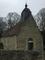
A very lovely, varied walk, much of which takes you through woodland; quiet and peaceful, with few other walkers, and suitable even on warm days. There is a café and a supermarket in the village; it is also worth visiting the church and the adjacent remains of an early medieval motte (castle mound).

Machine-translated

RED CLOUD
RED CLOUD

Overall rating : 5 / 5

Date of your route : Aug 12, 2025
Reliability of the description : ★★★★★ Very good
Ease of following the route : ★★★★★ Very good
Route interest : ★★★★★ Very good
Very busy route : No

Only the hunters were disturbing, due to their nervousness and strong presence

Machine-translated

mortluiloeil
mortluiloeil

Overall rating : 4.3 / 5

Date of your route : Oct 09, 2024
Reliability of the description : ★★★★☆ Good
Ease of following the route : ★★★★★ Very good
Route interest : ★★★★☆ Good
Very busy route : No

An interesting walk, varied scenery, no major difficulties – I’d recommend this route amongst the Normandy cows!

Machine-translated

Other walks in the area

For more walks, use our search engine .

The GPS track and description are the property of this route's author. Please do not copy them without permission.