Country:

 City:
City:


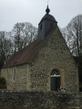
The walk starts at the car park between Craménil Church and the cemetery.
(S/E) Facing the porch, walk round the church to the right to reach the D254. Follow the signs for ‘Les Tourailles’. At the town hall, turn left towards ‘La Grivagère’, then take the Chemin du Paradis.
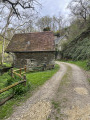
(1) In the shade of the woods, the stone walls invite you to pause and enjoy the birdsong: if you stay in silence for a few seconds, a soundscape unfolds: chaffinch, blackcap, common chiffchaff… Download the MerlinBird app to find out who’s watching you without being seen!
At the three-way junction, take the path leading uphill to the right.
Before crossing the road, stop and look up. In front of you stands an oak that was once trained as a pollard. You can recognise it by the swellings at the top of the trunk and the branches that all grow from the same level. This traditional farming technique involves topping the tree and then periodically pollarding it to produce timber. This means there’s no need to fell it: the tree provides branches throughout its life, which can span several centuries!
Continue along the path opposite. It’s well worth stopping at the two field entrances on either side of the path to admire the meadows.
(2) The field on the right is typical of a ‘pré bocager’: a permanent grassland (in place for over five years), either grazed or mown, and bordered by hedgerows. This habitat is home to a wealth of biodiversity and plays a major role in capturing carbon from the air.
At the end of the track, turn right. Take the road on the right, then immediately left past the wayside cross. Walk along an old sunken track where the embankments are still visible andlook out for the ‘tracks’ formed by animals passing through. The track, which is often muddy at this point, still bears their footprints. Have a go at spotting and identifying them! Can you recognise the footprints of a fox, a roe deer or a badger?
At the end of the track, turn left and walk for 300 m. At the crossroads, take the track on the right, walk for 150 m, leave the main path on your left, and continue straight on along the small tree-lined track with a fruit-bearing hedge.
(3) The right-hand side of the path is lined with shrubs typical of a hedgerow. Throughout the seasons, blackthorn, hawthorn, rosehip and medlar provide food for insects, birds and small mammals. Can you recognise them?
When you reach the tarmac, carry on along the road opposite towards the woods. After 250 metres, there’s an optional detour to explore the Chêne-Sec bridge (3.2 km return), via the Impasse de la Refardière and then the randonneur’s path. You can join the route to Briouze (connection to route no. 8). Otherwise, carry on straight ahead. Take the second path on the right towards the “Pont de la Motte”.
(4) Follow this sunken lanewith its high embankments planted with native species (field maple, hazel), which may be home to around a hundred plant species. It is a treasure trove of biodiversity, providing a habitat for the hazel dormouse, a small tree-dwelling rodent emblematic of a well-preserved bocage landscape.
Carry on along the tarmac and, at the junction, turn right onto the D254 – taking care – until you come to a hairpin bend on the left. Take this path to reach the Pont de la Motte, which dates back tothe 16th century.
(5) From the bridge, don’t miss the lovely view over the village! Beneath your feet, the River Rouvre is home to a population of European otters. Having all but disappeared from Normandy, this now-protected species is slowly recolonising the River Orne and its tributaries.
Retrace your steps back to the road, turn left and carefully follow the D254 upstream to the car park between the church and the cemetery (S/E).

 Visorando Member
 Moderate