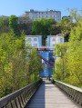
Route Michel Desprez

This route invites you to discover the built and natural heritage of Puymoyen and the Eaux-Claires valley.

Details

30698787
Creation:
Last update:
Last review:
  • Walking
    Activity: Walking
  • ↔
    Distance: 5.24 mi
  • ◔
    Average duration: 2h 40 
  • ▲
    Difficulty: Easy

  • ⚐
    Back to start: Yes
  • ↗
    Ascent: + 315 ft
  • ↘
    Descent: - 331 ft

  • ▲
    Highest point: 456 ft
  • ▼
    Lowest point: 217 ft

Photos

Description of the walk

Salle des Fêtes car park.

Yellow markings

(S/E) Head towards the roundabout where the shops and the town hall are located. Continue left along Rue du Bourg – you’ll see Saint-Vincent’s Church – and take Chemin des Rochers on the right. Walk down to the road and follow it to the right – you’ll see the marker indicating the old Roman road at the bottom.

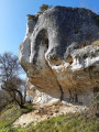
(1) At the junction, turn right and then turn right again under the rocks about a hundred metres further on. Carry on straight ahead through the valley, home to a world-renowned climbing site. Go through the gate and continue, ignoring all the paths branching off to the right and left, until you reach the Route de la Vallée des Eaux-Claires, which you follow to the right for about 600 metres.

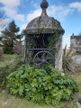
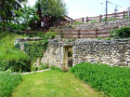
(2) Go up the path on the right behind the house and join the Rue du Château du Diable, which you follow to the right. Turn right in front of a house to reach the Place du Petit Rochefort – admire its elegant 16th-century well. Continue to the junction and turn right onto the Rue des Grands Champs – here, the houses are decked out in festive decorations for the end-of-year celebrations. Head straight across to the Sentier du Chêne Vert.

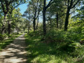
(3) Turn slightly right across the square before the gate and head diagonally to the right along the main path to cross the woodland. You’ll come out onto a path between a hedge and a meadow; follow it to the left. Turn left at the end onto Rue des Grandes Vignes.

(4) Turn right onto Rue du Bois Jamain and immediately left onto Rue du Verger – before turning, note the cross in front of the house on the right. Turn left into Impasse du Verger, then left again onto Rue du Cormier. Continue along the path until you reach Rue d’Angoulême.

(5) Cross at the pedestrian crossing slightly to the right and continue straight ahead along Rue des Brandeaux for 500 m.

(6) Before the bridge, turn right onto the white track running alongside the ring road, then keep right at the three-way junction.

(7) Leave the main track and turn left onto a footpath. This leads onto Rue des Gears, which you follow straight on. Turn right after 50 m to rejoin the footpath taken by theGR® 36 back to the starting point (S/E).


Waypoints

  1. S/E : mi 0 - alt. 453 ft - Village Hall
  2. 1 : mi 0.69 - alt. 269 ft - Junction
  3. 2 : mi 1.93 - alt. 217 ft - Path on the right
  4. 3 : mi 2.43 - alt. 364 ft - Turn right before the barrier
  5. 4 : mi 3.03 - alt. 433 ft - Rue du Bois Jamain
  6. 5 : mi 3.77 - alt. 322 ft - Rue d’Angoulême
  7. 6 : mi 4.12 - alt. 390 ft - Turn right at the fork
  8. 7 : mi 4.58 - alt. 440 ft - Entrance to the woods on the left
  9. S/E : mi 5.24 - alt. 453 ft - Village Hall

Notes

This route is signposted in yellow. Updated in early October 2023.
Contact: Pays d’Angoulême Tourist Office: 05 45 95 16 84

Worth a visit

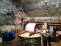
(1) See the Moulin du Verger, known for its traditional handmade paper and also famous thanks to the saga of Marie-Bernadette Dupuy.

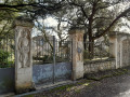
(2) See the gateway adorned with sculptures of devils. A nod to the stronghold that once housed the English, known as the “red devils”, during the Hundred Years’ War.

Always be cautious and plan ahead when you're outdoors. Visorando and the author of this route cannot be held responsible for any accidents occurring on this route.

The GR® and PR® markings are the intellectual property of the Fédération Française de Randonnée Pédestre.

Reviews and comments

4.1 / 5
Based on 4 reviews

Reliability of the description
4.3 / 5
Ease of following the route
4 / 5
Route interest
4 / 5
PRL
PRL

Overall rating : 4.7 / 5

Date of your route : Dec 30, 2024
Reliability of the description : ★★★★☆ Good
Ease of following the route : ★★★★★ Very good
Route interest : ★★★★★ Very good
Very busy route : No

The cliffs of Les Eaux Claires, the orchard mill, wooded areas, a few roads but with little traffic
A stretch I hadn’t explored yet
A lovely walk that I’ll definitely do again

Machine-translated

Florikawalk
Florikawalk
• Edited:

Overall rating : 4.7 / 5

Date of your route : Nov 25, 2024
Reliability of the description : ★★★★★ Very good
Ease of following the route : ★★★★★ Very good
Route interest : ★★★★☆ Good
Very busy route : No

As far as I can remember, we didn’t have any problems with the route description.
A pleasant semi-urban route, although the urban section is less enjoyable as there is nothing of particular note along the way.

Machine-translated

Office de tourisme Angoulême

Hello,
You’ve got the wrong walking route – the Puymoyen route doesn’t go through Baloge or past the Anguienne viaduct.
Kind regards,
Chantal

Machine-translated

matmarlulu
matmarlulu

Overall rating : 4.7 / 5

Date of your route : Jan 07, 2024
Reliability of the description : ★★★★★ Very good
Ease of following the route : ★★★★★ Very good
Route interest : ★★★★☆ Good
Very busy route : Yes

A lovely route, with some beautiful single tracks through the forest. Varied scenery and a pleasant stop at the Moulin de Baloge.

Machine-translated

Office de tourisme Angoulême

Hello Joël,
Thank you for your message.
I’m sorry to hear you had some problems on this route. It wasn’t signposted yet, but it will be very soon.
Kind regards,
Chantal

Machine-translated

joel 16
joel 16

Overall rating : 2.3 / 5

Date of your route : Apr 02, 2023
Reliability of the description : ★★★☆☆ Average
Ease of following the route : ★☆☆☆☆ Very disappointing
Route interest : ★★★☆☆ Average
Very busy route : No

__unmarked route__ – without a map or GPS, this is impossible for casual walkers

I’m a trail marker and I know what I’m talking about

Joel

Machine-translated

Other walks in the area

For more walks, use our search engine .

The GPS track and description are the property of this route's author. Please do not copy them without permission.