Country:
 City:
City:


Start from the lake car park. To get there, in Langonnet, head towards the abbey, then turn left towards Étang de Langonnet, where you can park.
The route is marked in yellow by the local council, but the markers are sometimes difficult to spot. It will be much easier to follow the route on your GPS.
(S/E) From the car park, follow the road until you reach the bend.
(1) Take the path on the left, heading north, and further on, ignore a path on the left – this will be the route back.
(2) Carry on straight ahead to the next junction with its burial mound.
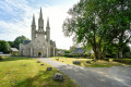
(3) Take the second road on the left, towards Restembley d’en haut. The route passes by the Kermain Tumulus, situated at a junction of several paths. Continue along the path that runs alongside the tumulus, heading east. Cross a road and head towards Langonnet Abbey to the south-east.
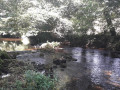
(4) After the abbey, take a track suitable for vehicles leading into a field. At a left-hand bend, leave the track and take a path running alongside the river. A very pretty stretch through the woodland.
(5) The abbey has created a meditative trail, with stopping points featuring signs displaying quotes to reflect on, all on the theme of time. Personally, I took this short detour as far as the first stop. The round trip I did allowed me to see two stops on the meditative route – not uninteresting, but not essential. On your return, continue due north and you’ll come out onto the D109.
(6) Follow it to the left for about 300 metres, continuing straight on at the junction, then, on leaving the hamlet, turn left onto a small road and you’ll reach a junction with a cross-road.
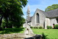
(7) You can take a detour to the right to visit Saint-Brandan Chapel, though there’s a chance it may not be open when you arrive.
(8) Return to the previous junction.
(7) Carry on straight ahead, then turn right onto the PR® and, a little further on, turn left to reach the hamlet of Cleuziou.
(9) Turn left twice and carry on until you reach the junction with the outbound route.
(2) Turn right and, following the route back along the same path as on the way out, head to the car park by the pond, where there are picnic tables if you’d like to have a bite to eat before setting off again (S/E).
 Visorando Member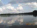
 Easy
Easy