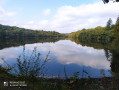
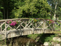
Route du Péan, Champeaux

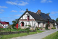
Take a stroll through the rolling countryside of Champeaux, a charming little village in the Vitré Community, home to a remarkable collegiate church.

Details

n°31039796
Creation:
Last update:
Last review:
  • Walking
    Activity: Walking
  • ↔
    Distance: 5.85 mi
  • ◔
    Average duration: 3h 00 
  • ▲
    Difficulty: Easy

  • ⚐
    Back to start: Yes
  • ↗
    Ascent: + 328 ft
  • ↘
    Descent: - 318 ft

  • ▲
    Highest point: 400 ft
  • ▼
    Lowest point: 236 ft
  • ⚐ Country: France
  • ⚐ City: Champeaux (35500)
  • ⚑
    Start/End: N 48.147783° / W 1.311284°
  • ❏
    IGN map(s): Ref. 1318SB
  • Hour-by-hour weather

Description of the walk

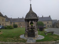
Start from the cloister.
YellowPR®signposting supplemented by green arrows marked with the number 12.
Signposted in a clockwise direction.
Suitable for both walking and mountain biking.

(S/E) From the cloister, head towards the collegiate church then turn left just after the cemetery. Follow the road to La Hurie.

(1) Take the road on the right. After 250 m, turn right at the Fork in the road, then turn left just after the farm. Then turn immediately right onto a dirt track and continue until you reach a road again.

(2) Turn right, then immediately left to continue along a dirt track. Follow it until you reach the D305.

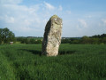
(3) Turn right and follow the road. At the entrance to the village of Landavran, turn left for 100 metres and take the small grassy path just before the last house to reach the menhir. When you reach the road, turn right and walk through the whole of Landavran village.

(4) On leaving the village, continue due south, cross a road and arrive at the hamlet known as La Mare aux Bauds.

(5) Carry on straight ahead and follow the road as it bends to the right towards La Bougrie.

(6) Turn left just before the houses and carry on until you reach a Stop sign on the D29.

(7) Turn left, then take the first road on the right. Continue for 250 m, then take a path on the right (GR®37) and follow it until it comes out at La Grande Planche.

(8) Turn left and follow the D29 to reach the cloister (S/E).

Waypoints

  1. S/E : mi 0 - alt. 272 ft - Cloister - Collégiale Sainte-Marie-Madeleine de Champeaux
  2. 1 : mi 0.47 - alt. 272 ft - La Hurie
  3. 2 : mi 1.2 - alt. 269 ft - Road near the hamlet of La Monnerie
  4. 3 : mi 1.91 - alt. 276 ft - D305
  5. 4 : mi 2.82 - alt. 371 ft - Landavran exit
  6. 5 : mi 3.23 - alt. 338 ft - A place known as La Mare aux Bauds
  7. 6 : mi 3.88 - alt. 331 ft - La Bougrie
  8. 7 : mi 4.27 - alt. 331 ft - Stop sign on the D29
  9. 8 : mi 5.66 - alt. 236 ft - La Grande Planche. Cross the - Ruisseau de Palet (rivière) - affluent de la Cantache
  10. S/E : mi 5.85 - alt. 272 ft - Cloister

Notes

Car park, picnic area, toilets and shops near the starting point.

Worth a visit

Sainte-Marie-Madeleine Collegiate Church, Champeaux.

Always be cautious and plan ahead when you're outdoors. Visorando and the author of this route cannot be held responsible for any accidents occurring on this route.

The GR® and PR® markings are the intellectual property of the Fédération Française de Randonnée Pédestre.

Reviews and comments

4.7 / 5
Based on 1 review

Reliability of the description
5 / 5
Ease of following the route
5 / 5
Route interest
4 / 5
Morinais
Morinais

Overall rating : 4.7 / 5

Date of your route : Jan 07, 2025
Reliability of the description : ★★★★★ Very good
Ease of following the route : ★★★★★ Very good
Route interest : ★★★★☆ Good
Very busy route : Yes

A very pleasant walk

Machine-translated

Other walks in the area

For more walks, use our search engine .

The GPS track and description are the property of this route's author. Please do not copy them without permission.