


 Country:
 City:
City:


Start from the car park at the La Galaisière Equestrian Centre, 49.04684°N–1.430535°E.
(S/E) Immediately follow theGR®221signposts to the left as you leave the car park on foot and walk up the street (Chemin du Parc) between the houses. After 50 metres, take the wide, stony path on the left, which runs straight ahead for 500 metres. Continue along this path, which then heads south-east.
(1) When the path joins the road at the hamlet of Gris-Cailou, take the small road (D199) on the left, still following theGR®221.
Carry on for 800 metres. The road winds its way through meadows, cultivated fields and the hamlet of La Besnardière. It is at La Besnardière that you leave the commune of Saint-Pierre-de-Coutances (population 410) and enter the commune of Courcy (population 568).
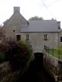
At La Quinarderie, following theGR®221signposting, take thefirst small road on the right which leads down to the railway line and its small gatekeeper’s cottage, which is well-preserved, although uninhabited.
(2) You arrive in the small village of La Cognerie, where the houses are clustered closely together around the single street.
Several houses have been well renovated or are still being worked on.
TheGR®221passes through the village farm, with its old residential buildings and outbuildings on the right, below the path, and the more modern buildings on the left, including the cattle shed.
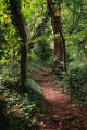
Recent alterations to the site make it difficult to see where the path goes next. You must go through a double metal gate directly opposite the path you have just come from, then immediately turn right onto the path which winds down in an S-shape towards a copse running alongside a field; it feels as though you are entering a wood, which is not the case. TheGR®221continues its steep descent towards La Soulles, and the copse finally gives way to a proper, fairly dark little wood. The path is passable without special equipment in early autumn. Best checked again in winter when the rain will have carved out gullies like a stream...
This isn’t a climb, but over a few dozen metres you’ll lose 65 metres in altitude.
At the bottom of the descent, we reach the banks of the Soulles, which we can just make out between the trunks of the poplars lining its banks. We’re very close to the village of Villodon and a pumping station, marked on the IGN map, but which I didn’t spot.
(3) Here, we leave theGR®221, which heads off to the left towards the village of Courcy, and turn right onto the small road.
This marks the start of a long but charming climb through the peaceful Coutenay countryside. High up on the left, you can clearly see La Dérie farm.
(4) First, we rejoin the railway line – which we crossed 1.5 km earlier – by passing through a tunnel beneath the tracks.
The road is called Rue de la Galaisière. It continues to the first junction with the D199, which branches off to the right towards Le Gris-Caillou (signposted ‘Le Grand-Gris-Caillou’).
Continue along the road to the left for 400 metres, skirting the La Galaisière housing estate towards the end. Take the first road branching off at a right angle to the right and follow it until you reach the heart of the housing estate. A final junction, which you passed earlier in the walk, leads you to the La Galaisière Equestrian Centre (S/E).


 Visorando Member

 Association / Club / Walk leader
 Moderate
  Tourist office
 Difficult
