Country:
 City:
City:


Parking and starting point at the orchard conservation area car park, not far from the town hall and the school.
(S/E) Leave the car park by heading right towards the village centre/town hall/school. Continue to the lodge, where you take the path on the right.
(1) Take the first path on the right and walk past the lodge. Continue along the path until you reach the Fork in the road and turn right.
(2) Turn right onto the road and carry on straight ahead until you reach the county road. Cross it and take the path opposite.
(3) Take the path on your left. Before the end of the path, look out for a small chapel on your right in the field behind the trees. Then turn right.Turn left at the fork, then immediately right, and carry on straight ahead.
(4) At the end of the path, by the oak tree, turn sharply to your right. Continue along the main path, which turns into a small local road. There is a lovely wild pond on your right.
(5) Walk past the village hall (picnic area). Carry on to the main road, cross it and continue straight on, keeping straight ahead all the way to the junction by the small town hall.
(6) At the fork in the road, turn left.
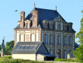
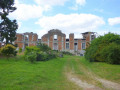
(7) Carry on to the roundabout opposite the entrance to the château. The grounds are open to visitors during the first weekend in June for the “Rendez-vous aux Jardins”, from 15 July until the end of August, and in September during the “Journées du Patrimoine”. Take the first exit until you reach the next junction.
(8) It’s well worth taking a detour to the cemetery to see the yew tree dedicated to the Virgin Mary and the enclosure at the far end of the cemetery, which features monuments chronicling the history of the Troncq fiefdom. Then retrace your steps slightly. Take Rue de la Chenaie on your left. At the end, turn left and then right onto the path.
(9) At the end of the path, turn left and, at the next junction, turn left onto Rue des Prés Hauts. Then turn right onto the D85 for about 20 metres.
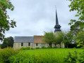
(10) You’ll come to Mare Gibelmare; walk along its left-hand side. Then take the small path on your left. Walk behind the school. Cross the departmental road, turn right onto it, then turn left onto Rue du Moustier (you can visit the church).
(11) Turn right and then left into the car park of the Maison Communale. Take a look at the architecture: the walls are made of recycled concrete and the roof is insulated with straw. Take the Sentier Guéret (the path behind the town hall), turn right and then carry on straight ahead. At the crossroads, turn right until you reach the D840 departmental road.
(12) Cross the road and head straight ahead. At the Fork in the road, turn left and carry on straight ahead until you reach the D80 departmental road.
(13) Cross it and carry on straight ahead. Turn right and, at the Fork in the road, turn left.
(14) At the four-way junction, take the road on the left and carry on to Bonne Mare (a good spot for a break). Carry on to the D83. Turn left, but before reaching your destination, take a detour via the church and retrace your steps to take Rue des Ecoles on the left back to the car park (S/E).
 Visorando Member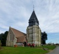
 Easy
Easy 

 Tourist office