Fouqueville Circular

A circular walk starting from the village centre and passing by the Mare du Moulin, the Croix Chère Mère, the Church of Fouqueville, the hamlet of Londemare and back to Crestot.

Details

395244
Creation:
Last update:
Last review:
  • Walking
    Activity: Walking
  • ↔
    Distance: 7.17 mi
  • ◔
    Average duration: 3h 20 
  • ▲
    Difficulty: Moderate

  • ⚐
    Back to start: Yes
  • ↗
    Ascent: + 26 ft
  • ↘
    Descent: - 26 ft

  • ▲
    Highest point: 528 ft
  • ▼
    Lowest point: 492 ft
  • ⚐ Country: France
  • ⚐ City: Crestot (27110)
  • ⚑
    Start/End: N 49.204765° / E 0.96931°
  • ❏
    IGN map(s): Ref. 1912SB
  • Hour-by-hour weather

Description of the walk

Start from the car park in front of the town hall/village hall, Rue des Écoles in Crestot.

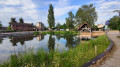
(S/E) Head right towards the crossroads, then turn right onto Rue de l’Église, walk past the pond and head towards the church.

(1) Turn right into Allée des Peupliers. At the end, turn left onto Rue de la Fosse Liard (track). At the end of the track, turn left onto Route de Cesseville. Go straight on at the first junction, then at the next one, and turn right onto the dirt track. Cross the RD81 with care, continue through the orchards for 100 m, then turn left onto Chemin du Paradis. Pass the orchard on your left and continue along this dirt track.

(2) At the Marinotte junction, turn left onto the track leading to the Mare du Moulin.

(3) Turn right and walk carefully alongside the D81 until you reach the three-way junction, then take the small local track on the right. Pass the next three-way junction 100 m further on and continue straight ahead. Carry on for 500 m and take the first dirt track on the left.

(4) At a place called Les Longs Champs, turn left again onto the dirt track leading to La Croix Chère Mère.

(5) Turn right, then, at the junction where three roads meet, take the road furthest to the left. Soon after, pass a first road on your left, then after 200 m, turn right onto Ruelle Poisson. Continue along the path that runs alongside this lane.

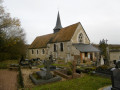
(6) Cross Ruelle Courval and carry on straight ahead. Go round the school and then the town hall, and you’ll come out onto Rue Léon Loubet. Take this street by turning left and continue to the Route de Louviers (D81) and the church.

(7) Turn right, walk past the church, then turn left onto Rue de l’Église. At the end, turn left again onto Chemin des Forrières aux Dauphins, pass the first junction, then, at the next junction, turn right onto Route de Londemare. Leave Route de Crestot on your left. After the right-angle bend, turn left onto the small path that winds between hedges and beautiful ash trees and leads out opposite a pond.

(8) Leave the pond on your left and turn right onto a small village track, which you’ll follow until the next junction with a dirt track at Les Malis.

(9) Turn left and continue to Crestot cemetery.

(10) Turn left onto the RD84 and then left again onto Rue des Forrières. Cross the next junction and head straight on along Chemin du Tour de Ville, which is tarmac-surfaced at the start but turns to grass after 200 metres. At the end of the path, continue to the right behind the tree-lined embankment until you reach Rue des Écoles.

(11) Walk left for about thirty metres, then turn right into Ruelle à la Roche and continue to the junction with Avenue de la Messe. Turn right onto Avenue de la Messe and, at the end, turn right onto Rue de l’Église. After passing the church and the pond – which you’ll leave on your left – you’ll reach the junction with Rue des Écoles. Turn left to return to the car park (S/E).

Waypoints

  1. S/E : mi 0 - alt. 502 ft - Town Hall, Rue des Écoles
  2. 1 : mi 0.19 - alt. 499 ft - Crossroads at the circular bend
  3. 2 : mi 1.52 - alt. 509 ft - Paradise Path
  4. 3 : mi 1.85 - alt. 492 ft - The Mill Pond
  5. 4 : mi 2.86 - alt. 505 ft - Les Longs Champs
  6. 5 : mi 3.36 - alt. 502 ft - The ‘Chère Mère’ Cross
  7. 6 : mi 3.92 - alt. 518 ft - Courval Lane
  8. 7 : mi 4.31 - alt. 522 ft - Fouqueville Church
  9. 8 : mi 5.34 - alt. 495 ft - The Ponds of Londemare
  10. 9 : mi 5.68 - alt. 492 ft - Les Malis
  11. 10 : mi 6.11 - alt. 502 ft - Crestot Cemetery
  12. 11 : mi 6.66 - alt. 499 ft - Rue des Écoles / Ruelle à la Roche
  13. S/E : mi 7.17 - alt. 502 ft - Town Hall, Rue des Ecoles

Worth a visit

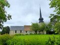
Crestot Church.
Mare du Moulin.
‘Dear Mother’ Cross.
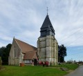
Fouqueville Church.
Londemare ponds.

Reviews and comments

4.3 / 5
Based on 4 reviews

Reliability of the description
5 / 5
Ease of following the route
5 / 5
Route interest
2.8 / 5
Dionisi Yves
Dionisi Yves

Overall rating : 4 / 5

Date of your route : May 21, 2026
Reliability of the description : ★★★★★ Very good
Ease of following the route : ★★★★★ Very good
Route interest : ★★☆☆☆ Disappointing
Very busy route : No

We’ve done this walk for the third time. One thing to note: between points 7 and 8, the suggested path was completely impassable, overgrown with brambles and nettles (perhaps because it was May). Apparently, this path is never maintained. So you’ll need to tackle it with a brush cutter! Another option is to take the road to Crestot just before the junction and, at the Fork in the road, take the road on the right which leads to point 8. Otherwise, no further comments to add to our previous reviews.

Machine-translated

Dionisi Yves
Dionisi Yves

Overall rating : 4 / 5

Date of your route : Feb 23, 2025
Reliability of the description : ★★★★★ Very good
Ease of following the route : ★★★★★ Very good
Route interest : ★★☆☆☆ Disappointing
Very busy route : No

This route is of little interest in itself: it mostly follows flat terrain over long, monotonous stretches with no vegetation. The only points of interest are the two churches we pass (though they were closed), which we were already familiar with as we’re from the area. All that remains is the pleasure of walking. A route to avoid in very hot weather (no shade).
Take care between points 3 and 4: the route description states to take the first path on the left. There are several apparent paths on the left, but these are tractor tracks, which can lead you astray. You’ll need to walk about 500 m past point 3 to find the correct path, which is clearly visible.

Machine-translated

ferrand.lucien
ferrand.lucien

thank you

Machine-translated

Yves-Marie
Yves-Marie

Overall rating : 4.3 / 5

Date of your route : Oct 17, 2023
Reliability of the description : ★★★★★ Very good
Ease of following the route : ★★★★★ Very good
Route interest : ★★★☆☆ Average
Very busy route : No

A short 11.5 km walk that’s a bit monotonous as the scenery hardly changes at all.
But that’s just my opinion.

Machine-translated

Planeu
Planeu

Overall rating : 4.7 / 5

Date of your route : Oct 16, 2023
Reliability of the description : ★★★★★ Very good
Ease of following the route : ★★★★★ Very good
Route interest : ★★★★☆ Good
Very busy route : No

A hike through the countryside – a lovely discovery of Fouqueville

Machine-translated

Other walks in the area

For more walks, use our search engine .

The GPS track and description are the property of this route's author. Please do not copy them without permission.