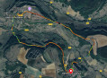
Route of birdwatching from Villeneuve-sous-Charigny

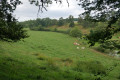
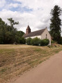
A pleasant walk offering a variety of landscapes: farmland, woodland, the lake and villages.
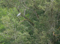
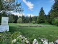
Along the route, there are signs showing the birds you might spot

Details

58467323
Creation:
Last update:
Last review:
  • Walking
    Activity: Walking
  • ↔
    Distance: 5.34 mi
  • ◔
    Average duration: 2h 40 
  • ▲
    Difficulty: Easy

  • ⚐
    Back to start: Yes
  • ↗
    Ascent: + 240 ft
  • ↘
    Descent: - 256 ft

  • ▲
    Highest point: 1,168 ft
  • ▼
    Lowest point: 965 ft

Photos

Description of the walk

Starting point: Villeneuve-sous-Charigny town hall.

(S/E) With your back to the car park, set off along Rue Avau (D10) until you reach a Fork in the road.

(1) Turn right, cross the D 970 with care, then follow the dirt track straight ahead which leads to the edge of the forest and joins a road.

(2) Turn left and follow the road until you reach a Fork in the road.

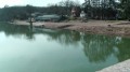
(3) Take the hairpin bend onto the path on the right, which turns into a track, to reach the edge of the forest. Head left to reach the shore of Lac du Pont.

(4) Turn left and follow the lakeshore until you reach a footbridge.

(5) Without crossing it, take the footpath on the left towards Montigny-sur-Armançon. At the first house, turn left and then, straight away, into the street on the right running alongside the D10.

(6) Turn left, then right (Rue des Macaire) to go through the village (rather than along the D10) and pass the town hall.

(7) Turn left towards the D10 and follow it to the left until you reach the first junction.

(8) Turn right onto the road leading downhill.

(9) Just before it ends, turn left onto the track leading towards the fields, and follow it to the D970.

(10) Cross it carefully and continue left along Rue Lierre until you reach Rue Avau.

(1) Turn right to reach the town hall of Villeneuve-sous-Charigny (S/E).

Waypoints

  1. S/E : mi 0 - alt. 1,096 ft - Villeneuve-sous-Charigny Town Hall
  2. 1 : mi 0.09 - alt. 1,079 ft - Common fork. A/R
  3. 2 : mi 1.32 - alt. 1,168 ft - Les Battraux (road)
  4. 3 : mi 1.71 - alt. 1,109 ft - Fork
  5. 4 : mi 2.67 - alt. 981 ft - Pont Lake
  6. 5 : mi 3.39 - alt. 1,001 ft - Footbridge – Armançon (river) – a tributary of the Yonne
  7. 6 : mi 3.72 - alt. 1,010 ft - Junction
  8. 7 : mi 3.89 - alt. 1,050 ft - Town Hall
  9. 8 : mi 3.99 - alt. 1,047 ft - Crossroads
  10. 9 : mi 4.23 - alt. 997 ft - Junction
  11. 10 : mi 5.07 - alt. 1,053 ft - D970
  12. S/E : mi 5.34 - alt. 1,096 ft - Villeneuve-sous-Charigny Town Hall

Notes

On the section of the path before reaching the lake, the route is poorly marked and there are brambles and stinging nettles (July 2024).

Reviews and comments

4.6 / 5
Based on 3 reviews

Reliability of the description
4.3 / 5
Ease of following the route
4.7 / 5
Route interest
4.7 / 5
Nadianico
Nadianico

Overall rating : 4.7 / 5

Date of your route : Aug 25, 2025
Reliability of the description : ★★★★☆ Good
Ease of following the route : ★★★★★ Very good
Route interest : ★★★★★ Very good
Very busy route : No

Very beautiful hike. Peaceful and birdsong.
I followed the route rather than the explanations, but my hike went very well!
Thank you

Machine-translated

Emma. M.
Emma. M.

Overall rating : 4.7 / 5

Date of your route : Aug 14, 2025
Reliability of the description : ★★★★★ Very good
Ease of following the route : ★★★★★ Very good
Route interest : ★★★★☆ Good
Very busy route : No

A beautiful route between fields and woods.
Walking along the Pont lake for about 1 km makes you want to go all the way around it 😉
Between (3) and (4), be careful not to slip: the slope is a little steep and may be slippery if it has rained in the previous days. Also note the presence of a few brambles and nettles, which will get your blood pumping, and a few fallen trees, ideal for practising hurdle jumping.

⚠️ Please note that in August 2025, the town hall (start/finish) will not be recognisable at first glance as it will be surrounded by scaffolding.

Machine-translated

NanaDidi
NanaDidi

Overall rating : 4.3 / 5

Date of your route : May 08, 2025
Reliability of the description : ★★★★☆ Good
Ease of following the route : ★★★★☆ Good
Route interest : ★★★★★ Very good
Very busy route : Yes

A very pleasant and varied walk. Although the signposts aren’t always legible, the birds are very much in evidence, their songs accompanying us all the way.
The path was clear all the way to the lake; however, a few fallen trees were blocking the way.
From Montigny onwards, the signposting is more helpful than the route description...

Machine-translated

Other walks in the area

For more walks, use our search engine .

The GPS track and description are the property of this route's author. Please do not copy them without permission.