Country:
 City:
City:


Place Henri IV car park.
(S/E) Walk to the ‘Stop’ sign at the junction with the Grande Rue. Turn right, then continue straight on for about 300 metres.
(1) Turn right at the third junction (small gravel road). Walk a few metres and take the small grassy path leading straight ahead. Follow this path for about sixty metres, then take the path on the left. Continue along this path for about 175 metres; it leads onto a small tarmac road at a place called Les Ruettes.
(2) Turn slightly left onto the small tarmac road and continue until you reach the junction with another small road. There, turn right and, at the first three-way junction, take the right-hand fork.
(3) At the second three-way junction, about 300 metres further on, turn left. Carry on straight ahead along this small road, pass the 90° left-hand bend and head towards the farm at a place called La Conrayère. Follow the farm track that continues from the small road and carry on straight ahead for about 500 metres until you reach a small tarmac road.
(4) Turn right and continue for 560m until you reach a three-way junction. Turn right and pass close to the hamlet known as La Fontenelle.
(5) At the junction, turn right onto the small grassy track that runs alongside a field and follow it for 1.4 km (please note that part of the track is not shown on the map). Turn left near a pond and you will then reach a junction with a small tarmac road.
(6) Cross the road and take the grassy, tree-lined path opposite. After about 200m, you’ll reach a junction with another path. First turn right then left, and continue straight on for about 300m until you reach the hamlet of La Binetière, where the path joins a small tarmac road. Continue straight on for 300m to reach a junction with another small road. Go straight ahead, then continue straight on for 470m until you reach the second junction.
(7) Turn right towards the hamlet of Les Croix-Vertes, then continue straight on for 300 metres until you reach a junction. Turn left, continue for 80 metres and, at the three-way junction, turn left to reach the buildings at the hamlet of La Trietterie.
(8) The small tarmac road then continues as a country lane: join it and carry on straight ahead. After just under 400 metres, the lane takes a 90° bend, then after 80 metres a path branches off to the right: take this. You will then reach the hamlet known as La Brochère, where the track joins a small tarmac road. Continue straight on along this road until you reach a junction with another small road.
(9) At this junction, there are two options. (See the practical information section. )
Cross the road and continue straight on along the small tarmac road opposite. Walk for about 300mm and turn onto the third path on the right. After 175m, you’ll reach a three-way junction. Take the right-hand fork and continue straight on along this path until you come out onto a tarmac road.
(10) Turn right, walk for about 400m, then, at the bend, turn left onto a path. Follow this path all the way to the end until you come out onto a small tarmac road at a place called l’Yvrière. Turn right and head towards a junction 200m further on. At the junction, turn right and continue for about a hundred metres. There, at the right-hand bend leading to the farm, a track branches off straight ahead.
(11) Take this track as you round the bend, then continue straight on for about 500 metres until you reach Château de Martigné (on the left). There, a track branches off to the left. Carry on straight ahead, passing close to the Ruisseau de la Morinière, and continue straight on for just over 1 km until you come out onto a small tarmac road at a place called La Poissonnière. Carry on straight ahead along this road for about 200 metres until you reach a 90° bend to the right.
(12) At this bend, follow a grassy path lined with trees that leads straight ahead. Continue straight on for nearly 1 km, passing close to the water treatment plant, until you reach the small Rue des Écholiers.
(13) At the junction, turn right onto the Route de Varennes. Carry on straight ahead, then take the second street on the left to reach Place Henri IV (S/E).

 Tourist office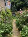

 Easy
Easy  Visorando Member