The Cousteilles and Serre Stream route starting from Prades-d’Aubrac

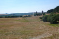
This walk follows paths leading to a few cow pastures. The starting village, Prades-d’Aubrac, takes its name from the Occitan word ‘prados’, meaning meadow. The path leading to the Prades mill still bears the marks in the stone left by the wheels of carts.

Details

n°3075871
Creation:
Last update:
Last review:
  • Walking
    Activity: Walking
  • ↔
    Distance: 2.24 mi
  • ◔
    Average duration: 1h 20 
  • ▲
    Difficulty: Easy

  • ⚐
    Back to start: Yes
  • ↗
    Ascent: + 331 ft
  • ↘
    Descent: - 331 ft

  • ▲
    Highest point: 2,923 ft
  • ▼
    Lowest point: 2,618 ft

Photos

Description of the walk

Park in the square opposite the church at Prades-d’Aubrac.

(S/E) As you leave the square, turn right to head back up the D19 towards the village exit. After the hairpin bend, you’ll come to a Y-junction marked by a cross.

(1) Turn left onto the small road towards Les Cousteilles. You’ll arrive at the hamlet.

(2) Turn left to follow the road to the junction at the Ferme du Serre.

(3) Continue along the road, leaving the Ferme du Serre on your right, and carry on along the path opposite which leads down towards the stream.
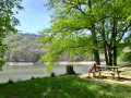
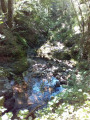
About 100 m further on, veer left to head down towards the Serre stream. Cross the stream: be careful, as the crossing can be difficult after heavy rain. After the stream, follow the path back up to the road and turn left. You’ll reach a Y-shaped junction, also marked by a stone cross.

(4) Take the road on the right, walk alongside the cemetery, and continue along the road to reach the car park at Prades Church (S/E).

Waypoints

  1. S/E : mi 0 - alt. 2,851 ft - Car park opposite the church at Prades-d’Aubrac
  2. 1 : mi 0.29 - alt. 2,923 ft - Crossroads towards Cousteilles
  3. 2 : mi 0.67 - alt. 2,759 ft - Les Cousteilles
  4. 3 : mi 1.03 - alt. 2,749 ft - Serre Farm junction
  5. 4 : mi 1.81 - alt. 2,746 ft - Crossroads with stone cross
  6. S/E : mi 2.24 - alt. 2,851 ft - Car park opposite the church at Prades-d’Aubrac

Notes

(4) Alternative route: take the road on the left, which joins the outward route at the hairpin bend on the D19; turn right to reach the car park (S/E).

Worth a visit

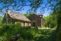
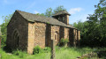
The 16th-century Church of Saint-Laurent in Prades-d’Aubrac.

Reviews and comments

3.4 / 5
Based on 3 reviews

Reliability of the description
3.3 / 5
Ease of following the route
3 / 5
Route interest
4 / 5
User 5772222

Overall rating : 3.7 / 5

Date of your route : Sep 16, 2026
Reliability of the description : ★★★★☆ Good
Ease of following the route : ★★★☆☆ Average
Route interest : ★★★★☆ Good
Very busy route : No

A short, easy circular loop.
However, between points 3 and 4, do not turn left through the meadows. Simply carry on straight ahead, passing a beautiful house on the right, and you’ll come to a path that leads to the stream.

Machine-translated

adouche
adouche

There is no need to climb over barbed wire fences for this hike; simply take the path on the left at the end of the mill road, which leads directly down to the Serre stream.

Machine-translated

CLA30
CLA30

Overall rating : 3 / 5

Date of your route : Sep 19, 2025
Reliability of the description : ★★★☆☆ Average
Ease of following the route : ★★★☆☆ Average
Route interest : ★★★☆☆ Average
Very busy route : No

The route includes many tarmac roads. It should be noted that after point 3, the description is "turn left to descend towards the Serre stream", it seems necessary to add: open a passage in the barbed wire and cross a field with no tracks on the ground, descending towards the stream, which you will need to cross. You will need to open a second passage in the barbed wire to find the path on the other bank.

Machine-translated

Nikytal
Nikytal

Overall rating : 3.7 / 5

Date of your route : Aug 16, 2022
Reliability of the description : ★★★☆☆ Average
Ease of following the route : ★★★☆☆ Average
Route interest : ★★★★★ Very good
Very busy route : No

Hello
We went for a walk after lunch in Prades d’Aubrac, where there’s a very nice restaurant.
It was perfect as a post-lunch stroll and shorter than the 5-hour PR walk around Prades (which looks stunning).
The only downside is that it’s very difficult to find the spot where you can head down to the stream… we ended up walking across a pasture, climbing over barbed-wire fences twice.

Machine-translated

Other walks in the area

For more walks, use our search engine .

The GPS track and description are the property of this route's author. Please do not copy them without permission.