Mardonenque Stream circular loop

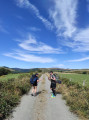
The commune of Aurelle-Verlac is a vast, south-facing, sloping plateau covering 55 square kilometres, overlooking the Lot valley. To explore it, here is a circular route starting from Verlac which passes through Les Mazes, Naves, Le Cros, Les Recostes and finally Les Fessouyres.

Details

64775
Creation:
Last update:
Last review:
  • Walking
    Activity: Walking
  • ↔
    Distance: 7.39 mi
  • ◔
    Average duration: 5h 15 
  • ▲
    Difficulty: Difficult

  • ⚐
    Back to start: Yes
  • ↗
    Ascent: + 2,152 ft
  • ↘
    Descent: - 2,152 ft

  • ▲
    Highest point: 3,360 ft
  • ▼
    Lowest point: 1,844 ft

Photos

Description of the walk

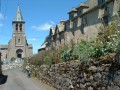
Start from the village square in Verlac.

(S/E) Take a small road heading west-north-west up to Verlaguet.

(1) Take the wide path branching off to the right (north).

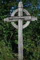
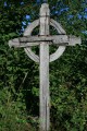
(2) At the 1008-metre mark, turn right and join the D503 at the Col de Verlac (wooden Celtic cross, primitive sculpture). Turn right and enter Les Mazes.

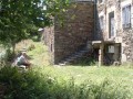
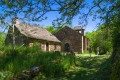
(3). Walk down through the hamlet, past an old barn converted into a guesthouse. Follow the path (facing east) for 1.5 km down to Boralde Monnette.

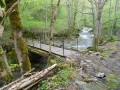
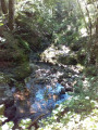
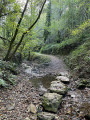
(4) Cross two streams in succession (take care). At Boralde Mardonenque, there are the ruins of a mill 50 metres to the right.
Head back up towards Naves along a south-facing path, which you follow for about 2 km.

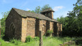
(5) You can visit the village, which is currently being renovated, and then retrace your steps.

(5) Take the path heading south-west at the entrance to the village and head towards Le Cros.

(6). Turn left and walk through the hamlet. At the Fork in the road just outside the hamlet, turn right onto the path below which leads to Les Recostes.

(7). At Les Recostes, turn right towards the west onto a path which, after about 1 km, turns north. You’ll reach the footbridge over the Madonenque, which has been rebuilt.

(8). Climb up to Les Fessouyres, then follow the small tarmac road for 700 metres.

(9) Turn right onto a wide track and head up to Verlac (1,200 m) (S/E).

Waypoints

  1. S/E : mi 0 - alt. 2,986 ft - Village square - Église Saint-Jacques (Verlac)
  2. 1 : mi 0.38 - alt. 3,130 ft - Towards Verlaguet
  3. 2 : mi 1.03 - alt. 3,307 ft - At the junction, turn right
  4. 3 : mi 1.45 - alt. 3,271 ft - Les Mazes
  5. 4 : mi 2.47 - alt. 2,635 ft - 2 boraldes (stream)
  6. 5 : mi 3.87 - alt. 3,159 ft - Visit to the village of Naves
  7. 6 : mi 4.48 - alt. 2,694 ft - Turn right towards the hamlet
  8. 7 : mi 4.72 - alt. 2,434 ft - Turn right towards the west
  9. 8 : mi 5.68 - alt. 1,847 ft - Head up to Les Fessouyres
  10. 9 : mi 6.63 - alt. 2,431 ft - Wide path on the right
  11. S/E : mi 7.39 - alt. 2,986 ft - Village square - Église Saint-Jacques (Verlac)

Notes

The water on the route is not drinkable; please make your own arrangements.
Shelters at Les Mazes, Naves, Le Cros and Les Fessouyres.
Wear high-top boots, a hat, a rain jacket and walking poles.
The second ford must be approached with caution; it can be quite difficult if it has just rained.
Take a packed lunch to avoid low blood sugar.
FFRP signposting

Worth a visit

Information about the commune of Aurelle-Verlac:
The distinctly mountainous character of the upper part of the commune, centred on the summit of the Aubrac in Aveyron known as Cazalet at 1,463 metres, contrasts with its lower reaches, which enjoy a milder, less windy climate around the Minié Bas at an altitude of 500 metres.
This vast area is also deeply carved out the further down you go, from north to south, by torrential and mysterious rivers known as ‘boraldes’. The commune comprises five ancient villages and around twenty hamlets, all linked by an age-old network of country lanes.

Reviews and comments

4.2 / 5
Based on 3 reviews

Reliability of the description
4.7 / 5
Ease of following the route
4 / 5
Route interest
4 / 5
brousse
brousse

Thank you for sharing your thoughts with us,

Machine-translated

degavroche
degavroche
• Edited:

Overall rating : 4 / 5

Date of your route : Jul 08, 2022
Reliability of the description : ★★★★★ Very good
Ease of following the route : ★★★★☆ Good
Route interest : ★★★☆☆ Average
Very busy route : No

A leisurely route, a bit warm for July 2022. There’s a tap in the village hall beneath the church in Verlac (starting point). We also found water at Le Cros (km 6) and Les Rescotes (km 7). Not particularly scenic, but the Aubrac countryside is lovely. Didn’t see any walkers, but came across a few herds of Aubrac cows.

Machine-translated

tom01nolan06
tom01nolan06

Overall rating : 4.7 / 5

Date of your route : May 15, 2017
Reliability of the description : ★★★★★ Very good
Ease of following the route : ★★★★☆ Good
Route interest : ★★★★★ Very good

Right, we did this on a very hot day, so you’ll need to bring plenty of water.

Machine-translated

brousse
brousse

Thank you for sharing your thoughts on PR4; I’ll go and post them on the “aurellerandos.fr” website straight away...
As for crossing the ‘boraldes’ – the rivers in the south of the Aubrac – I have asked the Mayor to have a footbridge built, primarily over the Boralde Mardonenque... Crossing it after periods of heavy rain is quite a challenge...

Machine-translated

septou
septou

Overall rating : 4 / 5

Date of your route : Jun 19, 2016
Reliability of the description : ★★★★☆ Good
Ease of following the route : ★★★★☆ Good
Route interest : ★★★★☆ Good

a walk that takes you past remote hamlets
Crossing the two streams was quite difficult, especially the second one
everyone took off their shoes to wade through the cold water
you need to help each other to avoid falling
Be careful – the end involves a fairly steep climb
This walk offers views of the foothills of the Aubrac

Machine-translated

Other walks in the area

For more walks, use our search engine .

The GPS track and description are the property of this route's author. Please do not copy them without permission.