Route of drystone shelters in Montazels

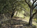
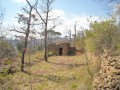
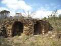
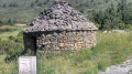
This hike will take you along a new route updated by a village association that is reviving forgotten paths that once allowed villagers to reach the vineyards and graze their flocks of sheep. You will discover drystone shelters that were used to shelter from the wind and bad weather and, in the case of the larger ones, to store equipment for working in the fields.

Details

541416
Creation:
Last update:
Last review:
  • Walking
    Activity: Walking
  • ↔
    Distance: 1.74 mi
  • ◔
    Average duration: 1h 15 
  • ▲
    Difficulty: Easy

  • ⚐
    Back to start: Yes
  • ↗
    Ascent: + 486 ft
  • ↘
    Descent: - 486 ft

  • ▲
    Highest point: 1,348 ft
  • ▼
    Lowest point: 863 ft
  • ⚐ Country: France
  • ⚐ City: Montazels (11190)
  • ⚑
    Start/End: N 42.945088° / E 2.245957°
  • ❏
    IGN map(s): Ref. 2347OT
  • Hour-by-hour weather

Photos

Description of the walk

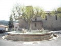
Start at the Town Hall, Place du Grifoul.

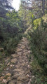
(S/E) Take the street to the left of the town hall, walk 60 metres and turn left into Rue du Caire. Turn right onto Chemin de la Montado, which climbs up a flight of steps. Follow the yellow markings with blue and red dots.

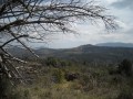
(1) On the way up, at the dry trees, turn left to discover some superb drystone shelters (drystone huts) then return to the path. Continue climbing, enjoying the views over the valley.

(2) When you reach the path at elevation 414, descend to elevation 395 to discover a beautiful drystone shelter and continue downhill to reach the old landfill.

(3) Turn left and continue along the path that leads to Rue du Caire at the entrance to the village. Ignore the first two streets on the right and turn into the third street towards the town hall, Place du Grifoul (S/E).

Waypoints

  1. S/E : mi 0 - alt. 863 ft - Town hall, Place du Grifoul
  2. 1 : mi 0.35 - alt. 1,152 ft - Fork in the road, drystone shelters
  3. 2 : mi 0.78 - alt. 1,345 ft - Path at elevation 414
  4. 3 : mi 1.16 - alt. 1,178 ft - Path on the left.
  5. S/E : mi 1.74 - alt. 863 ft - Town hall, Place du Grifoul

Notes

No water on the route but there is a tap at the start near the church.
Benches for resting.

Worth a visit

Drystone shelters.
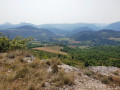
Views of the valley, Pic de Bugarach and Rennes-le-Château.
Le Griffoul, a listed fountain in the village.

Reviews and comments

4.6 / 5
Based on 6 reviews

Reliability of the description
4.8 / 5
Ease of following the route
4.2 / 5
Route interest
4.8 / 5
Jacques Mudry
Jacques Mudry

Overall rating : 4.3 / 5

Date of your route : May 07, 2025
Reliability of the description : ★★★★★ Very good
Ease of following the route : ★★★☆☆ Average
Route interest : ★★★★★ Very good
Very busy route : No

Very nice walk, easy to follow, except for the start! It should be more precise: to the left of the town hall, take rue du Griffoul on the right, then rue du Caire on the left, to climb the stairs on the right... From there, a perfect description

Machine-translated

Gilportier1961
Gilportier1961

Overall rating : 4.7 / 5

Date of your route : Oct 17, 2023
Reliability of the description : ★★★★★ Very good
Ease of following the route : ★★★★★ Very good
Route interest : ★★★★☆ Good
Very busy route : No

A short and pleasant hike, not very long, but with a nice climb from the village to the summit.
Uncovered, so very hot in the sun.
Beautiful view from the summit.
Of limited interest unless, like us, you are looking for a short hike to round off the day in a fun and active way.

Machine-translated

Stanou
Stanou

Overall rating : 4.7 / 5

Date of your route : Aug 16, 2023
Reliability of the description : ★★★★★ Very good
Ease of following the route : ★★★★☆ Good
Route interest : ★★★★★ Very good
Very busy route : No

A very pleasant route through the heath with a section through the undergrowth.
Once you've completed a short climb, you'll be rewarded with some stunning panoramic views!
You can see small stone walls and shepherds' shelters along the way.
The trail has been cleverly and carefully designed, with numerous information panels describing the flora, an orientation table at the viewpoint, and lots of fun features for children.
Don't hesitate to take the whole family along.

Thank you to everyone who maintained and developed the route.

Machine-translated

EliseB31
EliseB31

Overall rating : 4.3 / 5

Date of your route : Mar 26, 2023
Reliability of the description : ★★★★☆ Good
Ease of following the route : ★★★★☆ Good
Route interest : ★★★★★ Very good
Very busy route : No

A magnificent walk with beautiful views all around. Once there, simply follow the routes marked out by an association of Montazels residents, who have created small scenes at the citadels using recycled objects. The two routes, the citadels route (about 1 hour) and the Montsec route (about 2½ hours), are signposted. Access to the car park is via an extremely narrow road.

Machine-translated

LACeuro
LACeuro

Overall rating : 4.7 / 5

Date of your route : Jun 10, 2022
Reliability of the description : ★★★★★ Very good
Ease of following the route : ★★★★☆ Good
Route interest : ★★★★★ Very good
Very busy route : No

Hike with beautifully crafted decorations and pleasant views
A few issues at the start, but we got back on track
The association did a good job

Machine-translated

ca-use
ca-use

Overall rating : 5 / 5

Date of your route : Mar 08, 2019
Reliability of the description : ★★★★★ Very good
Ease of following the route : ★★★★★ Very good
Route interest : ★★★★★ Very good

I will do it again when time permits.

Machine-translated

Other walks in the area

For more walks, use our search engine .

The GPS track and description are the property of this route's author. Please do not copy them without permission.