Country:
 City:


Start from Place Henri IV in the village of Saint-Denis-d’Anjou.
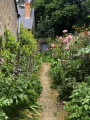
(S/E) Head north towards the junction with the Grande Rue. At the ‘Stop’ sign, turn left, then 25 metres further on, turn right onto Rue de Cohuau. At the end of this street, turn left onto Rue des Jardins, walk a few metres and turn right onto the small footpath between numbers 7 and 5 on Rue des Jardins.
Follow this path all the way to the end to come out onto Rue du Vivier-Cherruault.
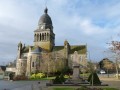
(1) There, turn left and head towards the market halls. After passing under the market halls, turn left onto Rue des Halles and head towards the church. When you reach the church, walk along its right-hand side.
(2) Turn right onto the small street just before the parking spaces. Carry on straight ahead to join Rue de la Roche and follow it. At the end of the street, it continues as a tree-lined path that curves to the right. Take this path and follow it all the way to the end, where it joins a small tarmac road. Continue for another hundred metres or so until you reach a junction.
(3) Carry on straight ahead. As the road curves to the right, a track branches off straight ahead. Follow this track all the way to a small tarmac road (D105). Turn right and follow this road for 200 metres.
(4) Turn right onto a small tarmac road and head towards the buildings at the end of the road. Leave the buildings on your left and take the path leading off to the right. After about 200 metres, you’ll reach a three-way junction.
(5) Here, you have two options:
- continue straight on until you come to a small gravel road, cross it and head towards the lake - - or turn left to take a 5 km circular route along the Circuit des Glandelles (optional).
From the three-way junction, turn left and continue along this path through the fields for just under a kilometre (please note: this path is not shown on the map). You will then reach a junction of two paths.
(6) Turn left and follow the path until it joins a small tarmac road at a bend. Turn right and continue along this road until you reach the hamlet of Haute Glandelle. Here, the road curves to the left towards some houses, whilst a tree-lined path leads straight ahead. Follow this path all the way to a small tarmac road at the hamlet of Maison Neuve (on the left).
(7) At the junction, turn right onto a tarmac road. Follow it, passing three junctions (one to the left, one to the right, then one to the left). 500 metres after the third junction, the road curves to the left and a tree-lined path branches off to the right.
(8) Take this path to reach the crossroads again, passing the Ruisseau de la Morinière.
(6) Turn left and follow the track to reach the three-way junction.
(5) Turn left to reach the lake.
(9) Turn right to walk round the lake.
(9) Return to the gravel track and turn right. Follow this track until you reach a junction at a place called La Pilardière.
(10) Turn left and continue straight on until you reach a crossroads. Turn left, then immediately right. After about fifty metres, the road continues as a country lane. Follow this, then 80 metres further on, take the path to the right. Follow the track all the way to a junction with the D14 at a place called La Corbelière. Cross the D14 and continue for about 50 metres.
(11) Take the track that veers slightly to the right as it rounds the bend. Follow it for 300 metres and, at the fork, take the right-hand track and continue along this path until you reach a small road (Chemin du Saultray). Turn right and head towards the junction with the D27 (Route de Sablé).
(12) Cross the D27 (take care – it’s a busy road) and carry on straight ahead, veering slightly to the left (leaving the wayside cross on your right) to join a small tarmac road. Follow it all the way to the end, then turn right at the junction. Walk for about fifty metres.
(13) Turn right at the first junction towards Le Ray. Continue straight on until you reach a small lay-by. There, at the end of the street on the right, a small tree-lined path begins. Follow it, then turn right at the end of the path to rejoin the D27. Turn left, then at thethird junction turn left to reach Place Henri IV (S/E).

 Tourist office

 Easy
 Visorando Member