Country:

 City:
City:


Start from the village hall. The route is marked in fluorescent pink ( temporary markings made with biodegradable chalk).
(S/E) Cross Avenue de la Mairie and take Rue Sans Nom to the end. Take care when crossing the departmental road, then climb the small flight of four steps.
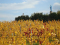
(1) After 300 metres, turn right onto a dirt track between the vineyards. There is a lovely view of Saint-Julien and Montmelas Castle. When you reach the road, turn left, then right at the Stop sign and follow the road.
(2) After Le Germain and a large boundary wall, take the path leading uphill to the right; after the bread oven, head down to the left, then right, and continue downhill to the dirt track.
(3) Turn left, then head back up the tarmac road. Leave it on the right and head towards Riberrolles.
(4) Turn right at the junction.
(5) When you reach Les Grandes Terres, head down to the right between the hay tunnels (crossing the farm) and descend towards the Marverand stream. At the top of the steep climb, continue to the left, reach the road, and follow it to the right, climbing up to Le Gay.
(6) In the hamlet of Le Gay, you’ll find a bench and a boundary marker. Then leave the road via a path on the left which takes you to a place called Le Peillon (where the CCAS provides refreshments on the day of the organised walk).
(7) Next, cross the Route de la Croix du Ban. At the crossroads of the paths, go straight on to Le Paragard. Then take the road on the left and cross Le Quart.
(8) As you leave the hamlet, follow a path climbing up to the left which leads into the woods, then through the vineyards.
(9) The path joins the Route de Blacé and, at this junction, a drinking fountain offers a chance to refresh yourself whilst admiring a beautiful panoramic view over the Saône valley and the Beaujolais region. As you walk down the Route de Blacé, 300 metres on, don’t miss the path on the left.
(10) Head down through the woodland and then past some old, abandoned vineyards. At the bottom of the concrete path, watch out for the drainage channel. Continue downhill to cross the Sallerin/Sovarin stream, then pass below Paragard with views of two châteaux (l’Hestrange and Paragard).
(11) Make sure you keep to the left at the junction, then turn left again.
(12) Carry on straight ahead to cross the Domaine de Croifolie (Crozet’s vineyard) and join the Route de la Folie on the left. At the left-hand bend, leave the road and take the path on the right, up to the Montée de la Croix Rousse. Then turn left.
(13) As you pass through the village, take Rue de la Treille, then turn right onto Rue du Breuil to discover a Cluniac site with its cloister and the “Le Prieuré” museum. Continue right along Rue du Breuil. As you leave the village, cross the junction.
(14) Turn right onto thefirst path on the right and go behind the old narrow-gauge railway station (toilets and water point) to join the Voie du Tacot.
(15) Cross the Route de la Croix Polage and head up the steep path on the right, between vineyards and plantations, to reach Montjoly on the right; then walk past the Château de Champrenard and head towards the village hall (S/E) on the left, along the Route de Berne, before continuing to the right.
 Local authority

 Difficult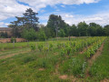
 Easy
Easy  Visorando Member