Country:
 City:
City:


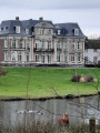
Start and finish at the 1815 Museum car park.
(S/E) Facing the museum entrance, turn left onto Rue Pierre Piraux. At the right-hand bend, cross the road and take Avenue du 16 juin 1815.
(1) Keep to the right onto Rue du Sart Mallet. Then keep right again on the long straight stretch.
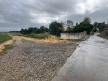
(2) At the junction, carry on straight ahead, continuing through the fields until you reach the N93.
(3) Cross the road and take the first right into the fields, Rue Croix Brulée, until you reach Rue Pont du Rieu. Take the road on the right, then right again onto Rue Pont-au-Rieu, and then the first left, Rue du Château, to reach the hamlet of La Goffe.
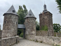
(4) There’s a small bench by the river, the Sombre, for a well-deserved break. Continue along Rue du Château, which bends to the right, then to the left, to reach the Château de Sombreffe.
(5) Carry on and cross the Chaussée de Chastre by first turning left then right. Take Rue Scourmont, keeping to the right, until you reach the Chaussée de Nivelles. Turn right for 100 metres, then right again onto the Chaussée de Chastre.
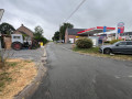
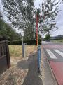
(6) Take a small, picturesque path on the left at the pedestrian crossing, which runs alongside the River Sombre to take you onto Rue Elveau. Turn right, then take the next street on the left (Rue Chapelle de Walcourt) and follow it. At the chapel, turn right onto the N93, continuing as far as the petrol station.
(7) Turn left for another long stretch across the fields and rejoin the junction of the two circular loops you passed on the way out.
(2) Carry on straight ahead until you reach the railway line.
(8) Turn left before the bridge that crosses it (towards Sombreffe), passing by the farm.
(9) Enter the residential area, cross Rue du Pinson, take Rue Gaie and then turn left onto Rue Tigrée. Next, turn right again until you reach the main road (Rue Pont Piraux), which you follow to the right to return to your car park (S/E).
 Visorando Member



 Difficult
 Easy
Easy