Country:

 City:
City:


Coming from Aix-les-Bains, head towards the “Les Peupliers” campsite (first left after the roundabout between the D914 and the D991) to find a car park. There is also a car park next to the sports ground.
(S/E) Set off on foot towards the north-west, between the buildings, and head for the end of Chemin du Stade.
(1) Turn left and continue through the (marshy) woodland until you come to a path running at right angles.
(2) Turn right onto it and continue along Chemin des Cris.
(3) Turn left onto Rue de Vars and follow it to its end.
(4) Carry on straight ahead through the forest and cross the Canal de Chautagne via a footbridge.
(5) Follow the narrow path, which stays within the forest the whole way (avoid the meadow on the right)
(6) Turn right and head towards the D57.
(7) After a right-left turn on the D57, take the path that crosses Le Vernay (ignore the paths running at right angles).
(8) First turn left then right and join the forest track through the Marais de Chautagne until you reach the junction with the Route des Marais (D904).
(9) Cross it carefully, then carry on straight ahead for 1.5 km until you reach a junction.
(10) Turn left and rejoin the cycle path. Follow it straight ahead.
(11) Leave the cycle path and carry on straight ahead.
(12) Turn left and follow the path that runs alongside a branch of the Rhône as far as La Loi.
(13) Here, there are two options:
- carry on along the low wall and go under the D904
- cross the hamlet via Rue de La Loi (which is what I do as I have a large dog).
(14) Cross the D904 carefully at the cycle car park. Take the cycle path opposite for 60 metres.
(15) Take the path on the right, on the other side of the D921.
(16) At the bend, ignore the path on the right and take the one on the left, which runs parallel to the Rhône. Follow it for 1.2 km.
(17) Follow the signposting to the left and go round the pond on the left-hand side.
(18) Return to the gravel path and follow it to the left; then, once you reach the junction with the Route de l’Étang Bleu, turn right.
(19) After the open-air café, head down to the left onto the footbridge and follow the path along the eastern bank of the Étang Bleu.
(20) Climb the short, steep slope to the left, just before passing under the railway lines.
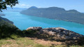
(21) Facing the metal gate, head up to the left and follow the steep path – sometimes bordered by a low wall – which leads to the Canon de Vions viewpoint (panorama).
(22) At the cannon, continue to the right to follow the Sentier du Mollard, which soon reaches the ridge, passing through some shaded sections. After the hairpin bend, continue to the junction with the Route du Mollard.
(23) Ignore this and carry on straight ahead to the Commanderie.
(24) Pass the chapel and the remains of the cemetery (on the left), and continue to follow the path, which soon descends via a short, steep slope to the cross in the hamlet of Bovéron. Follow the small road to the right (Rue du Boveron).
(25) Do not cross the railway tracks. Cross the D921 by turning left, and follow the path that runs alongside the railway tracks for 1.5 km.
(26) Carefully turn right onto the D914, then, after the road bridge over the railway tracks, take the path on the left. Follow this path, ignoring any side paths, until you reach the Chemin du Cul du Bois. Follow it to the left as far as Port de Chatillon.
(27) Turn back a few metres, then head north along the Route de Chatillon (D56). Cross the road bridge over the railway tracks, then turn right onto Rue de la Gare (D56) until you reach a car park.
(28) Continue left, heading north, on the D56, until you reach the junction with the D914, then follow it to the right for about 100 metres.
(29) Cross it carefully, then turn left, heading north, to return to the car park (S/E).
 Visorando Member
 Moderate
 Easy
Easy