


Refine your search for walks in Lac du Bourget
Lac du Bourget walks


 Chanaz - Pomey circular
 Visorando Member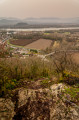
 5.02 mi
 +1,155 ft
 -1,145 ft
 3h 20
3h 20
 Easy
Easy
 Departure from Chanaz (Savoie)
An easy walk with beautiful views of Chanaz, then Lac du Bourget on the Chemin de Pomey.
From Bourdeau to Hautecombe overlooking Lake Bourget
 13.41 mi
+3,802 ft
-3,799 ft
9h 30
13.41 mi
+3,802 ft
-3,799 ft
9h 30
 Difficult
Departure from Bourdeau (Savoie)
Difficult
Departure from Bourdeau (Savoie)
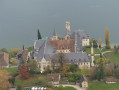
Here is a good route connecting Bourdeau to Hautecombe Abbey.
The outward journey takes you above the wild shores of Lake Bourget with numerous viewpoints, all on a somewhat rugged route.
After climbing a little higher, the return route takes you in the shadow of Mont de la Charvaz before coming back via the Col du Chat.
Corsuet Forest and Cross
5.71 mi
+968 ft
-968 ft
3h 30
Easy
Departure from Aix-les-Bains (Savoie)
The Corsuet Forest is criss-crossed, indeed criss-crossed by numerous paths and trails. It is an open space that allows you to escape the urban environment whilst remaining close to the town.
The numerous signposts will provide useful guidance for walkers.
The route described here is just a modest example of the possibilities offered by the Corsuet Forest.
Here, the paths have taken their names from the animal kingdom.
Around Saint-Germain-la-Chambotte
 8.98 mi
+1,565 ft
-1,545 ft
5h 30
8.98 mi
+1,565 ft
-1,545 ft
5h 30
 Moderate
Departure from La Biolle (Savoie)
Moderate
Departure from La Biolle (Savoie)
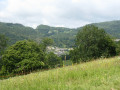
This walk allows you to explore the hamlets around Saint-Germain-la-Chambotte through woods and meadows and offers beautiful panoramic views.
Circular at Hautecombe Abbey starting from the Ontex viewpoint
6.36 mi
+1,926 ft
-1,946 ft
4h 35
Moderate
Departure from Saint-Pierre-de-Curtille (Savoie)
This hike takes you to the remarkable site of Hautecombe Abbey, starting from the Belvédère d'Ontex, which offers a magnificent view of the site. The route is more difficult than it appears, with a somewhat uneven path above the lake and a fairly challenging final climb.
Cat Tunnel Circular Loop
 4.54 mi
+2,546 ft
-2,539 ft
4h 20
Moderate
Departure from Bourdeau (Savoie)
4.54 mi
+2,546 ft
-2,539 ft
4h 20
Moderate
Departure from Bourdeau (Savoie)
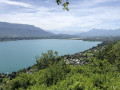
Exploring the Cat Tunnel via the safety gallery. This gallery, running parallel to the road tunnel, serves as an emergency exit in the event of an incident. Normally, this passage is used by many cyclists as well as pedestrians to get from the Lac du Bourget side to the Yenne Valley and the Chevelu Lakes. The tunnel has been converted into the “Musée du Chat” and features an impressive collection of murals created by contemporary artists, inspired by Savoyard tradition. In my opinion, it is unique in France. A note on the route: you will see an elevation gain of 732 m, which is incorrect, as the software includes the mountain height above the tunnel; you must therefore subtract 321 m, bringing the route’s total elevation gain down to 455 m.
Route through the Chautagne Forest and ascent of the Mollard de Vions
14.85 mi
+643 ft
-653 ft
7h 25
Difficult
Departure from Chindrieux (Savoie)
A lovely walk through the Chautagne State Forest (poplar groves), heading for the Mollard de Vions and the Port of Chatillon. The short, steep climb up to the Mollard de Vions offers panoramic views from the Canon de Vions site over the Rhône, the Grand Colombier and the Lavours Marshes plain. During the descent towards Vions, there’s a viewpoint overlooking Lac du Bourget and the Croix du Nivolet. From Vions, it’s possible to continue on a round trip to Chanaz and the lock on the Canal de Savières, but the entire section along the Rhône has very few shaded areas.