


Angreau Route


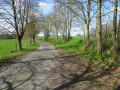
This family-friendly circular walk, starting from RUS Angreau, takes you through the rolling landscapes of the Bois d’Angre, amongst fields, meadows and woodland. The route, which is easy and presents no major difficulties (74 m elevation gain), is suitable for both occasional walkers and seasoned walkers, with or without a four-legged companion. It is a leisurely walk to enjoy the tranquillity of the Honnelois countryside and its views over the valley. An ideal route for a first family outing.
Details
Creation:
Last update:
Last review:
–
–
-
 Activity: Walking
 -
 Distance: 3.23 mi
 -
 Average duration: 1h 40
 -
 Difficulty: Easy
 -
-
 Back to start: Yes
 -
 Ascent: + 243 ft
 -
 Descent: - 243 ft
 -
-
 Highest point: 302 ft
 -
 Lowest point: 131 ft
 Country:
 City:
City:


Waypoints
- S/E : mi 0 - alt. 230 ft - Angreau
- 1 : mi 0.73 - alt. 138 ft - La Grande Honnelle
- 2 : mi 1.32 - alt. 246 ft - Fork in the road
- 3 : mi 1.75 - alt. 174 ft - La Grande Honnelle
- 4 : mi 2.12 - alt. 256 ft - Maison Verhaeren
- S/E : mi 3.23 - alt. 230 ft - Angreau
Other walks in the area
Circular Ancreau loop via Boucou and La Loquette
 Association / Club / Walk leader4.37 mi
+338 ft
-344 ft
2h 20
Easy
Association / Club / Walk leader4.37 mi
+338 ft
-344 ft
2h 20
Easy
 Departure from Honnelles (Hainaut)
For walkers wishing to extend the pleasure, this 7 km circular route starts at RUS Angreau and explores the wider Honnelles area, between the village of Angreau, the Bois d’Angre and the charming hamlet of Caillou-qui-Bique. With a moderate elevation gain, this route remains accessible whilst offering a little more nature and variety. A wonderful opportunity to discover the region’s typical trails and landscapes, accompanied by your dog.
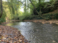
Countryside and woods around Roisin and along the Grande Honnelle
 Visorando Member
 7.28 mi
+266 ft
-253 ft
3h 35
7.28 mi
+266 ft
-253 ft
3h 35
 Moderate
Departure from Honnelles (Hainaut)
Moderate
Departure from Honnelles (Hainaut)
Straddling the French-Belgian border, take a short, hilly walk to discover the countryside and woods around Roisin. Part of the route follows the course of the Grande Honnelle, a charming stream. The route also passes by the famous "Caillou qui Bique".
From Le Sart to Le Caillou-qui-Bique in Eth
 AONB
AONB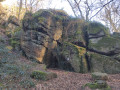 6.92 mi
+230 ft
-233 ft
3h 25
Easy
Departure from Eth (Nord)
6.92 mi
+230 ft
-233 ft
3h 25
Easy
Departure from Eth (Nord)
This cross-border route follows small roads and agricultural paths. The listed site of Caillou-qui-Bique
requests that visitors behave respectfully.
A walk around and through Gussignies
3.52 mi
+292 ft
-289 ft
1h 50
Easy
Departure from Gussignies (Nord)
This walk takes you round Gussignies, heading towards Belgium, whilst offering a beautiful view of the village, charming rustic cobbled streets and a path along the water’s edge.
A picturesque loop between the French Avesnois and the Belgian highlands
 11.95 mi
+633 ft
-604 ft
6h 05
Moderate
Departure from Gussignies (Nord)
11.95 mi
+633 ft
-604 ft
6h 05
Moderate
Departure from Gussignies (Nord)
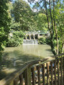
Starting from and returning to the Brasserie au Baron, traveling between the Avesnois Nature Park in France and the Haut-Pays Nature Park in Belgium, this hike brings together the most picturesque segments through back alleys, winding paths, remarkable village centres, paths through the wooded countryside and old railway lines.
Marble Valley Route starting from Gussignies
 5.82 mi
+269 ft
-269 ft
2h 55
Easy
Departure from Gussignies (Nord)
5.82 mi
+269 ft
-269 ft
2h 55
Easy
Departure from Gussignies (Nord)
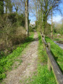
This route runs through the Hogneau valley along small roads or paths on the outskirts of the villages of
Bellignies and Gussignies.
For more walks, use our search engine .
The GPS track and description are the property of this route's author. Please do not copy them without permission.

