Cime de la Nauque

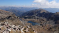
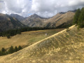
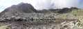
The Cime de la Nauque is a peak overlooking the Bieugne valley, the torrent that flows from the Lac des Mesches. The summit offers a panoramic view to the south over the final mountain ranges before the Mediterranean. To the north, you’ll see the Lac de la Minière and the Vallon de Castérino.

Before setting off, please read the ‘Practical Information’ section.

Details

n°3472944
Creation:
Last update:
Last review:
  • Walking
    Activity: Walking
  • ↔
    Distance: 7.29 mi
  • ◔
    Average duration: 6h 10 
  • ▲
    Difficulty: Difficult

  • ⚐
    Back to start: Yes
  • ↗
    Ascent: + 3,202 ft
  • ↘
    Descent: - 3,186 ft

  • ▲
    Highest point: 7,221 ft
  • ▼
    Lowest point: 4,075 ft

Photos

Description of the walk

From Saint-Dalmas de Tende (06), take the road towards Castérino / Les Mesches.
Park by the Lac des Mesches.

(S/E) From the car park, take the road downhill until you come to marker 235 on the right, signposted Granges de Gauron, Granile and Pas de la Tranchée.

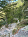
(1) Take the wooded path towards Granges de Gauron. At the 1349-metre mark, keep to the left; a sign also indicates the direction. Pass marker posts 236 and 237, then walk through the small hamlet of Granges Cioto. After a bend, cross a stream via a small bridge and reach a junction

(2) Continue following the signs for Les Granges de Gauron and Le Pas de la Tranchée; you’ll soon reach marker 238.

(3) Ignore the path branching off to the left, and after a winding climb through the grass, reach marker 222.

(4) Turn right towards the Pas de la Tranchée. The path is now flat and offers a bit of a breather before tackling the winding climb up to the Pas de la Tranchée.

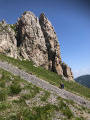
(5) Take a break at the Pas de la Tranchée, which offers a superb view to the south, over the Vallon de Berghe and further west towards the Authion. Make sure you spot the path towards the Cime de la Nauque; it starts just behind marker 223. Follow the Crête de Scaffa, using your hands to help you over a few rocky sections.

(6) Continue across more open terrain; the slope becomes steeper through grass and scree. Begin a bend northwards to reach the foot of a rocky section.

(7) Follow the cairns carefully as they lead to a passage that isn’t very obvious at first glance. You’ll emerge, to your surprise, onto a large grassy plateau. Make your way to a small hillock.

(8) Make your way to the Cime de la Nauque by crossing meadows bordered by larch trees.

(9) Go round the Cime de la Nauque to the south and join a gently sloping path leading to the Pas de la Nauque.

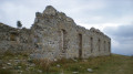
(10) Begin the pleasant descent through the woodland and head for the first building of the “Neige et Merveilles” lodge (Marker 86 – Vallauria Mine)

(11) Turn right onto the track and head back to the car park at Lac des Mesches. (S/E)

Waypoints

  1. S/E : mi 0 - alt. 4,485 ft - Lac des Mesches
  2. 1 : mi 0.3 - alt. 4,439 ft - Marker 235 – Pas de la Tranchée signpost
  3. 2 : mi 2.37 - alt. 4,311 ft - Junction
  4. 3 : mi 2.4 - alt. 4,301 ft - Marker 238
  5. 4 : mi 2.51 - alt. 4,432 ft - Marker 222
  6. 5 : mi 3.33 - alt. 5,207 ft - Pas de la Tranchée – Marker 223
  7. 6 : mi 3.76 - alt. 5,922 ft - The route starts on a grassy, stony slope
  8. 7 : mi 3.99 - alt. 6,440 ft - Rocky section
  9. 8 : mi 4.2 - alt. 6,660 ft - Mamelon
  10. 9 : mi 4.78 - alt. 7,221 ft - Cime de la Nauque
  11. 10 : mi 5.02 - alt. 6,985 ft - Pas de la Nauque – Marker 242
  12. 11 : mi 6.51 - alt. 4,895 ft - Marker 86 - Gite Neiges et Merveilles
  13. S/E : mi 7.29 - alt. 4,485 ft - Lac des Mesches

Notes

Warning!

From the Pas de la Tranchée (5) to the Cime de la Nauque (9), this section is graded T3.

? The IBP statistics for the route give a rating of 114 HKG

- A quick reminder about route ratings: see this page.

- Mountain kit, particularly good footwear.

Worth a visit

- Lac des Mesches.
- Pas de la Tranchée.
- Cime de la Nauque.
- Pas de la Nauque.
- Granges de Gauron.
- Cime de Gauron.
- Mont Bonsapel.
- Granile.

Reviews and comments

4.3 / 5
Based on 2 reviews

Reliability of the description
4.5 / 5
Ease of following the route
4 / 5
Route interest
4.5 / 5
User 25036182

Overall rating : 4 / 5

Date of your route : Aug 23, 2026
Reliability of the description : ★★★★☆ Good
Ease of following the route : ★★★★☆ Good
Route interest : ★★★★☆ Good
Very busy route : No

The route description is fairly accurate. There’s one section where you need to use your hands on the rock face, but it’s nothing too difficult.
The final climb is steep but presents no technical difficulties. The summit is well worth the effort, and it’s a place that’s remained quite unspoilt.

Machine-translated

titirex
titirex

Overall rating : 4.7 / 5

Date of your route : Nov 11, 2024
Reliability of the description : ★★★★★ Very good
Ease of following the route : ★★★★☆ Good
Route interest : ★★★★★ Very good
Very busy route : No

A magnificent and very wild summit. The climb from point 5 is quite a challenge. There are no technical difficulties, although around point 7 it’s not immediately obvious which way to go, but you’ll manage.

Machine-translated

Other walks in the area

For more walks, use our search engine .

The GPS track and description are the property of this route's author. Please do not copy them without permission.