Cilaos – La Nouvelle

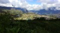
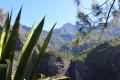
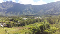
A pleasant hike with magnificent views over the cirques of Cilaos and Mafate, but challenging due to the length of the route and the elevation gain.

This walk is part of a multi-day hike: Les 3 cirques de La Réunion : Salazie - Cilaos - Mafate

Details

n°7835
Creation:
Last update:
Last review:
  • Walking
    Activity: Walking
  • ↔
    Distance: 9.98 mi
  • ◔
    Duration according to the author: 8 hrs 
  • ▲
    Difficulty: Very difficult

  • ⚐
    Back to start: No
  • ↗
    Ascent: + 5,305 ft
  • ↘
    Descent: - 4,551 ft

  • ▲
    Highest point: 6,831 ft
  • ▼
    Lowest point: 2,969 ft

Photos

Description of the walk

(S) Start from the “Ti Case Lontan” lodge.
Head down towards the church and, at the roundabout before the church, take the path that starts at the far end of the car park on the left. After a few hundred metres, the path joins the road; follow it to the left.

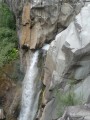
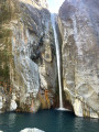
(1) At the crossroads, take the path – this is the GRR2, marked in red and white – which descends to the left and leads to the Bras-Rouge waterfall.

(2) Stay on theGR®, beginning a very gentle climb to reach the junction with the road near the Source Petit Louis.

(3) Cross the road and continue up the Col de Taïbit, where the climb becomes steeper. You’ll reach the Source de Ti Louis.

(4) Continue along theGR® to reach the Col de Taïbit.

(5) Descend to Marla, staying on theGR® the whole way.

(6) Walk through the village and turn right at theGR® junction onto the path that now follows all threeGR® routes (R1, R2 and R3) to reach another path junction at Maison Laclos.

(7) Turn left at Maison Laclos, leave theGR® trails, cross the Rivière des Galets and rejoin theGR® R1 and R2 trails further up.

(8) Continue in the direction of La Nouvelle to reach this village with ease (E).

Waypoints

  1. S : mi 0 - alt. 3,924 ft - Cilaos
  2. 1 : mi 0.49 - alt. 3,753 ft - Road and path junction. Towards the - Cascade du Bras Rouge
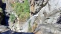
  3. 2 : mi 1.85 - alt. 2,986 ft - Bras Rouge Waterfall on the - Bras de Cilaos (rivière) - La Réunion -
  4. 3 : mi 3.52 - alt. 4,137 ft - Roadside car parks
  5. 4 : mi 5.04 - alt. 6,007 ft - Source: Ti Louis
  6. 5 : mi 5.88 - alt. 6,814 ft - Col de Tabit
  7. 6 : mi 7.13 - alt. 5,269 ft - Marla
  8. 7 : mi 7.69 - alt. 4,954 ft - Maison Laclos
  9. 8 : mi 8.36 - alt. 4,715 ft - GR junction
  10. E : mi 9.98 - alt. 4,672 ft - La Nouvelle

Notes

Signposting is present throughout and well maintained, but a map showing the printed route is strongly recommended.

Always be cautious and plan ahead when you're outdoors. Visorando and the author of this route cannot be held responsible for any accidents occurring on this route.

The GR® and PR® markings are the intellectual property of the Fédération Française de Randonnée Pédestre.

Reviews and comments

4.8 / 5
Based on 2 reviews

Reliability of the description
5 / 5
Ease of following the route
5 / 5
Route interest
4.5 / 5
User 27959871

Overall rating : 4.7 / 5

Date of your route : Oct 27, 2025
Reliability of the description : ★★★★★ Very good
Ease of following the route : ★★★★★ Very good
Route interest : ★★★★☆ Good
Very busy route : No

A beautiful route to do in reverse, less strenuous (starting from the church towards Bassin Bleu). 4½ hours of varied terrain, no technical sections, except in the rain, when it becomes slippery.

Machine-translated

Orando974
Orando974 ★

Overall rating : 5 / 5

Date of your route : Jun 04, 2020
Reliability of the description : Not used / Not applicable
Ease of following the route : Not used / Not applicable
Route interest : ★★★★★ Very good
Very busy route : No

I went on a hike yesterday, but only from Cilaos to the start of the Col du Taïbit trail as part of another circular route. A very beautiful hike with plenty of stunning views. There are a few dizzying sections shortly after the Waterfall du Bras Rouge.

Machine-translated

Other walks in the area

For more walks, use our search engine .

The GPS track and description are the property of this route's author. Please do not copy them without permission.