Alfred Waterfall

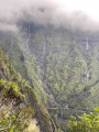
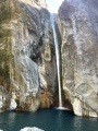
A short walk leading from the Cilaos road to Alfred Waterfall below.

Details

n°65399129
Creation:
Last update:
Last review:
  • Walking
    Activity: Walking
  • ↔
    Distance: 0.98 mi
  • ◔
    Average duration: 1h 00 
  • ▲
    Difficulty: Easy

  • ⚐
    Back to start: Yes
  • ↗
    Ascent: + 620 ft
  • ↘
    Descent: - 620 ft

  • ▲
    Highest point: 3,924 ft
  • ▼
    Lowest point: 3,304 ft

Photos

Description of the walk

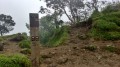
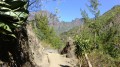
(S/E) Take the signposted path which descends, below the road, to the bed of the Bras Rouge River. The route alternates between rocky descents and stony steps.

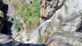
(1) Turn left. The final section, along the river, requires you to put your hands on the ground and use the vegetation to help you descend to the foot of Alfred Waterfall.

(2) Once you reach Alfred Waterfall, you can continue on to Fouquet Pool, situated not far below. Otherwise, retrace your steps.

(1) Turn right onto the path to return to your car (S/E).

Waypoints

  1. S/E : mi 0 - alt. 3,924 ft - RD242
  2. 1 : mi 0.43 - alt. 3,320 ft - Bras Rouge
  3. 2 : mi 0.49 - alt. 3,304 ft - Alfred Waterfall
  4. S/E : mi 0.98 - alt. 3,924 ft - RD242

Notes

You will need to use your hands to grip the ground between (1) and (2).

Reviews and comments

4.7 / 5
Based on 1 review

Reliability of the description
5 / 5
Ease of following the route
5 / 5
Route interest
4 / 5
davidelea38
davidelea38

Overall rating : 4.7 / 5

Date of your route : Oct 20, 2025
Reliability of the description : ★★★★★ Very good
Ease of following the route : ★★★★★ Very good
Route interest : ★★★★☆ Good
Very busy route : Yes

Very short walk, but the end is nice with the waterfall. Very crowded because it's very easy to access.

Machine-translated

Other walks in the area

For more walks, use our search engine .

The GPS track and description are the property of this route's author. Please do not copy them without permission.