Country:

 City:
City:


Park opposite the church and the cemetery on Rue Principale.
(S/E) Walk up Rue des Aviats until you reach a 90° bend to the left.
At this bend, turn right and then immediately left onto a dirt track running behind the houses.
Follow this track straight on and downhill until you reach a small wooden bridge – which is very, very slippery in wet weather – and cross it.
(1) You are now on Rue du Schnarupt.
Turn left, walk down the street towards Rue Principale, following the Blue Rectangle with a white cross signposting.
On this street, turn right, walk past the miner’s house and continue along this street until you reach the village exit. Take the path on the left which climbs into the woods just behind the road sign indicating that you are in the village of Urbeis.
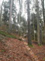
(2) Once on this forest path, you’ll head uphill through the woods, not emerging until the very end of the walk. Follow the Blue Triangle markings.
After a few minutes’ walk, you’ll reach a junction where you should keep to the right and continue uphill until you reach a large 180° bend.
(3) Just after this bend, on your left, a small path leads uphill; follow this path, marked with a Blue Triangle. Follow these markings until you reach the Théophile Mine.
Follow it for several minutes until you rejoin a wider path, which you’ll find at another 180° bend.
The same pattern as before: as you come out of this bend, you’ll take a path that climbs up to your left.
Follow it until you come to another, wider path, which you’ll take to the left.
After about a hundred metres, continue to your left, taking a path that descends towards the Théophile Mine.
(4) Once you’re in front of the mine, follow the path which climbs up and passes above the mine’s entrance.
When you reach a junction, turn left to return to a wide forest track. Follow it until you come to Rue du Gravier.
Take this road – it’s the first one you come to on your left.
Head down this path, signposted ‘Green Saltire’. Don’t be surprised if you pass between several houses – this is normal and you’re on the right track.
(5) After the first few houses, you’ll come to a wider path; carry on straight ahead, heading downhill and following the Green Saltire sign.
From here, carry on downhill until you reach the car park on Rue Principale (S/E).



 Visorando Member
 Moderate
 Tourist office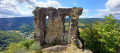
 Very difficult
  Difficult