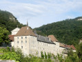
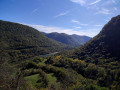
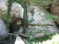
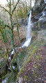
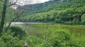
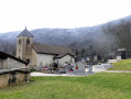
Sélignac Charterhouse and Échazeaux Chapel, starting from Corveissiat

Two iconic sites and beautiful viewpoints along a varied route.
20/10/2023 message from the moderators: route amended to avoid the ridge path.

Details

n°32404349
Creation:
Last update:
Last review:
  • Walking
    Activity: Walking
  • ↔
    Distance: 11.43 mi
  • ◔
    Average duration: 6h 45 
  • ▲
    Difficulty: Difficult

  • ⚐
    Back to start: Yes
  • ↗
    Ascent: + 1,686 ft
  • ↘
    Descent: - 1,693 ft

  • ▲
    Highest point: 2,175 ft
  • ▼
    Lowest point: 1,234 ft

Description of the walk

Park in the car park at the Salle des Fêtes in Corveissiat, Route de Bourg.

(S/E) Head towards Rue sur la Roche and follow it to the right until you reach the Pente à Gachy junction.

(1) Turn left here and follow the road up to the Route de Lavillat, following the red and yellow markings for theGRP® Tour du Revermont alternative route. Turn left, then at the bend continue along the path opposite, which crosses a wooded area and joins a small road; follow this to the right to reach Combet Baron.

(2) Leave theGRP® here, turn left and carry on for about a hundred metres until you rejoin thePR® on the left (along the fence). Cross the D936 and continue along thisPR® heading south-west. You’ll emerge at a place called La Chaume.

(3) Turn right across the meadow, then right again to rejoin theGRP® Tour du Revermont via the slopes of Renabou. Follow it straight on, heading north-east.

(4) Turn left onto the slightly steep path, cross the Ruisseau de Sélignac and reach a junction. Leave the signposted route to Arnans on your right, pass under the Abbaye bridge and follow the boundary wall of the Charteuse de Sélignac.

(5) Turn right towards the entrance to the site; look out for the cross on the left marking the start of the path and follow it upwards.

(6) Turn left to reach the statue, then retrace your steps.

(6) Continue straight on to the cross and the viewpoint overlooking the Chartreuse. Retrace your steps and, via a wide path, turn right (north-north-east) towards the village of Arnans. Walk through the village until you reach the Route de Chavannes.

(7) Turn right, leave theGRP® alternative route a little further on and follow the road to the next crossroads marked by a cross.

(8) Turn right and follow the road to reach the Bois de Tannay crossroads.

(9) Turn left onto the track. Pass through the Combe du Roi and Les Trèches, and arrive at Saint-Maurice d’Échazeaux. Cross the road to reach Rue de l’Ancienne Fontaine on the opposite side; follow this to the right until you reach the junction.

(10) Head up to the left towards the chapel via Rue du Four, then turn left at the crossroads. Ignore two successive turn-offs on the right and follow the road to reach the Saint-Maurice d’Échazeaux Chapel. Make your way to the viewing platform below the chapel.

(11) Turn right and follow the ridge path straight ahead. You’ll reach a car park; continue straight on towards the south, more or less following the ridge. You’ll come to a viewpoint, then immediately afterwards, to a junction with a track.

(12) Carry on along the path opposite until you reach a wider track. Take this and head gently downhill.

(13) Carry on straight ahead, heading towards the church, then turn right onto Rue de la Fruitière, which leads onto Grande Rue opposite the town hall. Turn left, then turn right.

(1) Keep to the left to return to the Salle des Fêtes car park (S/E).

Waypoints

  1. S/E : mi 0 - alt. 1,490 ft - Car park at the Salle des Fêtes in Corvessiat
  2. 1 : mi 0.16 - alt. 1,486 ft - Pente crossroads in Gachy
  3. 2 : mi 0.93 - alt. 1,736 ft - Combet Baron
  4. 3 : mi 2.51 - alt. 2,126 ft - La Chaume
  5. 4 : mi 3.71 - alt. 1,568 ft - Le Renabou
  6. 5 : mi 4.4 - alt. 1,260 ft - Chartreuse de Sélignac
  7. 6 : mi 4.96 - alt. 1,824 ft - Junction by the statue
  8. 7 : mi 6.1 - alt. 1,867 ft - Arnans – Route de Chavannes
  9. 8 : mi 6.44 - alt. 1,860 ft - Crossroads
  10. 9 : mi 7.19 - alt. 1,798 ft - Tannay Woods junction
  11. 10 : mi 8.2 - alt. 1,522 ft - Junction
  12. 11 : mi 9.02 - alt. 1,535 ft - Chapelle Saint-Maurice d'Echazeaux
  13. 12 : mi 9.69 - alt. 1,663 ft - Crossroads
  14. 13 : mi 10.74 - alt. 1,572 ft - Junction
  15. S/E : mi 11.43 - alt. 1,490 ft - Car park at the Salle des Fêtes in Corvessiat

Notes

Caution: unprotected viewing points at La Roche Béguine and the Échazeaux Chapel
Between 2 and 3, follow the GPX track

Worth a visit

Always be cautious and plan ahead when you're outdoors. Visorando and the author of this route cannot be held responsible for any accidents occurring on this route.

The GR® and PR® markings are the intellectual property of the Fédération Française de Randonnée Pédestre.

Reviews and comments

3.3 / 5
Based on 4 reviews

Reliability of the description
3.8 / 5
Ease of following the route
2.8 / 5
Route interest
3.5 / 5
lolo 01
lolo 01

Overall rating : 4.3 / 5

Date of your route : Apr 15, 2025
Reliability of the description : ★★★★★ Very good
Ease of following the route : ★★★★☆ Good
Route interest : ★★★★☆ Good
Very busy route : No

A lovely walk with some lovely views

Machine-translated

Alp1flyer
Alp1flyer

Overall rating : 3.7 / 5

Date of your route : Oct 02, 2023
Reliability of the description : ★★★★☆ Good
Ease of following the route : ★★★☆☆ Average
Route interest : ★★★★☆ Good
Very busy route : No

A walk with good views of the Chartreuse, but only if you stick to the ridge path. The tarpaulins on the roofs spoil the photos.
To avoid a stretch of road, the start of the walk takes you along a poorly maintained path, part of which runs through the trees and isn’t great. Tall grass and branches overhanging the path (watch out for scratches and the risk of tick bites). As far as I’m concerned, the rest of the walk isn’t particularly interesting.
The signposting needs reviewing.
It’s a shame – the box tree moth has been at work and has left nothing but dead trees.

Machine-translated

Pedibus
Pedibus

Hello Étienne,
Thank you for your prompt reply, and for the warning added at the top of the description.
Indeed, having read the extremely detailed comment from the hiker on 24 May, I realise that I ‘took the wrong path down the slope’, which inevitably led to my fall…

However, if a future hiker could clearly mark the correct (and the incorrect...) track, they would be doing a great service to those who follow.
Kind regards.

Machine-translated

favrebrunj
favrebrunj

Sorry for the disappointment!!!
You’ve probably missed the start of the ridge path, which isn’t dangerous
There is indeed a ‘dangerous’ track that plunges down the slope… AVOID IT
The correct route is a few metres further back on the left, and the path climbs straight away

Machine-translated

Pedibus
Pedibus

Overall rating : 1.7 / 5

Date of your route : Jul 09, 2023
Reliability of the description : ★★★☆☆ Average
Ease of following the route : ★☆☆☆☆ Very disappointing
Route interest : ★☆☆☆☆ Very disappointing
Very busy route : No

Hello,

Yesterday, 9 July, I tried to hike this circular route starting from Corveissiat.
No problems up to the “ridge path” after the mobile phone mast (marker 2 on the map). I found it easily, but…
This path isn’t just “difficult”: it’s impassable and, to be honest, DANGEROUS. After 100 metres, the path turns into an unstable track on the (steep) side of the ridge, then disappears completely, swept away by a scree slope.
We struggled for 2 hours to cover 300 metres and turned back after two hikers from our group took a tumble. We managed, with some difficulty, to rescue them 10 and 15 metres below.
The rest of the circular route is probably superb. There’s an alternative GR route that will spare you this tricky bit!!

Machine-translated

favrebrunj
favrebrunj

Hello
I’ve also come across a few route descriptions that are rather fanciful at times…
Creating a route can involve a few inconsistencies, especially when we use unmarked sections. We don’t all interpret a guidebook in the same way. However, it’s still essential to know how to read a map and identify ‘local landmarks’ that make progress easier. And then Visorando offers the chance to download and follow the route on a GPS, which is reassuring… or is it? Watch out for technical glitches!
In the meantime, thank you for your comments

Machine-translated

Deuxpattes
Deuxpattes

Overall rating : 3.7 / 5

Date of your route : May 18, 2023
Reliability of the description : ★★★☆☆ Average
Ease of following the route : ★★★☆☆ Average
Route interest : ★★★★★ Very good
Very busy route : No

A long walk with a bit of tarmac, but it’s still reasonable given the length of the route. Enjoyable; varied; plenty to see… We really enjoyed it.
However, there are some inaccuracies in the description, and it was only by sticking closely to the GPS route that we managed to find our way. To help walkers without GPS, I’ve therefore taken the liberty of revising the text and adding landmarks in capital letters.

Park in the car park at the Salle des Fêtes in Corveissiat, on Route de Bourg.

(S/E) Join Rue sur la Roche and follow it to the right to reach the Pente à Gachy junction.

(1) Turn left onto this road and follow it up to the Route de Lavillat, following the red and yellow markings for the GRP® Tour du Revermont alternative route. Turn left, then at the bend continue along the path leading straight ahead (THIS PATH WAS VERY OVERGROWN WITH GRASS ON THIS DAY AND MARKED WITH A CROSS; HOWEVER, IT ALLOWS YOU TO SHORTEN THE CIRCULAR ROAD, AROUND THE TARMACKED ROAD), cross a wooded section and join a small road which you should follow to the right to reach Combet Baron.

(2) Leave the GRP® here, turn left until you reach the junction, then turn right, walking alongside and carefully crossing the D936. Look out for the mobile phone mast; go round it and turn left onto the ridge path (not shown on the IGN map but clearly marked on OSM). Follow it to its south-western end, ignoring all other directions. (WE DIDN’T UNDERSTAND THIS LAST SENTENCE. IN FACT, AFTER GOING ROUND THE ANTENNA, CARRY ON FOR A FEW METRES, KEEPING AN EYE OUT FOR A STONY PATH THAT CLIMBS SLIGHTLY UP ON YOUR LEFT; THE SQUARE MARKER INDICATING THE TURN IS BEHIND THE TREE!!! FROM THE SIDE YOU ARE WALKING ON, YOU WILL SEE A HORIZONTAL YELLOW LINE, AS IF YOU WERE TO CARRY ON STRAIGHT AHEAD) You will emerge at a place called La Chaume.

(3) Turn right across the meadow, then right again to rejoin the GRP® Tour du Revermont via the slopes of Renabou. Follow it straight on, heading north-east. (HERE TOO, KEEP AN EYE OUT: ON YOUR LEFT, AT ONE POINT, THERE IS A SIGN READING ‘PRIVATE PROPERTY – NO VEHICLES’. DO NOT CONTINUE STRAIGHT ON; TAKE THIS PATH INSTEAD)

(4) Turn left onto the slightly steep path, cross the Sélignac stream
(YOU WILL STILL HAVE TO WALK THROUGH THE WATER FOR A FEW METRES. MAKE SURE YOU WEAR SUITABLE FOOTWEAR) and you will reach a junction. Pass the sign for Arnans on your right, go under the Abbey bridge and follow the boundary wall of the Charteuse de Sélignac.

(5) Turn right towards the entrance to the site; look out for the cross on the left marking the start of the path and follow it uphill.

(6) Turn left to reach the statue, then retrace your steps.

(6) Continue straight on to the cross and the viewpoint overlooking the Charterhouse. Retrace your steps and, taking a wide path, head right, north-north-east, (AT ONE POINT A WIDE FOREST PATH WILL CROSS YOUR PATH. TURN LEFT, NORTH/NORTH-EAST) to reach the village of Arnans. Walk through the village until you reach the Route de Chavannes.

(7) Turn right, ignore the GRP® alternative route a little further on and follow the road to the next junction marked by a cross.

(8) Turn right and follow the road to reach the Bois de Tannay junction.

(9) Turn left onto the track. Pass through the Combe du Roi and Les Trèches, and arrive at Saint-Maurice d’Échazeaux. Cross the road to reach the Rue de l’Ancienne Fontaine opposite, which you should follow to the right until you reach the junction.

(10) Head up to the left towards the chapel via Rue du Four, then turn left at the junction. Ignore two successive turnings on the right and follow the road to reach the Saint-Maurice d’Échazeaux Chapel. Make your way to the viewing platform below the chapel.

(11) Turn right and follow the ridge path straight ahead. You’ll reach a car park; continue straight on towards the south, more or less following the ridge. You’ll come to a viewpoint, then immediately afterwards, to a crossroads with a track.

(12) Continue along the path opposite until you reach a wider track. Follow this and walk gently downhill.

(13) Carry on straight ahead, heading towards the church, then turn right onto Rue de la Fruitière, which leads onto Grande Rue opposite the town hall. Turn left, then turn right.

(1) Keep left to return to the Salle des Fêtes car park (S/E).

Machine-translated

Other walks in the area

For more walks, use our search engine .

The GPS track and description are the property of this route's author. Please do not copy them without permission.