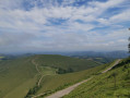
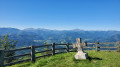
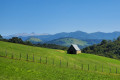
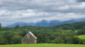
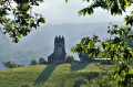
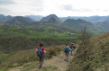
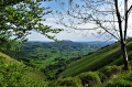
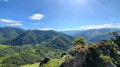
Chapelle de la Madeleine as seen from Sauguis-Saint-Étienne

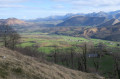
A climb from the village of Sauguis-Saint-Étienne through mountain pastures and forests to La Madeleine, the highest point at an altitude of almost 800 metres, offering a 360° panoramic view of the mountains of the Basque Country and the Pyrenees.

Details

38003616
Creation:
Last update:
Last review:
  • Walking
    Activity: Walking
  • ↔
    Distance: 6.66 mi
  • ◔
    Average duration: 4h 45 
  • ▲
    Difficulty: Moderate

  • ⚐
    Back to start: Yes
  • ↗
    Ascent: + 1,959 ft
  • ↘
    Descent: - 1,955 ft

  • ▲
    Highest point: 2,608 ft
  • ▼
    Lowest point: 650 ft

Photos

Description of the walk

Park in the village of Sauguis-Saint-Étienne, for example near the pelota court.

(S/E) Take the road running along the left-hand side of the pelota court, heading towards the far end of the village and the destination of the walk, which overlooks the village. Walk past the church and the cemetery and continue to the third junction.

(1) Turn right (hiking signpost indicating ‘La Madeleine’). The road turns into a track and climbs above the village, running alongside summer pastures. Stay on this track and ignore any potential side paths until you reach a cattle grid, situated above a field of cows.

(2) The track turns into a path that climbs ever more steeply through the forest, before opening out onto a small cirque dominated by the Col de Lecheguita. The aim here is to reach this pass by following as closely as possible the path that climbs up the mountainside, a rather difficult task given the many cow tracks that also seem to lead there. Arrive at the Col de Lecheguita.

(3) Take the very steep track which climbs sharply up to the Chapelle de la Madeleine. When you reach a tarmac road, take it to the right, then go round a sharp bend to the left.

(4) At a cross standing in the ground, leave the return path on your right. Continue along the road to the viewpoint, which offers a magnificent view of the whole region. It is also possible to go inside the chapel.

(5) Turn back until you reach the cross.

(4) Head down to the left across the grassy area along a path leading due west to a track below.

(6) Follow this track to the right as far as the Col de Lecheguita.

(3) Return via the same route as on the way out to (S/E).

Waypoints

  1. S/E : mi 0 - alt. 650 ft - Village of Sauguis-Saint-Étienne
  2. 1 : mi 0.23 - alt. 659 ft - Hiking signpost
  3. 2 : mi 1.38 - alt. 1,037 ft - Canadian passage
  4. 3 : mi 2.62 - alt. 2,136 ft - Junction of the circular loop - Col de Lecheguita (653m}
  5. 4 : mi 3.05 - alt. 2,598 ft - Access to the chapel
  6. 5 : mi 3.11 - alt. 2,605 ft - Chapelle de la Madeleine – Viewpoint
  7. 6 : mi 3.54 - alt. 2,178 ft - Junction
  8. S/E : mi 6.66 - alt. 653 ft - Village of Sauguis-Saint-Étienne

Notes

Between 2 h 30 min and 3 h 30 min, depending on your fitness level and the breaks you take.
No particular difficulties, despite some fairly steep slopes.

Reviews and comments

4.1 / 5
Based on 3 reviews

Reliability of the description
4.3 / 5
Ease of following the route
3.7 / 5
Route interest
4.3 / 5
lacris64
lacris64

Overall rating : 4 / 5

Date of your route : Apr 18, 2026
Reliability of the description : ★★★★☆ Good
Ease of following the route : ★★★★☆ Good
Route interest : ★★★★☆ Good
Very busy route : No

A little-used route, with fading markings
which makes the hike feel more ‘wild’
thanks for the guide

Machine-translated

xiberotarra
xiberotarra

Overall rating : 4.3 / 5

Date of your route : Dec 09, 2024
Reliability of the description : ★★★★★ Very good
Ease of following the route : ★★★★☆ Good
Route interest : ★★★★☆ Good
Very busy route : No

A former route from the Soule Local Walking Plan, which has been cleared of signposts to make way for the climb to La Madeleine via Tardets. The appeal of these descriptions and trails lies precisely in the fact that they take you along unmarked paths.
A pleasant route, though a little muddy in places at this time of year.

Machine-translated

Testeur59
Testeur59
• Edited:

Overall rating : 4 / 5

Date of your route : Jul 08, 2024
Reliability of the description : ★★★★☆ Good
Ease of following the route : ★★★☆☆ Average
Route interest : ★★★★★ Very good
Very busy route : No

A lovely walk, but some of the signposting is missing in thesecond third of the route. Be sure to follow the Visorando trail.
The actual markings follow the signage for the underground gas pipeline
Superb view from the top. Beautiful scenery along the route.
No water available at the chapel. But there are toilets.
I’d recommend it.

Machine-translated

Other walks in the area

For more walks, use our search engine .

The GPS track and description are the property of this route's author. Please do not copy them without permission.