Country:

 City:


By car: head for the Col de Porte in the village of Sarcenas. Park in the car park 50 m below the pass, on the north side.
(S/E) From the car park, follow the road uphill to the Col de Porte (alt. 1,324 m). Take the road on the left (south-east), which continues as a forest track. 100 m further on, it leads to a clearing on the right and a path on the left. This wide track (ski run) heads south-east, passing to the left of a building and a path: 50 m further on, there is a path on the left marked by a sign.
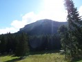
(1) At the signpost (alt. 1,350 m), leave the road that climbs straight ahead and turn left towards Chamechaude. The signposted forest track climbs through the forest (north-east), passes a hairpin bend and continues its ascent (south) for 500 m. At another junction (alt. 1,540 m), take the signposted path leading uphill to the left for 100 m and join a track at a signpost (alt. 1,560 m). Follow the sign for Chamechaude to the right. After ignoring two paths on the right, tackle a short, steep, rocky climb.
(2) At the top, there is a signpost at the junction for ‘La Cabane du Hollowed-Out Tree Trunk Serving as a Drinking Trough’ (alt. 1,630 m): there is a small concrete structure with a spring flowing beneath it. Leave the path towards Chamechaude on your left and turn right, below the hut, onto the Tour de Chamechaude path. The almost level path winds through woodland, runs alongside a rock face and reaches a sheep gate.
(3) Ignore the yellow-marked ‘Tour par le bas de Chamechaude’ path on the right, and, just after the gate, take a track to the left (Yellow Cross), which is the start of our ‘Tour par le haut’ route. It climbs towards the cliff and runs along its base. After a good kilometre, the path gradually moves away from the cliff.
(4) Leave the path 100 m before a scree cone to follow a track that joins the cliff face. It passes in front of a cirque with a white marble plaque embedded in the rock.
(5) 150 metres further on, walk along the foot of the Brèche Arnaud (alt. 1,860 m). This is followed by a short descent and a junction.
At this junction, leave the path leading down towards the Habert de Chamechaude and take the short, steep slope on the left which leads back towards the rock face, then continues above the scree cone. The well-marked path, running diagonally and slightly downhill, crosses gullies prone to rockfalls . Proceed with great caution. Further down , you can see a path rising diagonally which joins ours. About 50 m before this junction, look out for a yellow and red marker on the rock face to the left.
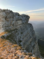
(6) Climb the escarpment (painted arrow), then turn right onto a path for 20 m before climbing a second, slightly more exposed path (painted arrow). You are now at the top of a wooded, grassy and stony slope (alt. 1,840 m). This ridge to the right of the north face bears the lovely name ‘Jardin’. Descend to the left along the cliff face on a well-marked path (north-west). Go round the rocky spur to head south-west: the view opens out onto a balcony-like path crossing the cliff face. In the Chartreuse, this geological feature is known by the masculine term ‘sangle’.
(7) This “sangle” of the Jardin, which is almost level, is exposed but not rugged. It is well worth taking the time to turn round and admire the impressive view behind you. Once past the “sangle”, which is about 500 m long, the path climbs in a zigzag through the rocks and reaches a wide fault, the bottom of which is filled with a scree slope.
(8) At the base of this gully (north-east), commonly known as ‘Le Canyon’ (alt. 1,850 m), a sign warns of the danger of climbing up this scree slope. Begin climbing it along the right-hand wall, where the scree is most stable. Then, as it begins to narrow, continue the ascent, gradually moving towards the centre, and at its narrowest point, to the left. It widens out again to reach a grassy slope where you’ll find a path (alt. 1,930 m).
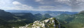
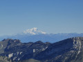
(9) The path veers off to the right (east), climbs via numerous hairpin bends and splits into several branches, all heading east towards the summit. The summit is marked by a large cross. From the edge of the cliff, you can see the path you took earlier and also enjoy the view of the Belledonne, Grandes Rousses, Taillefer and Écrins massifs.
(10) Follow the path southwards; after about a hundred metres on level ground, you’ll come to a small rocky outcrop. It is well-equipped and easy to climb down. Continue the descent via switchbacks through scree until you reach a junction.
(11) This junction consists of two paths. Ignore the one on the right, which leads directly to the car park, and continue left (south) along a path running alongside the cliff. When the path levels out, you’ll notice a gap marked by a large cairn (alt. 1,940 m). As you approach, you’ll see large cables; this is the Brèche Arnaud, which you’ve already seen from below. Continue (south-west) to a junction.
(12) Leave the path on the right and take the one on the left, which enters a sparse woodland and heads right (north-west) for 150 m, then turns right again (north). After 50 m, in a clearing, it crosses a track on the left (alt. 1,770 m).
(13) Leave the path heading straight on and follow a gently sloping track, marked blue, which leads to a rocky ridge. The descent (south) is via a sort of staircase running parallel to the rock face, known as the Rampe de l’Écureuil, not to be confused with the Arête des Écureuils du Néron.
(14) This ramp leads to a ledge with a path running along it. Continue against the flow of traffic to the right (north) for about thirty metres. Leave the level path opposite and turn onto a narrow track to the left. After about twenty metres, turn left (south), pass between the trees and through a few hairpin bends, descend a stony slope, then head right (north-west) along a small rocky outcrop. Follow an easier slope (south) to reach the bottom of the rock outcrop. Opposite, follow the path up the foot of the outcrop. Reach a high point and descend about ten metres to reach a narrow pass: the Pas de l’Arche.
(15) Climb down this very narrow, steep gully. Head up along the rock face towards an arch with three openings. Cross it to the right of the large boulder blocking the way and continue southwards, opposite, along the cliff face. Climb up the track and, after a short descent, rejoin the ascent path. Turn right (north-west) to return to the car park via the same route as on the ascent (S/E).

 Visorando Member
 Difficult

 Moderate
 Extremely difficult