Caunettes Hautes, the Heath du Sauvage

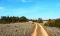
A short walk that climbs gently to (2) along a track suitable for vehicles but gravelled and in full sun.
The second section is better sheltered from the sun and runs across the Causse. The final stretch passes through three estates and ends along a vineyard path back to the cars.

Details

188281
Creation:
Last update:
Last review:
  • Walking
    Activity: Walking
  • ↔
    Distance: 3.99 mi
  • ◔
    Average duration: 2h 15 
  • ▲
    Difficulty: Easy

  • ⚐
    Back to start: Yes
  • ↗
    Ascent: + 433 ft
  • ↘
    Descent: - 430 ft

  • ▲
    Highest point: 938 ft
  • ▼
    Lowest point: 505 ft

Photos

Description of the walk

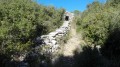
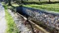
(S/E) After parking alongside the path, cross the bridge over the Combe Obscure stream and take the path on the left. Walk slightly uphill for 1.4 km until you reach a Fork in the road.

(1) Take the path on the right, heading north-north-east, until you reach a junction with several paths.

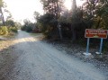
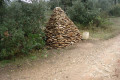
(2) Take the path furthest to your right, past a small stone marker, and continue until you reach a sign on your right reading ‘Forêt Communale de Ventenac Cabardès’. You will have walked nearly 4 km by this point.

(3) Thirty metres past this sign, turn right onto a path whose smooth, clayey surface differs from the slightly stony road you were on before. You’ll arrive at the Le Sauvage estate, which you’ll walk alongside.

(4) Immediately after the buildings, take the tarmac road on your left and head downhill to the hamlet known as Le Colombier.

(5) Pass the houses and turn right, staying on the tarmac road, until you reach La Bouriette. Here, take care: carry on along the road and, after two bends, you’ll find a small path on your right; take this and walk uphill for 80 metres.

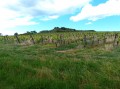
(6) There, turn left along the upper vineyard onto a grassy path. On this stretch, it feels as though you’re in the middle of a field; follow the vineyard all the way along until you reach a section of stony path. This will take you back to the starting point (S/E).

Waypoints

  1. S/E : mi 0 - alt. 505 ft - Park along the path
  2. 1 : mi 0.92 - alt. 814 ft - To the right
  3. 2 : mi 1.39 - alt. 935 ft - Junction of several roads
  4. 3 : mi 2.5 - alt. 748 ft - Clay path
  5. 4 : mi 3.07 - alt. 650 ft - Le Sauvage Estate
  6. 5 : mi 3.28 - alt. 594 ft - Le Colombier
  7. 6 : mi 3.65 - alt. 571 ft - Along a vineyard, just tractor tracks
  8. S/E : mi 3.99 - alt. 509 ft - Along the path

Reviews and comments

4 / 5
Based on 3 reviews

Reliability of the description
4.3 / 5
Ease of following the route
4.3 / 5
Route interest
3.3 / 5
claire11
claire11

Overall rating : 4 / 5

Date of your route : Jul 29, 2024
Reliability of the description : ★★★★☆ Good
Ease of following the route : ★★★★☆ Good
Route interest : ★★★★☆ Good
Very busy route : No

The starting point isn’t clear, and we needed some help to find it.

Machine-translated

fredo345
fredo345

Overall rating : 4.7 / 5

Date of your route : Jan 15, 2023
Reliability of the description : ★★★★★ Very good
Ease of following the route : ★★★★★ Very good
Route interest : ★★★★☆ Good
Very busy route : No

A really lovely route, but we parked in the hamlet of La Caunette-Hautes, as it was more convenient for the car.

Machine-translated

randonnéeaude
randonnéeaude

Overall rating : 3.3 / 5

Date of your route : Oct 02, 2016
Reliability of the description : ★★★★☆ Good
Ease of following the route : ★★★★☆ Good
Route interest : ★★☆☆☆ Disappointing

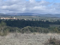
A monotonous path, with rather uninteresting scenery, apart from the view of the Pyrenees at the end. After passing point 3, it would be best to turn right onto a small path that overlooks the valley.

Machine-translated

Other walks in the area

For more walks, use our search engine .

The GPS track and description are the property of this route's author. Please do not copy them without permission.