Capu San Petru from Ota

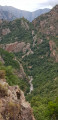
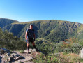
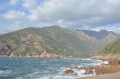
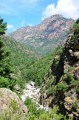
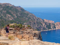
A substantial circular walk starting from and above the village of Ota, offering views of the Porto valley from both the mountain and sea sides. Splendid views all along the way.

Details

n°3957066
Creation:
Last update:
Last review:
  • Walking
    Activity: Walking
  • ↔
    Distance: 10.14 mi
  • ◔
    Average duration: 8h 00 
  • ▲
    Difficulty: Difficult

  • ⚐
    Back to start: Yes
  • ↗
    Ascent: + 3,786 ft
  • ↘
    Descent: - 3,773 ft

  • ▲
    Highest point: 3,629 ft
  • ▼
    Lowest point: 1,030 ft
  • ⚐ Country: France
  • ⚐ City: Ota (20150)
  • ⚑
    Start/End: N 42.258092° / E 8.742948°
  • ❏
    IGN map(s): Ref. 4150OT
  • Hour-by-hour weather

Photos

Description of the walk

Start from the village of Ota. Park near the fountain in the centre of the village.

(S/E) From the fountain, continue along the road towards the village exit (heading east, with the valley on your right). In front of the village hall and school, keep to the right. At a Fork in the road, turn left.

(1) Immediately take the uphill path signposted by a sign. Follow the markings. The path initially climbs along the hillside. It then climbs steeply through the forest (note the Gorges de la Spelunca on your right).

(2) Pass over a sort of pass and begin a steep descent. Then walk alongside the Ruisseau de Lonca, which runs below on your right.

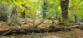
(3) At a junction signposted on site, take the path on the left which climbs towards the Bergerie de Corgola. Follow the winding path and the signposts until the climb becomes less steep as you approach a chestnut forest. Continue along the path to the ruins of the Bergerie de Corgola (currently being renovated).

(4) Turn left onto a wide path. It may not correspond to the map due to logging work, but it is very well signposted and easy to follow. Cross the forest and pass by the Bergerie de Larata. Reach Bocca di Larata.

(5) Continue along the signposted path and head downhill. Cross the Vitrone Stream (which may be dry), climb gently uphill and reach a junction.

(6) Carry on straight ahead (west) towards Capu San Petru. Ignore a path coming from the right and continue along the ridge. At the Fork in the road, take the left-hand path and climb rapidly up to Capu San Petru.

(7) Retrace your steps (ignore the path leading down to the left).

(6) At the junction, turn slightly right (east-southeast). Descend and cross the Ruisseau de Vitrone again.

(8) Beneath some rocky outcrops, the descent becomes steeper. Cross several streams (dry in summer).

(9) Shortly after crossing a stream, keep to the left and continue descending along the hillside. Reach the village of Ota and, after the first few houses, keep to the right to return to the starting point (S/E).

Waypoints

  1. S/E : mi 0 - alt. 1,112 ft - The village of Ota
  2. 1 : mi 0.44 - alt. 1,053 ft - Start of the path
  3. 2 : mi 1.59 - alt. 1,998 ft - Unnamed pass
  4. 3 : mi 2.28 - alt. 1,834 ft - Start of the ascent to the Corgola sheepfold
  5. 4 : mi 3.27 - alt. 3,169 ft - Bergerie de Corgola
  6. 5 : mi 4.42 - alt. 3,625 ft - Bocca di Larata
  7. 6 : mi 5.36 - alt. 3,133 ft - Junction – Access to San Petru
  8. 7 : mi 6.18 - alt. 2,995 ft - Capu San Petru
  9. 8 : mi 7.65 - alt. 2,776 ft - Passage beneath rocky ledges
  10. 9 : mi 9.22 - alt. 1,270 ft - Junction
  11. S/E : mi 10.14 - alt. 1,112 ft - The village of Ota

Notes

No water source

A long and challenging hike, featuring short sections over scree, long steep sections and a few steep climbs: suitable for those wearing suitable footwear, who are fit and experienced in the mountains

Allow three hours to reach the Bergerie de Corgola: a good hour along the ridge and two hours’ descent.

The path is clearly visible throughout, with almost continuous signposting.

Worth a visit

A bus runs between Ajaccio and Ota (via Porto) twice a day in July and August and once a day for the rest of the year. Enquire at the Porto tourist office or at the Lodge Chez Marie

A lovely lodge/restaurant, Chez Marie, in Ota: Chez Marie. Booking recommended.

From Ota, you can hike towards Corte via Evisa (Mar a Mar North) or towards Galeria via Girolata (Mar e Monti North)

Reviews and comments

4.3 / 5
Based on 2 reviews

Reliability of the description
4 / 5
Ease of following the route
5 / 5
Route interest
4 / 5
Mimi2A
Mimi2A

Overall rating : 4.3 / 5

Date of your route : Jan 28, 2024
Reliability of the description : ★★★★☆ Good
Ease of following the route : ★★★★★ Very good
Route interest : ★★★★☆ Good
Very busy route : No

A pleasant walk with clear directions; I’d add that if there are no parking spaces at the start by the fountain, you can try under the church or a little further down at the small car park by the town hall.
A few things have changed, of course, in the last four years: for example, at point 3, there are no longer any signs indicating a left turn, and you tend to carry on straight ahead, so do make sure to follow the route map (this is no doubt due to Storm Ciaran in November 2023, which also caused rockfalls on the path in places), the Corgola sheepfolds have now been renovated, and from there to San Petru you follow a track sometimes used by 4x4s; as in the previous comment, I recommend the view from the Larata sheepfolds – we actually had lunch there with an exceptional view...I strongly recommend climbing up to Capu di Larata, which is far more interesting than San Petru (which is rather disappointing afterwards); it towers 200 metres above San Petru and offers a much more beautiful view. However, the route isn’t easy (there are a few cairns up to the secondary summit) and it’s best to bring a machete and secateurs as the path is rarely used and quite overgrown; So, if you’ve made it up there, there’s no point in going to San Petru, especially as the descent from point 6 is no walk in the park – you’ll face a dozen or so very gruelling ascents and descents in quick succession, so make sure you save your energy…
In summer, I’d recommend doing the circular route in the opposite direction; on the way up, you’ll have views of sheer cliffs, and at the end you can have a swim in the Lonca pools, even if it means continuing along the stream for a bit, turning back to the left from point 3.
Enjoy the hike!

Machine-translated

Pounet Rando
Pounet Rando
• Edited:

Overall rating : 4.3 / 5

Date of your route : Sep 29, 2023
Reliability of the description : ★★★★☆ Good
Ease of following the route : ★★★★★ Very good
Route interest : ★★★★☆ Good
Very busy route : No

Hello, thank you for this guide. I completed the hike on 29 September 2023 in lovely weather: 25 degrees (3 litres of water), at a normal pace in 7 hours, plus 2 x 20-minute breaks. Although I’m used to long hikes over Corsican scree, I can confirm that this is indeed a challenging hike, for several reasons: the total duration, the gradient of the slopes, the length of the ascent (3 hours) to the Larata sheepfold, and the steep, stony slopes on the descent. The level of difficulty is confirmed by the IBP index of 117 (which means ‘difficult+’ for a hiker of average fitness). All this is relative, of course, and depends on the individual. What I really enjoyed: the fact that it was steep and quite a challenge; the ‘canyon’ atmosphere at the foot of the rocks in the first section; the variety (rocks, forest, chestnut groves, etc.) ; the sound of the river (which you follow without getting too close, as you turn off to the left at one point towards the sheepfolds); the picnic table with a magnificent view at the Larata sheepfold; and, of course, the splendid bird’s-eye view of the Gulf of Porto from the ‘bocca di Larata’, which alone is one of the highlights of this walk. On the other hand, the 45-minute round trip from the junction towards Capu san Petru is only worth the extra effort if you’re prepared to scramble over the rocks; otherwise, there’s no view of the sea. The total elevation gain is difficult to determine depending on the tools you use, but based on the IGN map, I estimate it to be around 1,000 metres. Throughout the day, the only person I came across in his chestnut grove was Jean-Dominique, the gold medallist at the Paris Agricultural Show for his chestnut flour. He was preparing for the harvest, which was just around the corner. I’d like to point out that the route is very easy to follow. I only checked my position on the downloaded route map from time to time. All in all, I came away from the day feeling very happy.

Machine-translated

Other walks in the area

For more walks, use our search engine .

The GPS track and description are the property of this route's author. Please do not copy them without permission.